Located on the west coast of Africa, Guinea-Bissau borders Senegal (to the north), Guinea (to the south and east) and the Atlantic Ocean (to the west). The Bijagós archipelago, formed by more than 80 islands, is also part of the territory of Guinea-Bissau. The nation is part of the Community of Foreign Language Countries.
The territory that currently corresponds to the country of Guinea-Bissau was colonized by the Portuguese in 1446. The colonizers set up trading posts to carry out the slave trade with the native population. Only on September 24, 1974, Guinea-Bissau gained its independence, becoming the first Portuguese colony in Africa to achieve this feat.
The country's economy is underdeveloped. Agriculture, responsible for absorbing more than 80% of the local workforce, is based on the cultivation of cashew nuts (the country is the sixth largest producer in the world), cotton, rice, yams, bananas, mangoes and sugar cane. This economic activity occupies 12% of the territorial surface of Guinea-Bissau.
Fishing is another important element for the national economy – the country is a shrimp exporter. There are large mineral reserves to be explored in Guinea-Bissau, and phosphate, bauxite and oil reserves have already been confirmed.
The country has several socioeconomic problems, has one of the six worst Human Development Indexes (HDI) on the planet. The majority of the population lives below the poverty line, on less than $1.25 a day; life expectancy is one of the lowest in the world – 46 years.

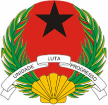
Guinea-Bissau Coat of Arms
Guinea-Bissau data:
Territorial extension: 36,125 km².
Location: Africa.
Capital: Bissau.
Climate: Equatorial.
Government: Presidential Republic (since 1984).
Administrative division: 9 regions.
Language: Portuguese (official), Creole, regional dialects.
Religion: Traditional beliefs 44.8%, Islam 40.7%, Christianity 13.2% (Catholics 9.9, others 3.3%), no religion and atheism 1.3%.
Population: 1,610,746 inhabitants. (Men: 797,910; Women: 812,836).
Ethnic Composition: Balantas 30%, Fulani 20%, maniac 14%, Mandinga 13%, paper 7%, other 16%.
Demographic density: 44.5 inhab/km².
Average annual population growth rate: 2.2%.
Population residing in urban areas: 29.87%.
Population residing in rural areas: 70.13%.
Life expectancy at birth: 46 years.
Households with access to drinking water: 57%.
Households with access to a health network: 33%.
Human Development Index (HDI): 0.289.
Currency: CFA Franc.
Gross Domestic Product (GDP): 430 million dollars.
GDP per capita: $211.
External relations: World Bank, IMF, WTO, UN, Ua.
By Wagner de Cerqueira and Francisco
Graduated in Geography
Brazil School Team
countries - geography - Brazil School
