Minas Gerais is one of the 27 states in Brazil. It is located in the Southeast region and its capital is Belo Horizonte.
It has 853 municipalities, which makes it the Brazilian state with the largest number of municipalities. Below, political, road and mining mesoregions maps.
Minas Gerais political map
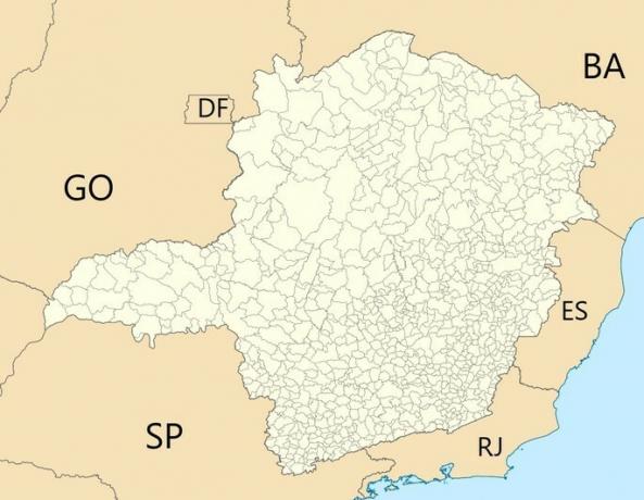
The state of Minas Gerais borders Bahia, Espírito Santo, Rio de Janeiro, São Paulo and Goiás.
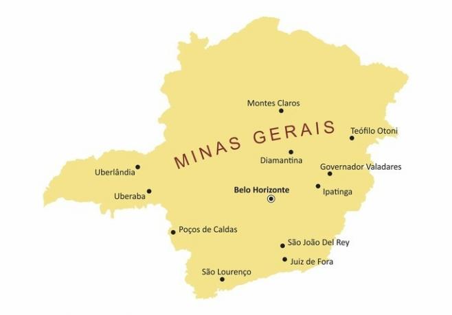
Map of the main cities of Minas Gerais
Minas Gerais road map

Map of Minas Gerais mesoregions

1. Strand Fields
2. Central Mineira
3. little Jequitinho
4. Metropolitan of Belo Horizonte
5. Northwest of Minas
6. North of Minas
7. west of mines
8. South and Southwest of Minas
9. Mineiro and Alto Paranaíba Triangle
10. Mucuri Valley
11. Vale do Rio Doce
12. Wood zone
We have more texts for you:
- Minas Gerais
- Mining Triangle
- Brazil's map