Located in South America, Paraguay has no access to the sea and borders Brazil (to the east), Argentina (to the south and west) and Bolivia (to the north). The Spanish were responsible for the colonization process in 1530, creating the fort of Nossa Senhora da Assunção (now Asunción). National independence was won on May 15, 1811.
The country once held one of the largest economies in South America, with a high degree of industrialization and infrastructure investments. However, between 1865 and 1870, Paraguay was involved in an armed conflict with Brazil, Argentina and Uruguay, characterizing the Paraguay War. This event caused serious damage to the country: death of half of the population, damage to infrastructure and territorial losses.
The Paraguay War resulted in a major socioeconomic crisis, and the country was never able to re-establish its status as a regional power. Currently, the nation has an economy with a low level of development. Agricultural activities, together with forestry, are responsible for 75% of exports, in particular soy (grown in the eastern portion), sugarcane, cotton and tobacco; the most exported woods are mahogany, walnut and cedar. The industrial sector is underdeveloped and is based on the processing of agricultural and forestry products. The country, together with Brazil, Argentina and Uruguay, is part of the Southern Common Market (Mercosur).
Paraguayan inhabitants face several social problems: high unemployment rate; malnutrition affects 11% of the population; environmental sanitation services are intended for less than half of the homes; the infant mortality rate is 31 deaths per thousand live births. According to data released in 2010 by the United Nations (UN), Paraguay has the second worst Human Development Index (HDI) in South America, with an average of 0.640.
Do not stop now... There's more after the advertising ;)

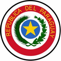
Paraguay Coat of Arms
Paraguay data:
Territorial extension: 406,752 km².
Location: South America.
Capital: Assumption.
Climate: Dry tropical (northwest and northeast), tropical (in the central portion) and subtropical (in the south).
Government: Presidential Republic.
Administrative division: 17 departments.
Current president: Federico Franco.
Languages: Spanish and Guarani (official).
Religions: Christianity 95.5% (Catholics 86%, Protestants 6.2%, others 3.3%), no religion and atheism 2%, others 2.5%.
Population: 6,348,917 inhabitants. (Men: 3,205,235; Women: 3,143,682).
Composition: Euramerindian 95%, Guaraní 3%, European Iberian 2%.
Demographic density: 15.6 inhab/km².
Average annual population growth rate: 1.7%.
Population residing in urban areas: 60.9%.
Population residing in rural areas: 39.1%.
Undernourished population: 11%.
Life expectancy at birth: 71.5 years.
Households with access to drinking water: 77%.
Households with access to a health network: 70%.
Human Development Index (HDI): 0.640 (average).
Currency: Guarani.
Gross Domestic Product (GDP): 16 billion dollars.
GDP per capita: 1,959 dollars.
External relations: World Bank, IMF, Rio Group, MERCOSUR, OAS, WTO, UN.
By Wagner de Cerqueira and Francisco
Graduated in Geography
Would you like to reference this text in a school or academic work? Look:
FRANCISCO, Wagner de Cerqueira and. "Data from Paraguay"; Brazil School. Available in: https://brasilescola.uol.com.br/geografia/dados-paraguai.htm. Accessed on June 29, 2021.


