Hurricane Ian hit Cuba on Tuesday (27) and is in category 3 out of 5 on the Saffir-Simpson wind scale.
After crossing Cuban territory through the province of Pinar del Río, the hurricane follows the Gulf of Mexico towards the state of Florida, in the U.S.
The storm recorded winds of up to 200 km / h, according to the National Hurricane Center (NHC), the United States.
Thousands of people had to leave their homes in Cubawith the passage of the hurricane. So far, no fatalities have been reported from the phenomenon.
The hurricane left Cuba by sea at 11:40 am (local time), according to the Meteorological Institute (Insmet) of Cuba. Heavy rains are still expected in Cuban territory.
Read too:how hurricanes, cyclones, and typhoons form
Hurricane Ian heading for Florida
Authorities in the state of Florida, in the United States, warned residents about the storm yesterday (26) when the hurricane strengthened.
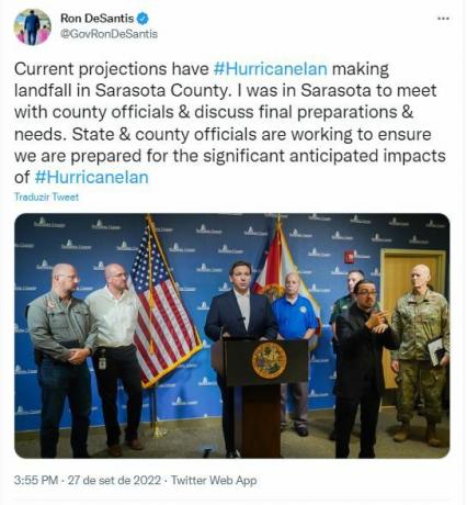
Hurricane Ian is expected to make landfall on US soil through Sarasota County. The information was published on the Twitter profile of the governor of Florida, Ron DeSantis, this Tuesday afternoon (27):

Credit: Reproduction / Twitter
Ron De Santis warns of "major impacts across the state". The governor declared a state of emergency for all of Florida and called in 5,000 National Guard troops to provide needed support.
Do not stop now... There's more after the publicity ;)
Among the risks mentioned by De Santis are flash floods, strong winds and rain, dangerous seas and isolated tornadoes.
The United States Environmental Safety and Inspection Agency reported that approximately 11% of current oil production and 8.56% of natural gas production were stopped.
Check out in the video below the difference between hurricane, cyclone and tornado:
By Lucas Afonso
Journalist


