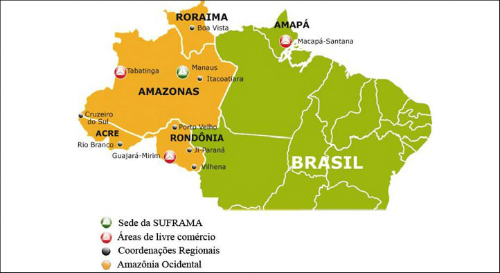
The northern region of Brazil is the least populated, however, it is the richest in biodiversity and natural landscapes. As for the characteristics of the hydrography and also the relief, both establish a relationship of effective interdependence, that is, one influences the other.
The region is home to the largest hydrographic network in the world, the Amazon Basin, named after its main river, the Amazon. It is the largest in the world in terms of extension and volume, during the 6,571 km it travels and drains the waters of approximately 7,000 tributaries.
Most of the rivers in the region are extensive and voluminous, which comes from the flat relief. The most prominent rivers are: Amazonas and Tocantins. The hydrographic network is characterized by its navigation potential, considering that there are about 25 thousand km of viable route for the displacement of river vessels. Several rivers that make up the Amazon Basin run through areas composed of plateaus, a factor that favors their use for hydraulic exploration, that is, production of electricity. However, due to the distance between these rivers and the main industrial and urban centers in the country, their exploitation for this purpose becomes unfeasible.
There are different relief features (plains, depressions and flattened plateaus) in the North region, however, what predominates is a very flat surface, that is, the plains. In all territorial extension, 5 plateaus, 5 depressions and 4 plains are identified, besides three high peaks, they are: Monte Caburaí, with 1,456 meters of altitude; Mount Roraima, with 2,727 meters; and the highest point in the country, Pico da Neblina, at 2,993 meters.
Do not stop now... There's more after the advertising ;)
By Eduardo de Freitas
Graduated in Geography
Would you like to reference this text in a school or academic work? Look:
FREITAS, Eduardo de. "The hydrography and relief of the North region"; Brazil School. Available in: https://brasilescola.uol.com.br/brasil/a-hidrografia-relevo-regiao-norte.htm. Accessed on July 27, 2021.


