Located in the central portion of the Asian continent and landlocked, Tajikistan has borders with Afghanistan (to the south), China (to the east), Kyrgyzstan (to the north) and Uzbekistan (to the northwest and to the west). The national territory is marked by high altitudes, which average 3 thousand meters above sea level, with peaks reaching more than 7 thousand meters.
In 1922, the country was incorporated into the Union of Soviet Socialist Republics (USSR), however, with the end of the USSR, Tajikistan gained independence. on September 9, 1991, joining the Commonwealth of Independent States (CIS) - bloc formed by Russia and the former republics Soviets. After political autonomy, the nation faced a conflict involving communists (who were supported by the Russian government) and Muslim groups, who received military apparatus from Afghanistan. This confrontation lasted from 1992 to 1993, causing the death of more than 50 thousand people.
The national economy, which is the least developed in the CIS, was severely damaged by the civil war. Despite the limited availability of land for agriculture (only 10%), the majority of the population works with rural activities. The main crops are: cotton, fruits and vegetables. Another element of great importance is the mineral wealth of the soil, which has gold, silver, aluminum, iron, lead, mercury, tin, etc.
According to 2010 data from the United Nations (UN), Tajikistan has an average Human Development Index (HDI): 0.580. Inhabitants are affected by various socioeconomic problems - malnutrition affects 34% of the population, more than half live below the poverty line (with less than $1.25 per day), the infant mortality rate is 59 for every thousand live births, environmental sanitation services are intended for less than half of the residences.

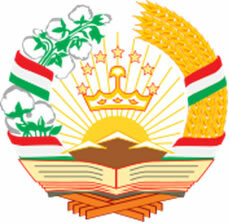
Coat of arms
Tajikistan data:
Territorial extension: 143,100 km².
Location: Asia.
Capital: Duchambe.
Climate: Cold arid (mostly) and mountainous (southeast).
Government: Presidential Republic.
Administrative division: 3 regions, one of which is autonomous (Kuhistoni Badakhshon).
Languages: Tajik (official), Russian.
Religions: Islam 83.8%, no religion 12.3%, other 2%, atheism 1.9%.
Population: 6,952,223 inhabitants. (Men: 3,432,263; Women: 3,519,960).
Composition: Tajiks 62%, Uzbeks 24%, Russians 8%, other 6%.
Demographic density: 48.5 inhab/km².
Average annual population growth rate: 1.5%.
Population residing in urban areas: 26.46%.
Population residing in rural areas: 73.54%.
Undernourished population: 34%.
Life expectancy at birth: 66.5 years.
Households with access to drinking water: 67%.
Households with access to a health network: 92%.
Human Development Index (HDI): 0.580.
Currency: Somoni.
Gross Domestic Product (GDP): 5.1 billion dollars.
GDP per capita: $460.
External relations: World Bank, CIS, IMF, UN.
By Wagner de Cerqueira and Francisco
Graduated in Geography
Brazil School Team
countries - geography - Brazil School
Source: Brazil School - https://brasilescola.uol.com.br/geografia/tadjiquistao.htm

