How many times have you asked yourself: “Where is the school?”, “Where is Brazil?”, “Where is this street?”, “How to get to the park?”, “I'm going to travel to the interior of Minas Gerais. But where is it?”.
These questions can be answered without anyone making a sound through their mouth. Just look at a map.
But what is a map?
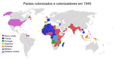
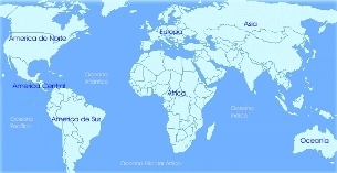
The map is a graphical representation of the earth's surface that serves for the orientation and location of objects, people, streets, cities and countries in geographic space.

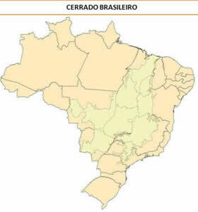
Map showing the location of the Cerrado Biome in Brazilian territory
In addition to the map, you may have already seen graphs and tables, which are also graphical representations. They serve to demonstrate certain events in geographic space. For example, population growth graph, unemployment rate, etc.

Table showing agricultural production in Goiás in 2008
So now you know that maps, graphs and tables are graphical representations to demonstrate events in geographic space.
Cartography will be the knowledge responsible for gathering geographic information and representing it in maps, graphs and tables. Based on scientific, technical and artistic knowledge, cartography elaborates graphic representations.
Graphic representations help both the orientation and location of something in geographic space, as well as the representation and demonstration of geographic phenomena.
By Regis Rodrigues
Graduated in Geography
Take the opportunity to check out our video lesson on the subject:


