O Rio Grande do Sul is a Brazilian state that integrates the South region, being the southernmost unit of the national territory. The seat of the state government is in the city of Porto Alegre. With 11.4 million inhabitants, the population of Rio Grande do Sul is the sixth largest in Brazil. The predominant climate in the state is the Subtropical, characterized by mild temperatures and harsh winters, and has a relief formed by plateaus and depressions.
He also read: Paraná – state in southern Brazil whose population is made up of 28 different ethnicities
General data for Rio Grande do Sul
- Region: South
- capital: Porto Alegre
- Government: representative democracy
- Areaterritorial: 281,707.149 km² (IBGE, 2020)
- Population: 11,422,973 inhabitants (IBGE, 2020)
- Densitydemographic: 37.96 inhab./km² (IBGE, 2010)
- spindle: Brasília Standard Time (GMT -3 hours)
- Climate: Subtropical
Geography of Rio Grande do Sul
Rio Grande do Sul is a Brazilian state belonging to the southern region. It consists of the southernmost federative unit in the territory, in addition to having the southernmost point of Brazil: the Chuí creek, which is on the southern border of Rio Grande do Sul with Uruguay. In addition to this country, located southwest of the state, Rio Grande do Sul borders the
Argentina, to the west, with Santa Catarina, to the north, and has an exit to the Atlantic Ocean, to the east.Rio Grande do Sul climate
Rio Grande do Sul is located in the Southern Temperate Zone of the planet. As a result, the Predominant climate in the state is the Humid Subtropical. One of its main features is the best distinction between the four seasons and the abundant and well-distributed rains throughout the year.
Regarding temperatures, the annual averages are between 14 ºC and 22 ºC. You summers range from warm to mild depending on the region, and the winters in the state they can be rigorous due to the high influence of polar air masses, which can lead thermometers to record temperatures close to zero or even negative.
In the months of autumn it's winter, frost is not uncommon and there is a possibility of precipitation in the form of snow, mainly in the mountainous region.
Relief of Rio Grande do Sul
With part of its territory inserted in the southern Brazilian plateau, the relief of Rio Grande do Sul can be divided into four morphological units.
The first one is the south-rio-grandense plateau, which covers all northern lands and a part of the western part of the state. It is where its highest elevations are located, which includes the highest point of Rio Grande do Sul: the peak of Monte Negro, located in the municipality of São José dos Ausentes, in the northeast region of the state, and at 1410 meters above the level of the sea.
The second is the central depression, which also extends to the southwest. The next unit consists of the Rio Grande do Sul shield, in the southeast and south of the state, and, subsequently, covering the entire coastal strip, there is the coastal plain.
Vegetation of Rio Grande do Sul
Rio Grande do Sul is covered by two biomes:
- Atlantic forest, in the northeast and part of the north of the state;
- Pampas, which, in Brazil, is restricted to the territory of Rio Grande do Sul.
Small plant species such as grasses and herbaceous plants predominate in this area, as well as shrubs and small trees.
It is located in the northeast of the state a fraction of mminutes of Theraucarias, as well as forests that cover a part of the western part of the state and a part of the coastal zone. The coast of Rio Grande do Sul is composed of characteristic formations such as restingas and dunes, without the presence of mangroves.
See too: Pantanal – largest floodplain in the world
Rio Grande do Sul hydrography

big three watersheds integrate the south-rio-grandens territoryand, the largest of them being the Uruguay basin, which covers 57% of the state's area. The second is the Guaíba basin, in the central portion of Rio Grande do Sul, and the Litorânea basin.
In addition to the waterways, the state's hydrological network is formed by lakes, such as the Lagoa dos Patos, on the coast, and the Lago Mirim, which begins on the coast of Rio Grande do Sul and extends to Uruguay.
Rio Grande do Sul map

Demographics of Rio Grande do Sul
With 11,422,973 inhabitants (IBGE, 2020), Rio Grande do Sul is the sixth most populous state in Brazil and the second in the South of the country, representing about 37.9% of the population in this region. According to the 2010 Demographic Census, the population distribution in the state was 37.96 inhabitants/km². This value jumped to 40.54 inhab/km², taking into account data for 2020.
The largest portion of the population of Rio Grande do Sul lives in urban centers, being the 85% urbanization rate. Porto Alegre, the state capital, is the municipality with the largest number of inhabitants, with 1,488,252, ranking 12th in the ranking of the most populous cities in Brazil. Caxias do Sul has the second largest population in the state, with 517,451 inhabitants.
The state's birth rates are down, which indicates slowdown in vegetative population growth. On the other hand, the number of people over 60 years of age has been increasing, with a life expectancy of 78.5 years.
Geographical division of Rio Grande do Sul
The territory of Rio Grande do Sul is divided into 497 municipalities. Since 2017, IBGE groups these units into 43 immediate geographic regions, which, in turn, form eight intermediate geographic regions, listed below:
- Porto Alegre
- pellets
- Santa Maria
- Uruguayan
- Ijuí
- Deep step
- Caxias do Sul
- Santa Cruz do Sul-Lajeado
Economy of Rio Grande do Sul
The Gross Domestic Product (GDP) of Rio Grande do Sul is R$ 457.29 billion, equivalent to 6.5% of Brazil's GDP. The state's economy accounts for 38.2% of the GDP in the south of the country, ranking first among the states that make up the region. The services correspond to 54.13% of the GDP value of Rio Grande do Sul, followed by industry (22.44%) and agriculture (8.98%).
O secondary sector is led by transformation industry, guided by the activities developed in the primary sector, that is, agriculture and, to a lesser extent, extractivism. Of note are tobacco, the production of food and beverages, such as wine, leather and shoes, the wood and pulp and paper industry, biofuels, and the chemical and mineral industries.
The state's agricultural production is guided by the soy, tobacco, mate, corn, wheat, rice, beans and cassava crops. Rio Grande do Sul is also a great breeder of sheep and cattle, which directly reflects on the production of milk, eggs, leather and meat.
See too: What is Brazil's GDP?
Government of Rio Grande do Sul
Rio Grande do Sul is a representative democracy, characterized by the holding of periodic elections for the population to choose their rulers. The state executive branch is headed by the governor. The Legislative is composed of three senators, 31 federal deputies and 55 state deputies. The seat of the state government is in Porto Alegre.

Infrastructure of Rio Grande do Sul
The state transport network is highly highway-centric. In addition to the state roads, the federal roads that pass through the state's territory are, among others: BR-101, BR-116, BR-153, BR-163, BR-290, BR-386. Some of them have a large movement of cargo derived from agricultural activities, serving as shipping routes to other Brazilian states and also to neighboring countries.
At railways in operation in the state, they are managed by the company Rumo Malha Sul, and are used both for transporting people, especially on tourist routes, and for transporting goods.
O main port in the state is Rio Grande, located in the city of the same name. Also on the coast of Rio Grande do Sul there are state waterways. In air transport, the Salgado Filho International Airport, in the capital, is the main one.
Flag of Rio Grande do Sul

Culture of Rio Grande do Sul
The gaucho cultural mosaic was formed based on diverse traditions and customs aggregated by populations of diverse origins, such as indigenous peoples, Portuguese, Africans, people coming from neighboring countries, such as Argentina, and European migrants who arrived in Rio Grande do Sul in the 19th century. In the latter case, the Italians, Poles and Germans have greater influence.
One of the important elements that is kept in some locations in the state is the mother tongue of the ethnic groups that make up the population of Rio Grande do Sul, which also reflects in the everyday language of Portuguese speakers.
Held every September, the Ragamuffin Week is considered the biggest popular celebration in Rio Grande do Sul. Traditional festivals also include the Feast of Our Lady of the Navigators, a PartygivesGrape and the Oktoberfest. In addition, the state is the stage for Gramado Film Festival, that happens annually.
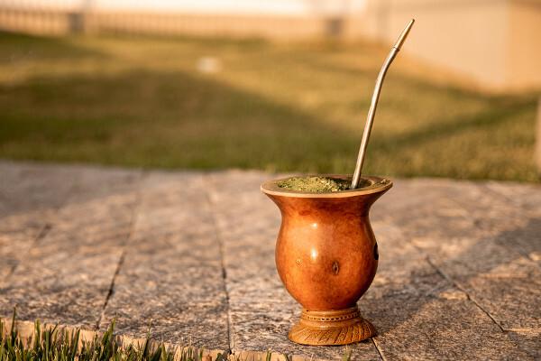
Red meat is widely present in Rio Grande do Sul gastronomy. O barbecue is one of the typical dishes, with the roasted ribs and the rice carreteiro. One of the most consumed beverages is chimarrão, which is based on yerba mate.

History of Rio Grande do Sul
During the first century of Brazil's colonization, Rio Grande do Sul was inhabited by different indigenous populations. Only in 1626 did the Spanish priests reach the region, across the western border, and found the first missions. In the middle of that century, the bandeirantes entered Rio Grande do Sul lands, engaging in direct conflict with the indigenous peoples.
The Portuguese only occupied the area in 1680, giving rise to the Colony of Sacramento, which was in current Uruguayan territory. Several conflicts arose between Portuguese and Spaniards in the border region, motivated by the dispute over the dominance of the southern lands. These clashes ended only with the Treaty of Santo Ildefonso, in 1777, a document that guaranteed the Portuguese possession of Rio Grande (founded in 1737), and, to the Spanish, domination over Sacramento.
THE War of the Rags (or Farroupilha Revolution) was one of the conflicts that marked the history of the state, extending from 1835 to 1845. It was triggered by the elite state discontent with high taxes charged by the government on the production of jerky, and later acquired a political character.
By Paloma Guitarrara
Geography teacher

