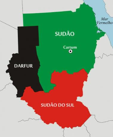
Located in the central portion of the African continent and "cut" by the equator, the territory of Uganda borders with Sudan (to the north), Kenya (to the east), Tanzania (to the south), Rwanda (to the southwest) and the Democratic Republic of Congo (the West). The country has large lakes, especially Albert and Vitória, which is the largest in Africa.
Former British colony (independence was conquered on October 9, 1962), the country is part of the British Commonwealth – a bloc formed by the United Kingdom and its former colonies. Later, the nation was ruled by several dictators who oppressed the inhabitants and commanded persecution of their opponents. In 1971, Idi Amin Dada, commander of the Armed Forces, staged a coup and assumed the national presidency, a position he held until 1979. This eight-year period (1971 to 1979) was the most violent in Ugandan history, in which several opponents were murdered.
Ugandans, in addition to living decades under dictatorial political regimes, face several socio-economic problems. Environmental sanitation services are provided to a minority of the population, a fact that reflects on the high infant mortality rates (72 deaths per thousand births) and low life expectancy: 50 years old. Another negative social factor refers to the high rate of illiteracy – 27% of inhabitants over 15 years of age are illiterate. The country also has high unemployment rates, and most of the population lives below the poverty line, that is, on less than $1.25 a day.
The national economy is underdeveloped, with agriculture being the main source of income. Fertile soils and the great availability of water drive this economic sector, with emphasis on the cultivation of coffee, which employs the majority of Ugandans, in addition to being the prominent product in exports. The nation also has large mineral reserves, especially copper and cobalt.
Do not stop now... There's more after the advertising ;)

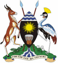
Coat of arms
Uganda Data:
Territorial extension: 235,880 km².
Location: Africa.
Capital: Kampala.
Climate: Equatorial of altitude.
Government: Presidential Republic.
Administrative division: 77 districts.
Languages: English (official), regional languages (main: luganda).
Religions: Christianity 88.9% (Catholics 43.4%, Anglicans 36.8%, others 8.7%), Islam 5.4%, traditional beliefs 5.1%, no religion and atheism 0.6%.
Population: 32,709,865 inhabitants. (Men: 16,382,656; Women: 16,327,209).
Composition: Indigenous ethnic groups 68.9% (hugandas 17.8%, tenos 8.9%, niancoles 8.2%, sogas 8.2%, gisus 7.2%, chigas 6.8%, langos 6%, Rwanda 5.8%), another 31.1%.
Demographic density: 138.6 inhab/km².
Average annual population growth rate: 3.2%.
Population residing in urban areas: 13.12%.
Population residing in rural areas: 86.88%.
Undernourished population: 15%.
Life expectancy at birth: 50.5 years.
Households with access to drinking water: 64%.
Households with access to a health network: 33%.
Human Development Index (HDI): 0.422 (low).
Currency: Ugandan Shilling.
Gross Domestic Product (GDP): 14.5 billion dollars.
GDP per capita: 403 dollars.
External relations: World Bank, Commonwealth, IMF, WTO, UN, AU.
By Wagner de Cerqueira and Francisco
Graduated in Geography
Brazil School Team
countries - geography - Brazil School


