You rivers of Brazil They are fundamental for the supply of national biomes, for the supply of water to the population and economic agents and also for transport. Rich in water resources, the country has a dense drainage network that covers all regions. Most Brazilian rivers are perennial rivers that, favored by the climate, do not dry out during the period without rain. Furthermore, the natural characteristics of Brazil's rivers provide high hydroelectric potential, which is widely used in different parts of the country.
There are thousands of rivers in Brazil. Below we list just nine of the main ones:
Amazon river;
Madeira River;
Xingu River;
Tocantins River;
Araguaia river;
São Francisco river;
Parnaíba river;
Parana River;
Paraguay River.
Read too: What are the main rivers in the world?
Topics in this article
- 1 - Summary of Brazil's rivers
- 2 - What are the rivers in Brazil?
-
3 - Characteristics of the main rivers in Brazil
- → Amazon River
- → Madeira River
- → Xingu River
- → Tocantins River
- → Araguaia River
- → São Francisco River
- → Parnaíba River
- → Paraná River
- → Paraguay River
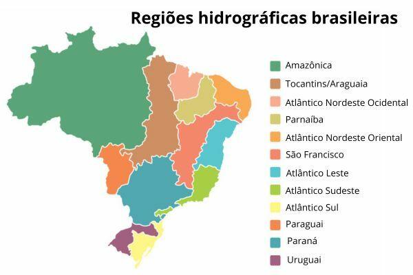
- 4 - Map of Brazilian hydrographic regions
- 5 - What is the largest and smallest river in Brazil?
Summary about Brazil's rivers
Brazil It is a country with abundant water, holding a third of the surface water on the American continent and just over 12% of the world's drinking water.
The country has a wide and dense river network that serves all regions.
The main rivers in Brazil are: Amazon River, Madeira River, Xingu River, Tocantins River, Araguaia River, São Francisco River, Parnaíba River, Paraná River and Paraguay River.
The types of climate in Brazil favor the occurrence of perennial rivers, for the most part, which are characterized by the presence of water in their beds throughout the year, even during drought.
Brazil's rivers have high potential for generating electricity and for inland navigation.
Thousands of rivers cross Brazilian territory, but at least nine of them draw attention due to their size and environmental, social and economic importance.
Brazil's rivers are divided into 12 hydrographic regions, and each of them has one or more river basins.
The Amazon River, which flows through the states in the North of Brazil, is the longest and most powerful in the world.
The Azuis River, in the state of Tocantins, is the smallest in Brazil and one of the smallest in the world.
What are the rivers in Brazil?
Brazil is one of the largest holders of water resources on planet Earth. Approximately 13% of the world's surface waters are concentrated in Brazilian territory. This amount represents a little more than a third of all surface fresh water contained in the Americas. This factor, added to the occurrence of predominantly humid and rainy climates, conditions Brazil to existence of a dense hydrographic network formed by thousands of watercourses that drain the country from north to south. Below we list some of the main rivers in Brazil:
Amazon river;
Madeira River;
Xingu River;
Tocantins River;
Araguaia river;
São Francisco river;
Parnaíba river;
Parana River;
Paraguay River.
Do not stop now... There's more after the advertising ;)
Characteristics of the main rivers in Brazil
→ Amazon river
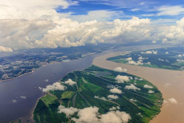
The Amazon Riveris the most extensive and the most extensive (higher water flow) river of the world, extending 6,992 km from its source in the Peruvian portion of the Andes mountain range to its mouth on the island of Marajó, between the Brazilian states of Amapá and Pará.
The exclusively Brazilian stretch of the Amazon River is more than three thousand kilometers long and directly borders the states of Amazonas, Pará and Amapá. Together with its more than a thousand tributaries, including the Purus, Madeira and Negro rivers, this important watercourse forms the Amazon basin, also considered the largest in the world, with an area of 7 million square kilometers that covers eight South American territories and seven states Brazilians.
The waters of the Amazon River, in Brazilian territory, run through plain areas, which makes them suitable for navigation. As a result, the Amazon River It is an important transport route for cargo and passengers., especially in regions that are difficult to access. In addition to being essential for transportation, the Amazon River provides water for thousands of people and feeds the region with the greatest biodiversity in the world, which is the Amazon Rainforest.
→ Madeira River
The Madeira River is a 3,315 km long watercourse that runs through the states of Rondônia and Amazonas, in the Northern region of Brazil. It is considered the largest tributary of the Amazon River, where it flows. The source of the Madeira River is located in a mountainous region in Bolivia, and, before entering Brazil, this watercourse also bathes Peruvian territory.
The steepness and wide flow of the Madeira River give this watercourse great potential for generating electricity, which is used in the Jirau and Santo Antônio hydroelectric plants, both located in the stretch Rondônia. The Madeira River is of great importance for urban supply and transport, being widely used for moving heavy loads, such as grains. Furthermore, It harbors enormous biodiversity in its waters and feeds part of the Amazon biome.
→ Xingu River
The Xingu River It is a watercourse that originates at an altitude of 600 meters nthe confluence between the Culuene and Sete de Setembro rivers in a plateau area in the state of Mato Grosso, in the Central-West region. From there, it runs approximately 1,980 km through the state of Pará, in the North region, until it flows into the Amazon River near the city of Porto de Moz.
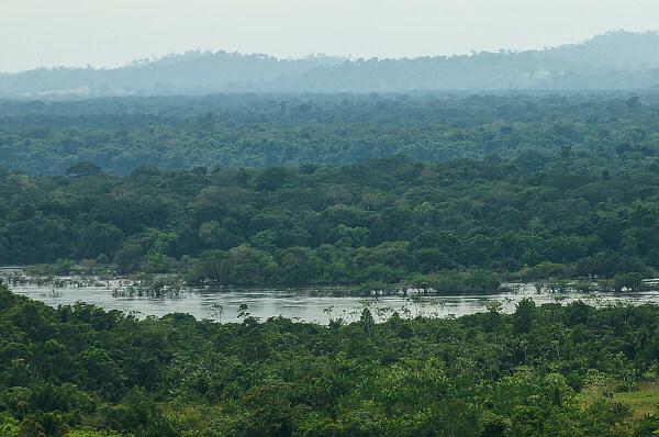
This watercourse bathes sections of two of the most important and threatened Brazilian biomes, the Cerrado and the Amazon. Its waters are essential for maintaining the biodiversity of these ecosystems, as well as for the use of the population of the numerous cities it passes through. Among these populations are traditional communities, notably indigenous people and riverside people.
The Belo Monte Hydroelectric Plant was built near the Pará city of Altamira, which is the largest hydroelectric plant exclusively in Brazil. Despite its importance for energy generation in the national territory, the Belo Monte Plant caused serious socio-environmental impacts.
→ Tocantins River
The Tocantins Riveris a watercourse that originates in the Center-West of Brazil, more precisely between the Goiás municipalities of Ouro Verde de Goiás and Petrolina de Goiás, at an altitude of 1,100 meters. It runs 2,416 km between this area and the North and Northeast regions of the country, passing through almost 30 municipalities in the states of Tocantins and Maranhão until it flows into the bay of Marajó, in Pará. Its main tributary is the Araguaia River.

Although it is a perennial river, whose waters do not dry up during the dry season, the reduction in water levels forms freshwater islands and beaches during drought, which favors tourism in the state of Tocantins. More than 8 million people live in the hydrographic basin formed by this river who depend directly on the waters of the Tocantins and its tributaries for domestic supply. Yet, é important for maintaining local biodiversity and your natural aspects, which provide the occurrence of long navigable stretches and high hydroelectric potential.
→ Araguaia River
The Araguaia Riveris a watercourse that born on the plateau dthe Central-West region of Brazil, covering 2,115 km through the states of Mato Grosso, Goiás, Tocantins and Pará to the Bico do Papagaio region, where it meets the Tocantins river. Along with this, it forms the second largest hydrographic basin located entirely in Brazilian territory, which is the Tocantins-Araguaia basin. The Araguaia, for most of its length, serves as a natural border between the states it crosses, totaling 55 cities bathed by this river.

The river's great electrical potential is used mainly by the Tucuruí Plant, which is the third largest Brazilian hydroelectric plant. The extensive navigable stretches of the Araguaia are used to transport people and cargo, especially bulky cargo such as grains and ores. Still in the economy, fishing and tourism are two economic activities developed in Araguaia. In the second case, the formation of islands due to drought stands out, as happens in the course of the Tocantins River.
→ São Francisco River
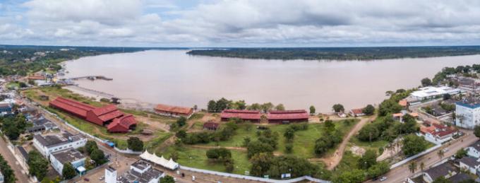
The São Francisco River, nicknamed Velho Chico, is a watercourse that originates in the Serra da Canastra State Park, in the state of Minas Gerais, but can be described as one of the main rivers from the Northeast region of Brazil. The São Francisco course is approximately 2,700 km long and runs through more than 500 municipalities between Minas Gerais Gerais, Goiás, Distrito Federal, Bahia, Pernambuco, Sergipe and Alagoas, where it flows into the ocean Atlantic. Furthermore, the waters of the São Francisco feed three large Brazilian biomes, which are the Cerrado, the Caatinga and the Atlantic Forest.

The San Francisco is of great importance for residential and urban supply, especially in the Northeast region. In 2008, works began to transpose the course of the São Francisco so that its waters reached a even larger population, aiming to meet the demand for this resource in regions of greater scarcity in four states of the North East.
The São Francisco River It is also essential for the economic sustenance of many families, which depend on fishing activity, and for the transport of cargo and people. Furthermore, five hydroelectric plants make use of the potential of this river, with emphasis on the Sobradinho and Paulo Afonso plants, both in Bahia.
→ Parnaíba River
The Parnaíba RiverIt is the second largest river in the Brazilian Northeast. It rises in the Chapada das Mangabeiras, on the border between the states of Maranhão, Tocantins, Piauí and Bahia, and crosses the territory of Piauí until it flows into the Atlantic Ocean, covering a total of 1,400 km and benefiting almost 300 municipalities located in its river basin.

The Parnaíba River is ffundamental for residential supply, mainly in cities in the semi-arid region, It is also provides water for irrigation in agricultural areas located in the states through which it passes and which constitute an important expansion region of the Brazilian agricultural frontier. Local producers use the Parnaíba river to transport cargo, as it presents extensive navigable stretches. The waters of the Parnaíba River are also used to generate electricity at the Boa Esperança Hydroelectric Plant, located in Guadalupe, Piauí.
→ Parana River
The Paraná River is a watercourse that runs 4,880 km from its source, on the border between the states of Mato Grosso do Sul and São Paulo, to its mouth, on the River Plate, in Argentine territory. On its route it crosses two of the most populous regions of Brazil, which are the Southeast and South, until reaching the country's borders with Paraguay and Argentina. The Paraná River basin supplies more than 60 million inhabitants It is plays a fundamental role in the economic activities developed in the region, such as agriculture and industry.
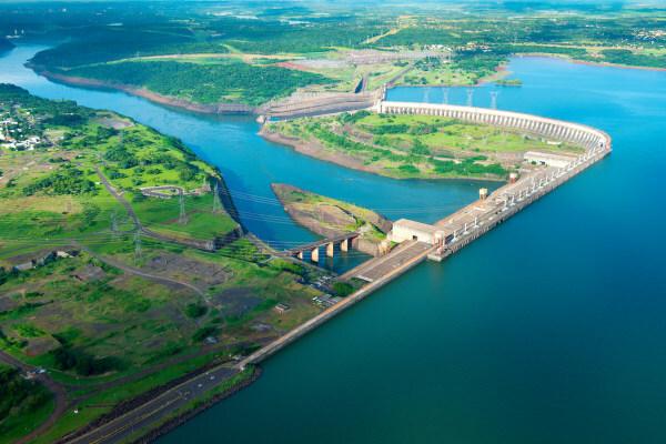
The slopes found in several stretches of the Paraná River give it a high hydroelectric potential, which is widely used to generate electricity at the Itaipu Binacional Power Plant, one of the largest hydroelectric plants in the world, which is located on the border of the state of Paraná with the Paraguay. Furthermore, this river it has wide stretches suitable for navigation. Its waterway is important for transporting goods and cargo between Mercosur countries, in addition to transporting part of the agricultural production from the Central-West and South regions.
→ Paraguay River
The Paraguay Riveris a watercourse that Born in the municipality of Alto Paraguai, in the state ofIt is Mato Grosso, and continues its course for 2,695 km until its mouth in Argentine territory. Along this route, the Paraguay River feeds the Pantanal system, a Brazilian biome located in the states of Mato Grosso and Mato Grosso do Sul, and contributes to the maintenance of Cerrado ecosystems Brazilian. This watercourse is part of the daily life of traditional populations, such as the indigenous people who live in the region, and feeds the main urban centers of Mato Grosso.

Due to the predominantly flat relief and other favorable natural aspects, the Paraguay River It is widely used for transporting passengers and also for transporting goods and cargo. derived from agricultural production in the Central-West region.
See too: What are the Brazilian biomes?
Map of Brazilian hydrographic regions
What is the largest and smallest river in Brazil?
Longest river in Brazil: Amazon River, which is 6,992 km long and flows through the states of Amazonas and Pará, in the North of Brazil. It has more than 1,000 tributaries and is considered the longest and most voluminous river in the world.
Smallest river in Brazil: Azuis River, whose crystal clear waters run through a stretch of just 147 meters in the city of Aurora do Tocantins, in the state also located in the North of Brazil. The Azuis is considered the third smallest river in the world.
Image credit
[1] Edivaldo Alves de Sousa / Wikimedia Commons (reproduction)
Sources
A-N-A. Panorama of the waters. National Water and Basic Sanitation Agency (ANA), [n.d.]. Available in: https://www.gov.br/ana/pt-br/assuntos/gestao-das-aguas/panorama-das-aguas.
A-N-A; SNIRH. Digital geographic atlas of water resources in Brazil. National Water Resources Information System (SNIRH), 2013. Available in: https://portal1.snirh.gov.br/atlasrh2013/.
IBGE. Rivers of Brazil. IBGE Educa, c2023. Available in: https://educa.ibge.gov.br/jovens/conheca-o-brasil/territorio/18305-rios-do-brasil.html.
ESSAY. At 147 meters long, the Azuis River, in Tocantins, is the smallest in Brazil. Amazon Portal, 2021. Available in: https://portalamazonia.com/estados/tocantins/com-147-metros-de-comprimento-o-rio-azuis-no-tocantins-e-o-menor-do-brasil.
VELASQUEZ, Cristina; QUEIROZ, Heber; BERNASCONI, Paula. (Eds.) Stay in: the Xingu river basin in Mato Grosso. São Paulo: Instituto Socioambiental; Instituto Centro de Vida, 2010. (Cartô Brasil Socioambiental Series). Available in: https://www.icv.org.br/noticias/fique-por-dentro-a-bacia-do-rio-xingu-em-mato-grosso-2/.
Would you like to reference this text in a school or academic work? Look:
GUITARRARA, Paloma. "Rivers of Brazil"; Brazil School. Available in: https://brasilescola.uol.com.br/brasil/rios-do-brasil.htm. Accessed on November 7, 2023.