
Florianópolis is a Brazilian municipality and capital of the state of Santa Catarina, which is in the southern region of Brazil. the city is formed by a set of islands and a continental stretch, being the Island of Santa Catarina the largest of them. Due to its rich folklore and legends that permeate the popular imagination, it is known as Ilha da Magia. Florianópolis is the second most populous city in Santa Catarina, with 508.8 thousand inhabitants, and the third largest economy in the state.
Read too: What are the capitals of Brazilian states?
Summary about Florianópolis
Florianópolis is the capital of the state of Santa Catarina, in southern Brazil.
Most of its territory lies on Santa Catarina Island, the largest island in the archipelago that forms the city.
It integrates the Metropolitan Region of Florianópolis.
It has a humid subtropical climate and heterogeneous relief, consisting of plains, hills, dissected valleys and dunes.
It is the second most populous city in Santa Catarina, with 508,826 inhabitants.
Its GDP is R$21.05 billion, the third highest in the state.
Florianópolis' economy is led by the tertiary sector, with an emphasis on tourism.
It has a very diverse technology park.
The city is known as Ilha da Magia due to the numerous legends that originate in the capital of Santa Catarina.
Florianópolis general data
Gentile: Florianopolitan.
-
Location of Florianópolis
Parents: Brazil.
Federative unit: Santa Catarina.
Intermediate region[1]: Florianópolis.
Immediate region[1]: Florianópolis.
Metropolitan region: Metropolitan Region of Florianópolis. Formed by the following municipalities: Florianópolis, Águas Mornas, Antônio Carlos, Biguaçu, Governador Celso Ramos, Palhoça, Santo Amaro da Imperatriz, São José, São Pedro de Alcântara.
Bordering municipalities: Saint Joseph.
-
Florianópolis geography
Total area: 674.844 km² (IBGE, 2020).
Total population: 508,826 inhabitants (IBGE, 2020).
Density: 623.68 inhab./km² (IBGE, 2010).
Climate: humid subtropical.
Altitude: 3 meters.
Time zone: GMT -3 hours.
-
Florianópolis History
Foundation: March 23, 1673.
See too: Victory — capital of the southeastern state of Espírito Santo
Florianópolis geography
Florianópolis is a Brazilian city located in Rsouthern region from the country and capital of the state of Santa Catarina. Located in eastern Santa Catarina, most of the municipality is on the island of Santa Catarina. In addition to this, Florianópolis is made up of several islands and islets, all of them bathed by the Atlantic Ocean. According to IBGE, the total area of the municipality is approximately 675 km², equivalent to 0.7% of the state area.
To the west, where its continental portion is located, the capital of Santa Catarina borders the city of São José. It integrates the Metropolitan Region of Florianópolis or Greater Florianópolis, which is made up of eight other municipalities. Its metropolitan expansion area, in turn, comprises 13 municipalities.

Florianópolis climate
The capital of Santa Catarina is located in a part of the globe where there is predominance of subtropical climates. The influence of maritime life conditions the city to a climate humid subtropical or humid mesothermic. It is characterized by rains that are well distributed throughout the year, which add up to between 1,400 and 1,600 mm, and mild temperatures. The average in summer is around 24 ºC, while in Winter the thermometers record an average of 16°C.
Florianópolis relief
Florianópolis has a very heterogeneous relief, composed by plains, in which it is observed, on certain surfaces, the formation of dissected dunes, hills, hills, mountains and valleys. The highest elevations are concentrated in the interior of Santa Catarina Island, notably in the northern region. Its highest point is at Morro do Ribeirão, 520 meters above sea level.
Florianópolis Vegetation
Florianopolis is inserted in the biome Atlantic forest and it also exhibits formations characteristic of the Brazilian coastal-marine system. Therefore, mangroves, salt marshes and humid tropical forests and dense ombrophilous forests are found in its area in some regions.
Florianópolis Hydrography
The Florianópolis drainage network splits into six watersheds main:
of the Ratones,
of Big Bag,
of Lagoa da Conceição,
from Lake Peri,
of the Tavares River and
of Itacorubi.
Important aquifers, which are nothing more than geological structures through which water moves underground, also make up the city's hydrography, namely: Campeche, Ingleses and Rio Red.
Florianópolis map

Demographics of Florianópolis
Florianópolis is the second most populous city in the state of Santa Catarina, just behind Joinville. The capital has 508,826 inhabitants, equivalent to 7% of all residents of that state. The capital of Santa Catarina is in 23rd place among the state headquarters in Brazil, being the least populated in the South Region, thus being behind Curitiba (PR) and Porto Alegre (LOL). On a national scale, Florianópolis is in 48th position.
In 2019, the population of Florianópolis had a high growth rate, approximately 1.6% and 1.56% in the following year, which indicates an accelerated growth and about twice the population growth in Brazil.
The city can be considered densely populated, with a population distribution of 623.68 inhab./km², the 6th highest in Santa Catarina. The vast majority of Florianopolitanos live in the urban area of the municipality., corresponding to 96.2% of its inhabitants, while 3.78% live in the rural area of Florianópolis. Most of the residents of Florianópolis, 84.55%, declare themselves white. Browns make up 9.74% of the city's population. Blacks are 4.95%, yellows are 0.52%, and indigenous people are 0.24%.
See too: What is demographic transition?
Geographical division of Florianópolis
the territory of Florianópolis is divided into 85 districts. These are grouped into different districts, which are currently twelve in number. Are they:
Florianópolis (Headquarters);
Ribeirão da Ilha;
Campeche;
British from Rio Vermelho;
Bom Jesus Waterfall;
Cane vines;
Lagoa da Conceição;
São João do Rio Vermelho;
Southern Swamp;
Santo Antônio de Lisboa;
Barra da Lagoa;
Ratones.
Florianópolis Economy
Florianopolis is the third richest city in the state of Santa Catarina, behind only Joinville and Itajaí. The Gross Domestic Product (GDP) of the capital of Santa Catarina is BRL 21.05 billion, which corresponds to 7% of the state GDP, as shown by the data from IBGE for the year 2018.
The economy of Florianópolis is led by tertiary sector. This segment accounts for just over 75% of the municipality's wealth collection, even excluding activities linked to the public sector, which makes the amount even more expressive. Thus, we have that more than three quarters of the city's economy is formed by services and commercial activities.
Tourism is an important source of revenue in Florianópolis, notably in summer. Visitors especially go in search of beaches, including Jurerê Internacional and Traditional, Praia da Daniela, Praia da Joaquina, Praia da Lagoa, among others, totaling more than 40 places.
Although it does not have an extensive set of industries, Florianópolis has a large technological and innovation park, being responsible for moving other branches of the economy directly or indirectly linked to information and communication companies.
Industry accounts for 8.77% of the GDP of the capital of Santa Catarina, while the agricultural sector is responsible for a share of 0.28%. In this segment, the production of Florianópolis stands out in terms of fish, especially oysters, being one of the largest national producers of this mollusk.
Florianópolis Government
The government of Florianópolis is a representative democracy. City residents elect their representatives through the municipal election, which is held at four-year intervals. O Mayor is the head of the executive branch. The body that integrates the Legislative Power is the City Council, which is formed by 23 councilors.
Florianópolis plays the role of capital of Santa Catarina. This means that the city houses the official seat of the state government, which is located in the Administrative Center of the State Government of Santa Catarina.
Infrastructure of Florianópolis
The vast majority of residents of the capital of Santa Catarina live in its urban area and a small portion is in the rural area. Both situations thus demand a series of essential services and an infrastructure network to meet the basic needs of this population. The IBGE (2010) points out that just over half of the households, around 54.4%, it was located in areas with adequate urbanization, that is, with paving, sidewalks and manholes. Access to adequate sewage covered 87.8% of households. The general water supply network served 93.5% of households in Florianópolis, while 99.9% had access to electricity.
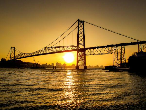
The connection between Santa Catarina Island and the mainland is made through the Hercílio Luz bridges, Colombo Sales and Pedro Ivo Campos, allowing transfers between different areas of the capital Santa Catarina. Some federal and state highways interconnect the capital with other cities and regions of the country, such as the BR-282. Florianópolis Hercílio Luz International Airport, located in the capital, is the main airport in the state of Santa Catarina.
Florianópolis Culture
THE culture Florianópolis has many elements of the Azorean culture and other peoples who migrated towards the Island of Santa Catarina. The city has a rich folkloric ensemble of legends, dances and festivities, which earned him the nickname of Isle of Magic. Furthermore, this nickname may have a direct reference to the beautiful landscapes observed along the entire coastal zone of the capital of Santa Catarina. Among the legends are that of the stones at Praia de Itaguaçu, which — they say — are said to be petrified witches, and that the map of the islands that make up the capital is shaped like a witch's silhouette.
Jurerê beach is one of the main tourist destinations in Florianópolis, in addition to the beaches of Joaquina, Ilha do Campeche, Praia Mole, Praia do Forte, Praia da Lagoinha and others. The city has many buildings and historical monuments that recount its formation and settlement process, such as the Fortress of São José da Ponta Grossa, historical heritage of Florianópolis, the Cruz e Souza Palace, which also houses the Santa Catarina Historical Museum, and the Santo Antônio dos Fort Ratones.
Check out our podcast:What is material and immaterial culture?
History of Florianópolis
The region where Florianópolis is located today was, since long before the arrival of the colonizers, inhabited by the Tupi-Guarani indigenous people. With the beginning of Brazilian colonization and the advance of Europeans through the south of the South America, the vessels only passed through the area without settling. in the year 1675, so at the end of the 17th century, began the settlement of the current capital of Santa Catarina, with the establishment of Francisco Dias Velho, intensifying from then onwards the arrival of immigrants from the Southeast region.
The first forts were built in the 18th century, as a strategy to protect the island territory. The advance in the settlement of Florianópolis also made the local economy progress., which was predominantly composed of primary activities and manufactures. From the moment it became the capital of the Province of Santa Catarina, in 1823, the process of modernization and urbanization of the city. Florianópolis is today one of the main urban centers in Santa Catarina, with the second largest population in the state.
By Paloma Guitarrara
geography teacher
