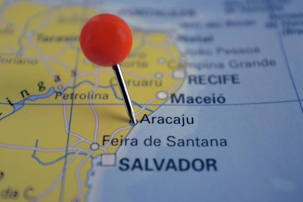
Aracaju is a Brazilian city and capital of the state of Sergipe, which is in the Northeast region of the country. Born as a planned city in the year 1855, and today it is the main political and economic center of the state. Aracaju also has the largest population contingent in Sergipe, with more than 664,000 inhabitants in 2020. Accounting for a large portion of the state economy, services and commerce represent the largest portion of Aracaju's GDP, with an emphasis on tourism.
Read too: What are the capitals of Brazilian states?
Summary about Aracaju
Aracaju is the capital of the state of Sergipe, in northeastern Brazil.
It is a planned city founded in the year 1855.
It has a semi-humid tropical climate and relief formed by plains and plateaus.
It integrates the Atlantic Forest biome.
Forms the Metropolitan Region of Aracaju.
It has 664,908 inhabitants, making it the most populous city in Sergipe.
It is the richest city in the state, with a GDP of R$ 17 billion, 41% of Sergipe's GDP.
The tertiary sector leads the economy of Aracaju, with an emphasis on tourism activities.
Among the city's sights are the Orla de Atalaia, the Passeio do Caranguejo, its beaches, and places such as the Oceanário and the Museu da Gente Sergipana.
Aracaju general data
Gentile: Aracajuan
-
Location
Parents: Brazil
Federative unit: Sergipe
Intermediate region[1]: Aracaju
Immediate region[1]: Aracaju
Metropolitan region: Metropolitan Region of Aracaju, formed by the following municipalities: Aracaju, Barra dos Coqueiros, Nossa Senhora do Socorro, São Cristóvão.
Bordering municipalities: São Cristóvão, Nossa Senhora do Socorro, Barra dos Coqueiros, Itaporanga d'Ajuda and Santo Amaro das Brotas.
-
geography
Total area: 182.163 km² (IBGE, 2020)
Total population: 664,908 inhabitants (IBGE, 2020)
Density: 3140.65 inhab./km² (IBGE, 2010)
Climate: semi-humid tropical
Altitude: four meters
Time zone: GMT -3
-
Historic
Foundation: March 17, 1855
See too: São Luís – capital of the northeastern state of Maranhão
Aracaju geography
Aracaju is the capital of the Brazilian state of Sergipe, located on the northeast coast of the country, being bathed by the Atlantic Ocean. The city has an area of 182 km² and is the third smallest capital in size in Brazil, only behind Victory (What if Christmas (RN).
As explained by the city of Aracaju, the municipalities that border the Sergipe capital are Nossa Senhora do Socorro, Santo Amaro de Brotas and São Cristóvão. Since 1995, together with three other municipalities, the city forms the Metropolitan Region of Aracaju.

Aracaju climate
In Aracaju there is the weather occurrence Ttropical semi-wet. This climate type is marked by the presence of a dry and a rainy season, in addition to the temperatures that remain high throughout the year, averaging 26 ºC. The precipitation is concentrated in the months of autumn and Winter, therefore, between March and August. The annual volume of rain reaches almost 1600 mm.
Aracaju relief
Aracaju is at domain of FORwoolen and Tmistakes Blines Çostlets, as indicated by the classification of the relief proposed by Aziz Ab’Sáber. The capital of Sergipe is composed of mostly flat terrains, characterized by features such as the fluvial-marine plains and coastal plateaus. The municipal seat is located four meters above sea level.
Aracaju Vegetation
the biome Atlantic forest comprises almost the entire east coast of Brazil, which includes the city of Aracaju. In addition, the city is part of Brazil's coastal-marine system, characterized by the presence of restingas and mangroves.
Aracaju Hydrography
the main Rivers that bathesm the city of Aracaju they are the Sergipe river, which runs to the north, and the Vaza-Barris river, which runs in the southern portion and divides between the territories of the Bahia and from Sergipe. Other important watercourses that make up the municipality's drainage network are the Poxim and Pitanga rivers, responsible for a good part of the supply to its metropolitan region, and the Sal river.
Aracaju Map
Aracaju Demographics
The city of Aracaju currently has a population of 664,908 inhabitants, according to the data of the IBGE for the year 2020. It is the largest population contingent in Sergipe, representing 28.67% of all residents in the state.
the municipality it is also the least populous among the state headquarters of Northeast region from Brazil, ranking 19th when considering all Brazilian capitals. Despite this, it is the capital that showed the fastest growth in the Northeast, which was 1.2% among the years 2019 and 2020, surpassing the Brazilian average of 0.88%, as informed by the IBGE unit of Sergipe.
Due to its small territorial extension, Aracaju consists of a heavily populated city, which means it is discharged demographic density. Thus, the population distribution in the capital of Sergipe is 3140.65 inhab./km² (IBGE, 2010). IBGE indicates that all households in Aracaju are located in its urban area.
According to population composition, more than half of Aracajuans declare themselves brown (56.13%). Just over a third declare themselves white (31.99%); 10.19%, black; 1.31%, yellow; and 0.38%, indigenous.
See too: Immigration - entry of an individual into a territory other than the one of origin
Aracaju geographic division
The territory of Aracaju is subdivided into 42 neighborhoods. The last IBGE Census, carried out in 2010, indicated that the district of Farolândia, located near the The coastal strip in the south of the city and limited to the north by the Sergipe river is the most populous of them. Also noteworthy are the Santa Maria and São Conrado districts.
Aracaju Economy
Aracaju is the richest city in Sergipe. Your Gross Domestic Product (GDP) is BRL 17.27 billion, which represents a share of approximately 41% of the state's wealth. Considering all cities in Brazil, Aracaju appears as the 53rd municipal economy.
It's the tertiary sector, comprising the provision of services and commercial activities, which leads the economy of Aracaju. Disregarding the participation of the public and administrative sector, the segment accounts for 65.88% of the GDP of the capital of Sergipe.
One of the main sources of revenue is tourism added to all the categories that it directly or indirectly moves. Aracaju has numerous beaches and natural landscapes, which attract many visitors, such as the beaches of Atalaia, dos Náufragos, de Aruana and Artistas, in addition to being located close to other important tourist areas in Sergipe, such as the São canyon Francisco.
Industry represents 14.2% of municipal GDP, while primary activities account for the smallest share, which is only 0.2%. In this segment, the practice of fishing and smaller-scale urban agriculture stand out.
Aracaju Government
Aracaju has a representative democracy, through which its population elects individuals who will occupy positions in the municipal government. O Mayor is one of them, being the head of the FOROder ANDlocal executive. The body that represents the Legislative Power is the City Council, which is composed of 24 councilors.
As the capital of the state of Sergipe, Aracaju represents the political-administrative center of this federative unit, housing the seat of government. The main functions, and where the governor's office is located, are carried out in the Governor Augusto Franco Palace.
Aracaju Infrastructure
All households in Aracaju are located in the urban area of the municipality., as shown by IBGE data. Thus, most of them use urban infrastructure services and are connected to municipal sanitation networks. a portion of 86.5% of these units received adequate sanitary sewage, and only 0.3% his was inadequate when the Census was carried out. The coverage of the water network is much greater, at 97.9%. Households with access to electricity, in turn, were 99.8%.
Transport and displacement carried out in Aracaju, and in its metropolitan region, take place through various modes. One of them is the waterway. In addition to ports for larger scale trips, such as the Port of Aracaju — which does not carry out export and import services because it is very shallow —, there is also transport between different cities in the region through rivers. It became popular on the Sergipe coast to use of the vessel called tototó, made of wood and whose name refers to the sound of its engine.
At federal and state roads are responsible for connecting the capital of Sergipe with other regions and Brazilian cities, and the Domestic and international flights operate mainly through Santa International Airport Mary.
Aracaju Culture
The capital of Sergipe has a Very rich cultural collection from diverse origins. The influences of the African and European populations stand out, which are manifested through the professed beliefs, dances, traditional festivals and in the various arts. An example is the Maloca urban quilombo, which preserves African traditions, such as the arts, revelry, which is a popular festival, folklore groups and religious festivals of Candomblé.|1|
The city's traditional festivals range from June celebrations to religious festivities, such as the day of the city's patron saint, on December 8, and the processions held in January. Aracaju's cultural calendar also includes music festivals and the Feira de Sergipe, which brings together exhibitors from all over the state.
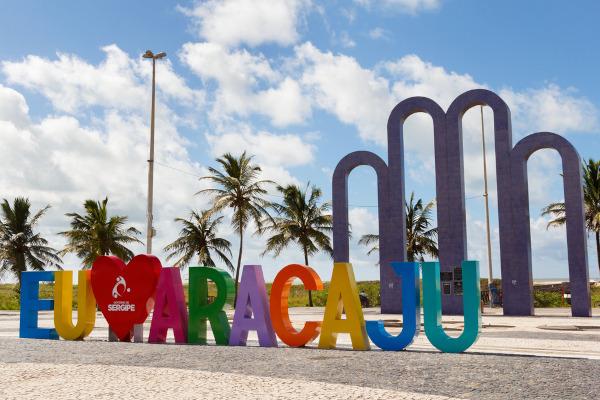
THE Orla de Atalaia and the Passarela do Caranguejo are some of the main tourist attractions in Aracaju. The capital of Sergipe also has an Oceanarium, where you can learn more about marine life. In addition, Aracaju has numerous historic buildings, museums such as the Museum of Sergipe People, and popular markets, where you can delve into the city's culture.
Check out our podcast: material and immaterial culture
Aracaju History
The first capital of Sergipe emerged in the first century of Brazilian colonization, with the foundation of the city of São Cristóvão near the Sergipe river, on January 1, 1590. Its founder, the Portuguese Cristóvão de Barros, did so after an attack on the indigenous tribes that lived there, as a way to guarantee Portuguese rule over the area.
The district of Aracaju was created in 1837, with this name, which means “caju tree of parrots”. As a planned city, it is considered that the foundation of Aracaju took place in the year 1855, having arisen from the need to transfer the capital of the then province of Sergipe to an area where it was easier to transport sugar production, which was not available in São Christopher.
With pre-established streets and blocks whose design form a chessboard, as it is commonly described, Aracaju was established in 1865, and its urban development began. Approximately two decades later, the city gained its first factory, and the arrival of the 20th century marked the acceleration of the process of urbanization of the capital of Sergipe. Today the city is Sergipe's main economic and political center.
Grades
|1| CITY HALL OF ARACAJU. Culture. Available on here.
Image credit
[1] Iuliia Timofeeva / Shutterstock
By Paloma Guitarrara
geography teacher