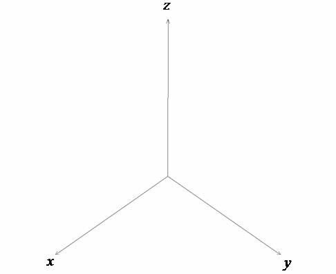
In mathematics we use an axis system that allows us to locate any point in the plane or in space. This coordinate axis is called the Cartesian Coordinate Plane. In it, we can represent graphs of functions and, through graphics revolution techniques, create new geometric shapes.
Coordinate axis involving two axes (x, y)

Coordinate axis involving three axes (x, y and z)

In everyday geographic life there is a location system based on cardinal points (north, south, east and west), collateral points (northeast, northwest, southwest and southeast) and at subcollateral points depending on compass. But this system only provides the meaning and not the exact location sought.
Seeking an exact location of points, two imaginary axes related to the terrestrial sphere were established: the equator line (horizontal) and the Greenwich meridian (vertical). Above the equator line we have the Northern Hemisphere and below we have the Southern Hemisphere ranging from 0º to 90º (above positive and below negative). The Greenwich meridian orients locations from East to West (0º to 180º), being it the main reference of the time zones.
Do not stop now... There's more after the advertising ;)
Note that the usual unit of location on the globe is degree. In this case, as the locations look for exact orientations, we use the submultiples of the degree: minute and second. Remembering that 1st (degree) corresponds to 60’ (minutes) and 1’ (minute) is equivalent to 60’’ (seconds).
To the elements latitude and longitude we add a reference relative to the sea level that is called altitude. Therefore, any point on the terrestrial sphere is under the location of three coordinate points: Latitude, Longitude and Altitude.

For example, the city of Caldas Novas–GO has the following approximate land location coordinates:
Latitude: 17º 44’ 69’’ south of the equator.
Longitude: 48º 37’ 95" west of Greenwich.
Altitude: 721 meters above sea level.
Source: Google Earth
Currently, programs such as Google Earth and GPS devices are used to determine the coordinates of cities and the exact location and orientation of the routes to be used.
by Mark Noah
Graduated in Mathematics
Brazil School Team
Roles - Math - Brazil School
Would you like to reference this text in a school or academic work? Look:
SILVA, Marcos Noé Pedro da. "Absolute Location Coordinates"; Brazil School. Available in: https://brasilescola.uol.com.br/matematica/coordenadas-localizacao-absoluta.htm. Accessed on July 27, 2021.


