Relief
Most of North Africa is covered by the great expanses of the Sahara, 2The largest arid region on the planet. The portion referring to the Sahara includes smaller deserts such as the Libyan and Nubian deserts in the east and the Great Eastern Erg, Great Western Erg and the Erg Iguidi in the west. In the middle of the desert there are two important plateaus: Tibesti and Hoggar, in the central part of the Sahara. The region's relief is also marked by depressions, with an emphasis on the Lake Assal basin, 156 meters below sea level.
In the northwestern portion, between Morocco, Algeria and Tunisia, there is the Atlas Chain, a mountainous complex that is approximately 2.5 thousand kilometers long, with altitudes of more than 4,000 meters. Its location between the Atlantic, Mediterranean and Sahara waters contributes to the formation of dry areas.
Along the southern bank of the Sahara are three large sedimentary basins: the Djouf basin, through which the Niger River flows; Chad basin, containing Lake Chad and the Sudan basin, where a stretch of the Nile River is located. The Congo River basin, in Central Africa, is almost entirely surrounded by plateaus, with the East African Plateau being the one with the highest altitudes. The basin contains most of the Congo River valley, which narrows into the Cristal Mountains near the Atlantic coast.
In the eastern and southern portions of Sudan and the Congo basin are located the highest plateaus on the continent. There are considerable tracts of plateau inland, especially in Tanzania, Zambia and South Africa. In the eastern part of these plateaus, from northern Ethiopia to southern Mozambique, runs the Great Rift Valley, a series of unevenness caused by a huge tectonic fault. In some areas of the steep slopes of the Rift Valley the Ruwenzori Mountains in Central Africa and numerous volcanoes appear, including the two highest peaks in Africa, Kilimanjaro in Tanzania (5,895 m) and Mount Kenya in Kenya (5,199 m). Along the edges of the eastern plateau and southeast coast, a series of cliffs are found. The highest, reaching 3,350 meters, is the Drakensberg in South Africa.
Hydrography
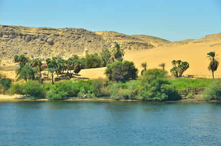
Africa has some important and mighty rivers, but its hydrography cannot be considered balanced. Its rivers are poorly distributed due to the presence of several areas with desert climate, which aggravates the situation of drought and water scarcity in various parts of the continent. In the Sahara region there are many temporary rivers, also known as intermittent, as the flow of these rivers decreases in the driest period until it stops completely. Only the Nile River, the second longest in the world in length, with about 6,700 km, does not lose its flow on the way from the desert to the sea. The Nile rises in the equatorial region near the Nyungwe Forest in Rwanda. As it flows into the Mediterranean Sea, forming an immense delta, it was historically used for irrigation and agriculture.

The Nile River, with about 6,700 km, is the only one that, in periods of drought, does not lose its flow on the way from the desert to the sea.
The equatorial regions have a well-developed drainage, mainly due to the presence of the Congo River, which holds the second largest flow on the planet, with approximately 41,000 m3/segundo. The main river in West Africa is the Niger (4,800 km), while in the southern portion the Orange (2,200 km), Zambezi (2,574 km) and the Limpopo (1,600 km) stand out. Many of the rivers and waterfalls reduce the potential for navigation but provide great hydroelectric potential. The most important are Victoria Falls, on the Zambezi River, and Boyomsa (formerly Stanley Falls), a series of falls on the Congo River.
The main lake region is in the Grande Rift Valley, where Lakes Vitória, Albert, Tanganyika and Niassa (or Malawi) are located. Because they are related to the relief modified by the movements of tectonic plates, these lakes are called tectonic lakes. Lake Victoria, on the plateau between the branches of the Rift Valley, is the largest lake in Africa, with a total area comparable to the territory of Ireland and full of springs that lead to the River Nile. The only large natural lake located outside of East Africa is Lake Chad, at the southern tip of the Sahara. Its size varies depending on seasonal rains, but its area has been severely reduced in recent decades due to agricultural practices that disregarded its conservation.
Julio César Lázaro da Silva
Brazil School Collaborator
Graduated in Geography from Universidade Estadual Paulista - UNESP
Master in Human Geography from Universidade Estadual Paulista - UNESP
Source: Brazil School - https://brasilescola.uol.com.br/geografia/aspectos-naturais-Africa-relevo-hidrografia.htm
