
Thematic maps are those that focus on a specific theme to present the information.
Remember that maps are geographic representations of our planet, be it a continent, the world, the country, a region, a state, etc.
When the central idea is to gather only some data or characteristics about something specific (vegetation, biomes, culture, etc.), then we have thematic maps.
Typically, thematic maps make the data easier to understand. Therefore, they are accompanied by explanatory legends, colors and symbols, which help in interpreting the information presented.
Nowadays there are several types of thematic maps and with the advancement of representation techniques associated with technology, they are made with extreme precision. Check out the main ones below.
Types of Thematic Maps
There are several types of thematic maps. See some classifications and the main features of each of them:
Physical Map: gathers various information related to the physical aspects of a location (relief, altitude, hydrography, etc.). The colors on the map indicate some important aspects. For example, brown is used to indicate plateaus and mountains; darker colors to indicate altitude; and green to mark plains.
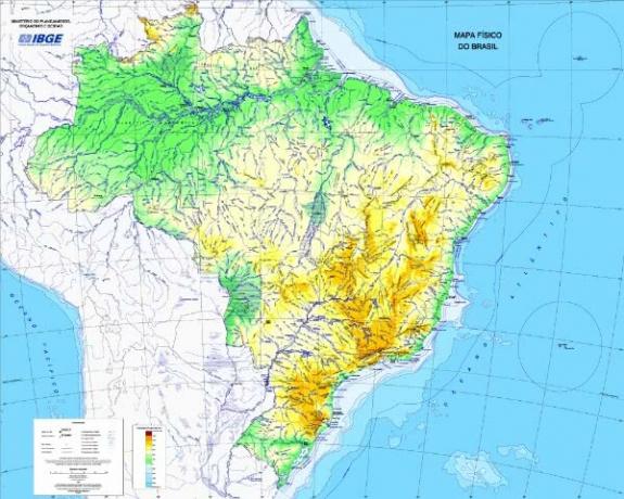 Physical Map of Brazil
Vegetation Map: displays information related to the type of vegetation cover in a given location. As with the physical map, it is full of colors and legends that facilitate the reader's understanding.
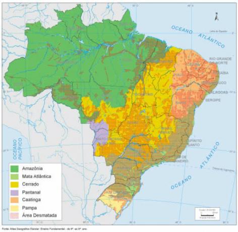 Brazil Vegetation Map
Political Map: gathers various information about the administrative regions of a territory, that is, the political-territorial division. Thus, it presents the most important states, capitals and cities. Colors are also very important in this type of map, marking the boundary between territories.
 Political Map of Brazil
Economic Map: brings together aspects related to the type of economy in each region, that is, the activities economic developments developed in each territory (industries, commerce, services) based on the sectors of economy. It can also display information about the GDP, the HDI, among others.
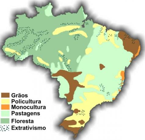 Economic Map of Agricultural Activities in Brazil
Historical Map: Displays historical information or events about a particular location. It usually contains titles that are context-related. Historical maps can also indicate those older maps.
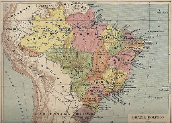 Historical Map of Brazil (1922)
cultural map: brings together various cultural phenomena from a region, state, country, continent. In this case, it can also present the ethnic groups of a country or region (ethnic map) or some characteristics about the language or dialects, for example (linguistic map).
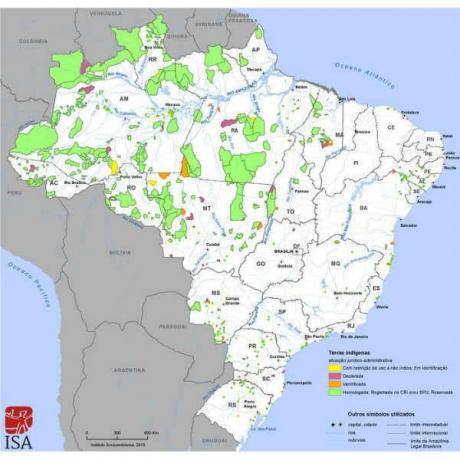 Map of Indigenous Lands in Brazil (Instituto Socioambiental, 2015)
Tourist Map: features places where tourism is identified as an important economic activity. He can gather the main places where this activity is much explored, as well as instruct some tourists about the sights of a region. For example, the main monuments, museums, libraries, historic streets of a city, state, country.
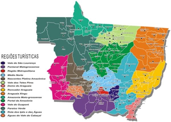 Map of Touristic Regions in the State of Mato Grosso
Population Map: Also called a demographic map, this type of map gathers information related to the demographic density of a given location. They usually use colors and legends to indicate a place with greater or lesser density.
 Demographic Map of Brazil, IBGE (2010)
Transport Map: in this case, maps can be related to highways, railways, subways, navigable rivers, among others. It usually contains labels about roads as well as distances between some locations.
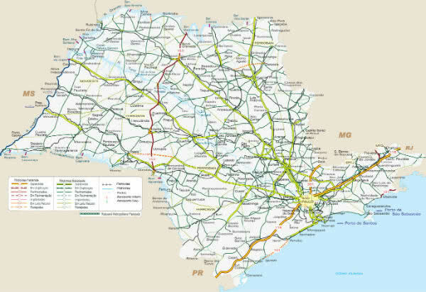 São Paulo State Road Map
climate map: gathers information related to the type of climate and meteorological phenomena that occur in a given location.
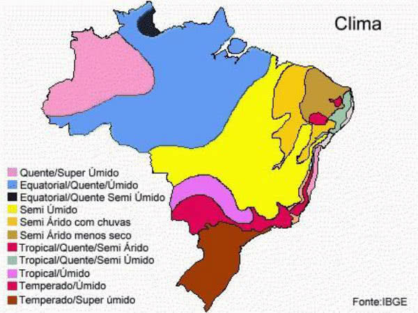 Brazil Climate Map
Rainfall Map: Widely used in meteorological studies, this type of map gathers information about rainfall in some places.
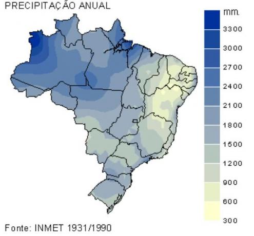 Rainometric Map of Brazil
Learn more about the topic by reading the articles:
- Brazil's map
- World map
- What is Cartography?
- Cartographic Projections
- Cartographic Scale Exercises

