Maps are all the same, right? Wrong. There are several different types of representing a particular portion of space. Thus, we have thematic maps, which are usually divided into: economic, political, demographic, historical and physical, in addition to the stylized ones.
Historical Maps: they are old maps, usually with a more rustic, aged look. Most of them were developed when the technologies we have today did not exist, so some are very imprecise. Even so, they were very important in their respective times. They are widely used today to discover how people in other times conceived their space.
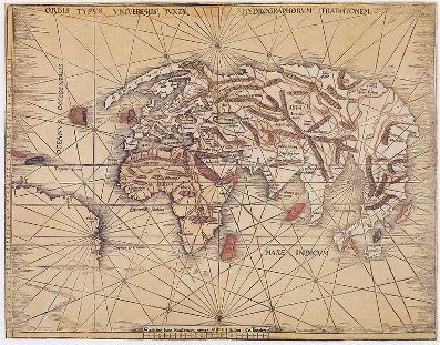
This map represented the world known to Europeans in 1513
Also called historical maps are those that were produced in the present, but that represent an event in the past.
Physical Maps: they are maps used to represent the physical space of a given environment, presenting information such as rivers, relief, vegetation, altitude, among other elements.

Physical Map of the European Continent
economic maps
: they are those maps that represent productive and financial activities, as well as providing information and socioeconomic data, such as poverty, hunger, among other factors. Thus, we have maps of the distribution of industries, the location of raw materials, certain types of services, among other topics.political maps: they are the maps that represent the distribution of national territories, with the borders that delimit countries and the boundaries between states, cities or provinces.
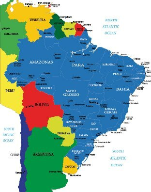
Political map of Brazil in relation to South America
Demographic Maps: are those used to represent themes related to populations, such as number of inhabitants, concentration of dwellings, division of ethnic groups and demographic density.
Stylized or anamorphosis maps: these maps are the most interesting, as they are the type that are distorted to represent the information contained in them. For example, a map of the world's largest economies will purposely make rich countries larger and poor countries smaller, regardless of the original sizes of the areas in those countries.
By Rodolfo Alves Pena
Graduated in Geography

