O Rio Grande do Sul is a state located in the South region of Brazil. Known as the fourth largest state in the country, it is the fifth most populous and the third with the highest Human Development Index (HDI).
THE economy of the state is based on agriculture, livestock and textiles. Even more, there are several tourism options. For example, Gramado and Canela, two nearby cities that draw attention to romantic walks and Christmas decorations.
The territorial limits of the state are: Santa Catarina (to the north), Uruguay (to the south), Atlantic Ocean (to the east) and Argentina (to the west). Your territorial area is 281,748, 538 km².
Index
- Relief
- Climate
- Hydrography
- Vegetation
- Natural resources
Relief
Rio Grande do Sul has three types of relief. These are: plateaus, depressions and plains. Its plateaus are located in the north of the state, with an altitude above 100 meters.
The highest point in the state has 1,410 meters and is called Pico do Monte Negro. This one is located in São José dos Ausentes.

In addition, there are four morphological units, named as:
- Central depression: areas with less than 400 meters, located in municipalities such as Porto Alegre, Santa Maria, Bagé and São Gabriel;
- South Grande Shield: Rocks formed in other periods with erosive wear. The altitude is no more than 600 meters;
- Coastal Plain: It has low altitudes and is found throughout the territory's Atlantic Coast.
Climate
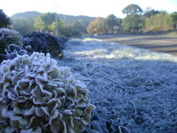
In Rio Grande do Sul, the humid subtropical climate prevails, with two well-defined seasons. Summer, with high temperatures and winter, with low temperatures. One of the smallest in the country.

- Free Online Inclusive Education Course
- Free Online Toy Library and Learning Course
- Free Online Math Games Course in Early Childhood Education
- Free Online Pedagogical Cultural Workshops Course
During the year, the rains are well distributed. Temperatures change according to altitude, that is, where there are low elevations, the climate is tropical. Already at high elevations, the temperate climate.
Hydrography
Rio Grande do Sul has a hydrographic network divided into three regions. These are: Uruguay Basin, Guaíba Basin, Litoral Basin.
You most important rivers in Rio Grande do Sul they are:
- Jacuí;
- Falls;
- Pellets;
- Camaquã;
- Bells;
- Uruguay.
Vegetation
Rio Grande do Sul has four different types of vegetation. These are:
- Atlantic forest: Vegetation located in the coastal region, from North to the south of the country;
- Araucaria Forest: This vegetation is formed by conifers and Paraná pine and is characterized by a subtropical forest;
- Coastal Vegetation: Humid vegetation with a large amount of sand, located on the coast.
Natural resources
the main natural resources from Rio Grande do Sul are:
- Copper;
- Mineral coal;
- Lead;
- rock crystal;
- Tungsten.
Related content:
- geography of acre
- Amapá geography
- Amazon geography
- Bahia geography
- Federal District Geography
- Geography of Goiás
- Geography of Maranhão
- Geography of Mato Grosso
- Geography of Mato Grosso do Sul
- Geography of Pará
- Paraná geography
- Geography of Rio de Janeiro
- Geography of Rio Grande do Norte
- Roraima geography
- Santa Catarina geography
- São Paulo geography
The password has been sent to your email.


