the state of Rio de Janeiro is one of the 27 federative units of Brazil, and its capital has the same nomenclature, the famous “wonderful city“.
Those born in the state of Rio de Janeiro are called fluminenses, while those that come from the capital are the cariocas.
Located in the Southeast region, three states border Rio de Janeiro: Espírito Santo, to the north; Minas Gerais, to the northwest; São Paulo, to the southwest; and its entire east coast is washed by the Atlantic Ocean.
Known for its large number of beaches and tourist attractions, it is among the first states colonized by the Portuguese. It was also the capital of Brazil between 1763 and 1960.
The state was named Rio de Janeiro on account of the exploratory expedition made by the Portuguese, in which they arrived in Guanabara Bay on January 1, 1502.
According to the Brazilian Institute of Geography and Statistics (IBGE), the estimate is that there are 17,264,943 people in the state, in an area of 43,780 km². In the capital alone, 6,718,903 are estimated people.
Its population is the result of the mestizaje between indigenous peoples, Africans and Europeans.
Considering the second largest economy in the country, its territory is one of the places with the greatest industrialization.
Rio de Janeiro is categorized as one of the two Brazilian global cities, framing the region as the only megalopolis in the South America, in a space that extends to São Paulo and the Baixada Santista.
Index
- Rio de Janeiro State Political Map
- Map of the regions of Rio de Janeiro
- Rio de Janeiro road map
- Rio de Janeiro old map
- Map of the city of Rio de Janeiro - regions and neighborhoods
- Rio de Janeiro city map
- Rio de Janeiro map to color
Rio de Janeiro State Political Map
The state of Rio de Janeiro has 92 municipalities and eight government regions.
Map of the regions of Rio de Janeiro
At eight Government regions and municipalities of Rio de Janeiro they are:
- Metropolitan Region of Rio de Janeiro (RMRJ);
- Northwest Region;
- North region;
- Coastal Lowlands Region;
- Mountain Region;
- Central-South Region;
- Middle Paraíba Region;
- Costa Verde region.

- Free Online Inclusive Education Course
- Free Online Toy Library and Learning Course
- Free Online Preschool Math Games Course
- Free Online Pedagogical Cultural Workshops Course
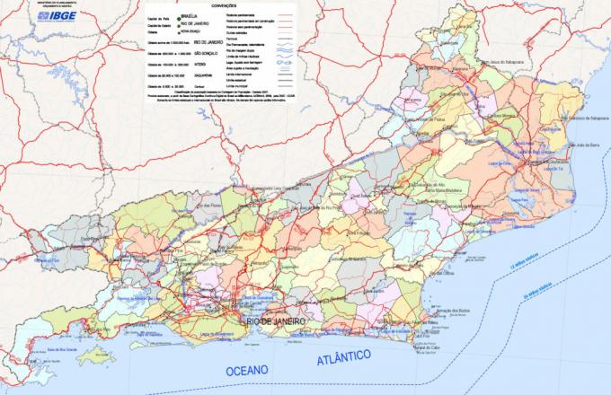
Rio de Janeiro road map
The state has about 6,000 kilometers of paved and paved highway. The map created by the Ministry of Transport shows the main highways and highways in Rio de Janeiro. Look:

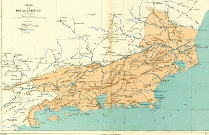
Rio de Janeiro old map
The old map shows what the state was like in the year 1923. He follows:
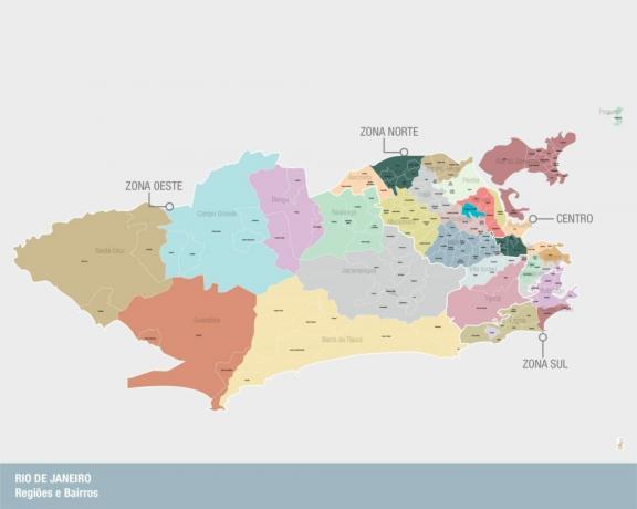
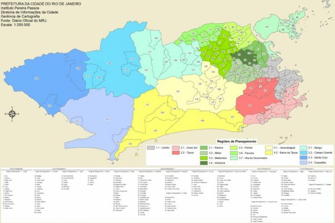
Map of the city of Rio de Janeiro - regions and neighborhoods
The municipality of Rio de Janeiro is subdivided into nine sub-prefectures, grouped into four regions or "zones" (west zone, north zone, center and south zone).
These have 33 administrative regions, which total 160 districts.
Rio de Janeiro city map

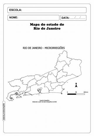
Rio de Janeiro map to color
Now that you are geolocated with the state, check out the map of the microregions below. Rio de Janeiro to print and color:
You may also like:
- Brazil's map
- Sao Paulo map
- Map of Minas Gerais
The password has been sent to your email.