You Geographic Information Systems (GIS) they are technological equipment and means to study terrestrial space. They are used by researchers, companies, NGOs, governments, intelligence services, among others.
GIS results from the combination of three different types of technologies: Remote sensing, GPS and geoprocessing.
Remote sensing: consists in the use of tools, such as satellites and radars, to capture information and images about the earth's surface. They can provide important information, such as the extent of an agricultural area, the size of a certain vegetation cover, locate outbreaks of fires and deforestation, the movement of air masses, among others.
In addition to using satellites, remote sensing can work through the use of aerial photography, which is also called aerophotogrammetry. This procedure is done by taking photographs taken in cameras attached to planes and helicopters.

Example of an aerial photograph: Fethiye, Turkey
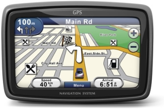
GPS [Global Positioning System]: is a device that is spreading more and more in people's daily lives. Supported with a coverage of dozens of satellites, the GPS can transmit information from any location in the world, based on geographic coordinates. In addition to reporting latitude and longitude positions, GPS can now provide addresses, teach shorter routes to reach a certain location and even record the paths taken and inform the speed of displacement.

GPS is becoming more and more common in people's lives
Geoprocessing: consists of the processing step of information obtained through remote sensing and GPS for the production of maps, cartograms, graphics and systematization in general. Such procedure consists of the use of softwares specially programmed for this function, which are able to add subtitles and various information about the represented space. One of the most known GIS tools and used by people is the Google Earth, available both in software and through internet access.
By Rodolfo Alves Pena
Graduated in Geography
