A member of the Commonwealth of the British Commonwealth (formed by the United Kingdom and its former colonies), Ghana is located in West Africa. Its territory is limited to Burkina Faso (to the north), Côte d'Ivoire (to the west), Togo (to the east), besides being bathed by the Gulf of Guinea, in the Atlantic Ocean (to the south). The country was a British colony, being the first in West Africa, to become independent in 1957, bringing together the former territories of the Gold Coast and Togoland.
During the Portuguese colonial period (between the 16th and 19th centuries), several inhabitants of the territory that currently corresponds to Ghana were taken to America to work as slaves. With the end of slavery, many of them returned to their home territory, forming a community called Tabom.
Ghana has one of the most stable economies on the African continent. The country is a great exporter of gold, diamonds, manganese, bauxite and wood. Another element of great importance for the national economy is cocoa – a product that characterizes the country as the second largest producer in the world.
Agriculture is based on the production of coffee, bananas, potatoes, corn and rice. The industry operates in the production of food, beverages, cigarettes, chemical products, metallurgy and wood. Industrial activity is benefited by the Akosombo hydroelectric plant, whose dam forms the largest artificial lake in the world, the Volta.
Even with a diversified economy, Ghana has major socio-economic problems. Approximately 10% of the population is undernourished and only 10% of homes have a sewage system.
Do not stop now... There's more after the advertising ;)

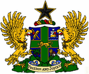
Ghana Coat of Arms
Ghana Data:
Territorial extension: 238,533 km².
Location: Africa.
Capital: Accra.
Climate: Equatorial.
Government: Presidential Republic.
Administrative division: 10 regions subdivided into districts.
Languages: English (official), regional languages.
Religion: Christianity, 57.6% (Protestant, 24%, independent, 15.7%, others, 12.6%, no affiliation, 5.3%), traditional beliefs, 22.1%, Islam, 19.8 %, no religion and atheism, 0.5%.
Population: 23,837,261 inhabitants. (Men: 12,080,684; Women: 11,756,577).
Ethnic Composition: Açães, 44%, mossi-dagombas, 16%, euês, 13%, gas, 8%, others, 19%.
Demographic density: 100 inhab./km².
Average annual population growth rate: 2%.
Population residing in urban areas: 50.74%.
Population residing in rural areas: 49.26%.
Undernourished population: 9%.
Life expectancy at birth: 59.4 years.
Households with access to clean water: 80%.
Households with access to a health network: 10%.
Human Development Index (HDI): 0.467 (low).
Currency: New Cedi.
Gross Domestic Product (GDP): 16.1 billion dollars.
GDP per capita: $647.
External relations: World Bank, Commonwealth, IMF, WTO, UN, AU.
By Wagner de Cerqueira and Francisco
Graduated in Geography
Brazil School Team
countries - geography - Brazil School
