THE Bahia is a Brazilian state located in the RNortheast region. The population of Bahia is 14.9 million inhabitants, the fourth largest in Brazil. The city of Salvador is the state capital and also played the role of the first Brazilian capital between 1549 and 1763. The geography of the state is characterized by plains and depressions, as well as by two dominant climatic types, the tropical and the semiarid. The Bahian economy is the main one in the Northeast and turns to the tertiary sector and the manufacturing industry.
Read too: Regions of Brazil - grouping of federative units with similar characteristics
Bahia general data
- Region: North East.
- capital: Savior.
- Government: representative democracy, with the governor at the head of the state executive branch.
- Areaterritorial: 564,760.427 km² (IBGE, 2020).
- Population: 14,930,634 inhabitants (IBGE estimate, 2020).
- Densitydemographic: 24.82 inhab./km² (IBGE, 2010).
- spindle: Brasília Standard Time (GMT -3 hours).
- Climate: tropical and semiarid.
Do not stop now... There's more after the advertising ;)
Bahia geography
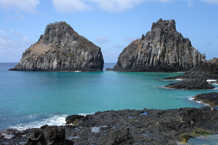
Bahia is a Brazilian federative unit located in the Northeast Region. With an area of almost 565,000 km², is the largest northeastern state in territorial extension and fifth in the national ranking.
It has an exit to the Atlantic Ocean to the east, being the longest coastline of the entire Brazilian coastline, with 932 km. The state borders:
- to the north, with the Piauí and Pernambuco;
- northeast, with alagoas and Sergipe;
- to the south, with the Holy Spirit and Minas Gerais;
- to the west, with Goiás and Tocantins.
Most of the territory of Bahia is part of the Sertão Northeast sub-region, which covers its central and western lands. A narrow strip to the east is part of the Agreste, which consists of a transition area to the Zona da Mata, which comprises the entire coast of the state.
Bahia climate
Two climatic types are predominant in Bahia. The first is the semiarid, which occurs in the central region (with the exception of the higher areas) and part of the west of the state. This climate is characterized by the high temperatures and low relative humidity, with irregular rainfall and a dry period usually in the winter months. The rains are concentrated in the summer, with an annual average of around 800 mm.
The weather tropical occurs mainly in eastern Bahia, also marked by the high annual temperatures and a higher humidity index, especially on the coast. Average annual precipitation varies between 1,200 and 1,600 mm. In some coastal cities, this value can exceed 2,000 mm.
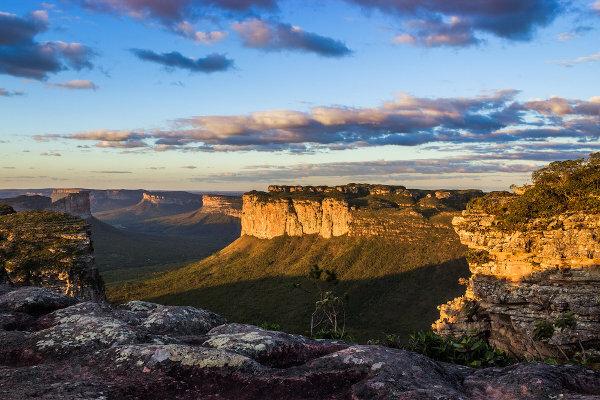
Bahia relief
You plateaus and the depressions These are the predominant forms of relief in Bahia, which gives most of the state altitudes above 300 meters.
According to Jurandyr Ross' classification, the west of Bahia and part of the north are part of the Sertaneja and São Francisco Depression, east of which extend the Plateaus and Mountains of the East-Southeast. The highest lands in the state are located in this domain, especially Serra do Espinhaço and Chapada Diamantina. The highest point of Bahia and the Northeast is located here: Pico do Barbado, 2,033 meters above sea level. On the east side, finally, we have the Pwoolen and Coastal Boards.
Vegetation of Bahia
the state integrates three biomes: Cerrado, Atlantic Forest and Caatinga. This covers just over 62% of Bahia, mainly in the central and northern areas, being characterized by vegetation formed by deciduous trees (which lose their leaves in the dry season), shrubs and grasses.
O thick extends through the west of Bahia, while the Atlantic forest occupies the eastern range, close to the coast. In certain points of the coastal wetlands, there is the pioneer formation, marked by the presence of mangroves, restingas and alluvial forest.
Bahia hydrography
The drainage system of Bahia belongs to the São Francisco and East Atlantic basins. The main rivers in the state are: San Francisco, Paraguaçu, Current, Contas, Jequitinhonha, Grande, Pardo, Itapicuru.
Read too: Hydrographic basins - part of the relief supplied by rivers and tributaries
Bahia map

Demographics of Bahia
Bahia has a population of 14,930,634 inhabitants, according to the estimates of the IBGE for 2020, being the 4th most populous state in Brazil, with 7.1% of the national population and 26% of the Northeast Region. THE demographic density of the state was 24.82 inhab./km² at the time of the 2010 census. Taking into account the updated area and population data, there is a distribution of 26.43 inhab./km².
Most of the Bahian population lives in cities. Bahia's urbanization rate is 72.02%, as per 2010 census numbers. Salvador is the most populous city in the state and the fourth capital in population in Brazil, with 2,886,698 inhabitants. Next is Feira de Santana, which has 619,609 residents. Vitória da Conquista, Camaçari and Itabuna stand out.
Data from 2019 show that 57.6% of Bahians declare themselves brown; 22.5%, black; 18.7%, white; and 1.2%, indigenous. In addition, most of the Bahian population is female.
Life expectancy at birth is 74.2 years, lower than the Brazilian average.
Geographical division of Bahia
Since 2017, IBGE has adopted the division of Brazilian states into immediate geographic regions and intermediate geographic regions. You 417 municipalities in Bahia were grouped into 34 immediate regions, which, in turn, conform 10 intermediate regions. Are they:
- Savior;
- St. Anthony of Jesus;
- Ilhéus – Itabuna;
- Victory of the Conquest;
- Guanambi;
- barriers;
- You;
- Juazeiro;
- Paulo Afonso;
- Feira de Santana.
Bahia Economy
With Gross Domestic Product (GDP) of BRL 286.2 billion, the Bahian economy is the largest in the Northeast region and the seventh from Brazil. The value is equivalent to 4.1% of the national GDP and 28.5% of the regional one. Most of the Bahian economy comes from the tertiary sector, corresponding to trade and services, followed by industry and agriculture.
O secondary sector is led by the manufacturing industry, with an emphasis on petrochemicals. Bahia accounts for 9.8% of the national production of Petroleum (refining), which places the state in third place among Brazilian producers. The state's transformation industry is also made up of the production of food, paper, cellulose, rubber and plastics.
Agriculture has soy as its flagship, followed by cotton and corn. These crops are concentrated in the western municipalities of the state (Barreiras, São Desidério, Luís Eduardo Magalhães), an area that integrates the productive region of Matopiba (Maranhão, Tocantins, Piauí and Bahia). The state is also the second largest fruit producer in the country, mainly banana, mango, orange and papaya. In addition, it has a large herd of sheep, followed by a herd of cattle and chickens.
See too: What are commodities?
Government of Bahia
The government of Bahia consists of a representative democracy. State elections are held periodically, at an interval of four years, so that the population can elect their governors. The Executive Branch is led by the state governor, while the Legislative branch is formed by 3 senators, 39 federal deputies and 63 state deputies.
Flag of Bahia

Bahia Infrastructure
Highways are the main means of connection between the municipalities of Bahia and between the state and the other units of the federation. One of them is the BR-101, which extends along the entire east coast of Brazil. Also noteworthy are the BR-116, BR-234, BR-407 and BR-242. Considering federal, state and municipal roads, the state has more than 124 thousand kilometers of highways.
THE Central Atlantic Railway (FCA) it is one of the most important in the state, linking it to the Southeast and Midwest regions. Is under construction the West-East Integration Railway (Fiol), which will integrate Tocantins with the Port of Ilhéus, which is the main bulk port in Bahia. make up the state port structure the ports of Salvador and Aratu, in addition to the private terminals. Arrivals and departures by air take place mainly at the airports of Salvador, Porto Seguro and Luís Eduardo Magalhães.
THE Bahia's energy matrix is mostly made up of renewable sources. In addition to hydropower, especially the Paulo Afonso hydroelectric complex, the state accounts for 32% of solar energy and 29.5% of the wind energy produced in the country.
Bahia culture
The state of Bahia holds a rich culture, formed from indigenous, European and, mainly, African influence. Such aspects are evidenced in everyday customs, gastronomy, popular dances and festivals, music and even religiosity. In addition to the Christian faith, notably Catholic, there is a strong presence of African-based religions in the state, such as (but not only) the çandomblé and the uband.
Among the characteristic dances and rhythms, we have the capoeira and maculelê. Also in music, nationally renowned names and varied styles they have their roots in Bahia, such as Gilberto Gil, Caetano Veloso, Raul Seixas, Maria Bethânia, Ivete Sangalo, Gal Costa, Dorival Caymmi and many others. João Gilberto, considered the father of bossa nova, was also born in the state. At literature, authors such as Jorge Amado and João Ubaldo Ribeiro. O geographer Milton Santos is of Bahian origin.
O Çarnaval from Salvador it is a great tourist attraction and one of the most popular festivals in the state. Some religious celebrations that annually gather countless faithful are the Lavagem da Escadaria de Bonfim, the Festa de Iemanjá and the Festa do Nosso Senhor dos Navegantes.
Typical Bahian cuisine includes dishes such as acarajé, shrimp bobó, vatapá, Bahia moqueca, quindim and mugunzá.
![The Lavagem das Escadarias de Bonfim gathers thousands of faithful annually in the capital, Salvador. [1]](/f/c0a93f62c4e0aaf292f409fb65ccd65b.jpg)
History of Bahia
The current territory of Bahia was the first place where the Portuguese settled when they arrived in Brazil, in the year 1500. It was in Porto Seguro, on the south coast, that Pedro Álvares Cabral's expedition landed on April 22 of that year. The new land was named Vera Cruz. Shortly after the discovery, new expeditions were carried out, and the population of the region began to be carried out in 1534.
The current capital of Bahia, savior, was founded by the then governor-general of Brazil, Tomé de Souza, in 1549. The city became the first capital of Brazil, a condition that remained until 1753, when he was transferred to Rio de Janeiro. When the government headquarters was defined, Brazilian lands had already been divided into hereditary captaincies, with Bahia being subdivided into five other territories.
The Bahian economy at the time was essentially focused on exploration of brazilwood and for sugar production, using enslaved labor. Its decline took place with the transfer of the colony's political center to Rio, which also coincided with the flourishing of the gold economy. This was one of the reasons that led toTailors' Revolt or Bahia Conjuration in 1798, which brought together the popular layers and part of the elite.
In the nineteenth century, Bahia was the scene of other political and social conflicts of great relevance to its history. Are they the Malês revolt, of 1834, and the Straw War, which took place between 1896 and 1897.
Image credit
[1] Vinicius Tupinamba / Shutterstock
By Paloma Guitarrara
Geography teacher
Bahia is a Brazilian federative unit located in which region of the country?
Check the alternative that indicates the capital of the state of Bahia.