O Holy Spirit is one of the 27 Brazilian states and is located in the Southeast region of the country. It consists of the fourth smallest in territorial extension, not considering the Federal District. It has a coastline of 400 km, and the sea has a great influence on its climate, which is predominantly humid tropical.
Regarding vegetation cover, it has characteristics of the Atlantic Forest biome, in which the state is located. Espírito Santo's economy is led by the industrial sector, with emphasis on the extractive industry. The state is also a major coffee producer.
Read too: São Paulo – the most populous state and with the highest GDP in Brazil
General data of Espírito Santo
Region: Southeast.
capital: Victory.
Government: Renato Casagrande and vice-governor Jaqueline Moraes (2018-2022).
Areaterritorial: 46,074.447 km² (IBGE, 2019).
Population: 4,064,052 people (IBGE, 2020).
Densitydemographic: 76.25 inhab/km² (IBGE, 2010).
spindle: GMT -3 hours (Brasilia standard time).
Climate: tropical humid.

Geography of Espírito Santo
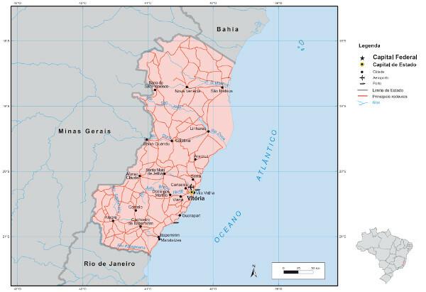
Espírito Santo is one of the states that make up the Southeast region of Brazil. With a land area of 46,074.447 km², it is the fourth smallest state in size in the country. It is washed to the east by the Atlantic Ocean and has a coastline of 400 km. THE Bahia it borders the capixaba territory to the north; Minas Gerais, to the west; it's the Rio de Janeiro, South.
Espirito Santo climate
The state's climate is predominantly tropical wet, with differentiation in the coastal plain areas due to the influence of maritime and in the interior portions, where there is the occurrence of higher elevations and, therefore, having the altitude as one of the main climatic factors.
Temperatures are high most of the year, with an average of 23 ºC. The rains are concentrated in the summer, when the rainfall index can reach 1800 mm, with the state average being 1400 mm.
At mountainous areas do Espírito Santo have typical characteristics of the subtropical climate, with mild temperatures, rainy summers and winters dry.
Do not stop now... There's more after the advertising ;)
Vegetation of Espírito Santo
The Holy Spirit is fully inserted in the biome Atlantic forest, whose vegetation cover is marked by forest formations that are divided between dense rainforest, which covers most of the state, and open. The coast has characteristic vegetation, such as mangroves, restingas and lowland vegetation.
The Espírito Santo territory is also part of the Mata Atlântica Biosphere Reserve. It is an area dedicated to research and improvement of environmental management and sustainable development, in order to promote the protection of the ecosystem.
See too: What is sustainability?
Relief of the Holy Spirit
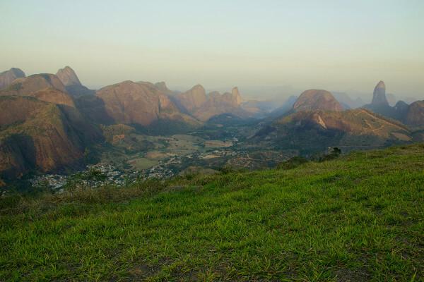
The relief of the Holy Spirit is divided between the flat land coastal and the areas of plateaus and saws in its western portion. The first is known as Baixada Espírito-Santense, which corresponds to 40% of the state's area. The most rugged parts of the territory, located to the west, have altitudes that exceed 2,000 meters. The highest point in the state is Pico da Bandeira, with 2,892 meters of altitude.

Espírito Santo Hydrography
The Holy Spirit divides into 12 watersheds, the largest being the Doce-Suruaca Basin.
The main river that crosses the state is the Rio Docand, with 853 km of extension and whose source is located in Minas Gerais. Other important rivers in the state are: Jucu, Itabapoana, Itapemirim, Itaúnas, São Mateus and Santa Maria da Vitória.
Espírito Santo map

Demographics of Espírito Santo
The population of Espírito Santo is from 4,064,052 inhabitants (IBGE, 2020), 15% higher than the population recorded in the 2010 Census, which was approximately 3.5 million people. THE demographic density in the state is 76.25 inhab/km², the seventh largest in the country.
The urbanization rate of Espírito Santo is 83.4%, being the municipality of Serra the most populous in the state, with 527,240 inhabitants. The capital, Vitória, has 365,855 inhabitants.
According to the 2010 Census, the population was composed of 49.25% men and 50.74% women, concentrated in age groups ranging from 10 to 39 years old. Life expectancy at birth in Espírito Santo was 79.1 years in 2019, the second largest in the country. The State also stands out for having registered, in 2019, the lowest rate of infant mortality in Brazil.
Geographical division of Espírito Santo
Until 2017, IBGE divided Espírito Santo into four mesoregions, which were composed of micro-regions formed by a set of municipalities, as listed below.
-
Northwest Espírito Santo
Bar of San Francisco
New Venice
Colatina
-
North Coast of Espírito Santo
Mountain
Saint Matthew
Linhares
-
Espírito Santo Center
Alfonso Claudio
Saint Teresa
Victory
Guarapari
-
South Espírito Santo
happy
Itapemirim Waterfall
Itapemirim
Since 2018, the IBGE adopts the subdivision by Intermediate and Immediate Geographic Regions.
The Holy Spirit divides into four intermediate regions and their respective immediate regions:
Vitória (Vitória, Afonso Cláudio, Venda Nova do Imigrante and Santa Maria de Jetibá);
São Mateus (São Mateus and Linhares);
Colatina (Colatina and Nova Venécia);
Cachoeiro do Itapemirim (Cachoeiro do Itapemirim and Alegre).
Also access: Socioeconomic regionalization of the world space
Economy of Espírito Santo
O Gross Domestic Product (GDP) Espírito Santo was R$ 137.02 billion for the year 2018. The service sector, with the exception of administration and public sectors, is responsible for the composition of the largest portion of this amount (48.63%). Next is industry, with 32.35% and, finally, agriculture, which participated in 2018 with 3.77% of GDP in Espírito Santo (IBGE, 2018).
The main industrial sector in the state is the extractive industry, with emphasis on the extraction of Petroleum and natural gas, which account for 24.5% of industrial GDP. Still in terms of the extraction industry, Espírito Santo also stands out in mining and steel, especially in steel production.
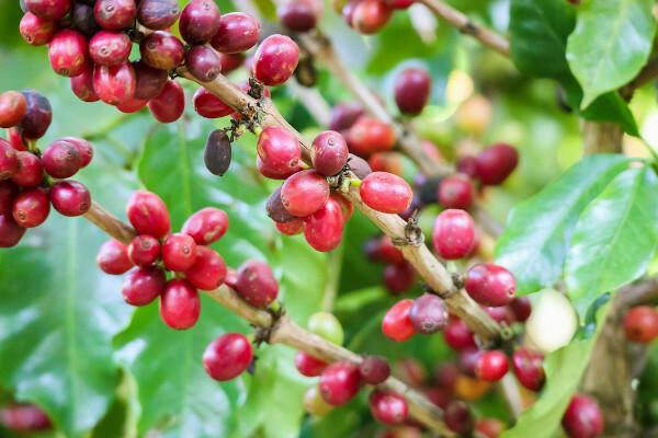
In agriculture, the conilon type coffee appears in first place among the main agricultural products of the state. Next is the Arabica coffee. The Holy Spirit still produces black pepper, tomato, banana, papaya, this leader in fruit exports, as well as sugar cane, cocoa, coconut and pineapple.

Government of Espírito Santo
The seat of the state government of Espírito Santo is in the municipality of Vitória. The current governor is Renato Casagrande (PSB), elected in 2018 for a four-year term with his vice president, Jaqueline Moraes (PSB). In the same election, 2 senators, 10 federal deputies and 30 state deputies were elected to represent the state.
Infrastructure of Espírito Santo
Espírito Santo, more specifically the metropolitan region of Vitória, is one of the departure and arrival points of the Vitória a Minas Railroad (EFVM), which connects the state to Minas Gerais, reaching Belo Horizonte. It transports both passengers and cargo, such as iron ore from Vale (the company that operates the EFVM), coal and agricultural products.
The state also has an international airport and another five regional. Among the federal highways that pass through Espírito Santo is the BR-101, which crosses the entire Espirito Santo coastline and extends along the Brazilian coastline of the large northern river to the Rio Grande do Sul.
Regarding urban infrastructure, 81.3% of the population of Espírito Santo had access to the water network in 2019. The sewage network served 55.9% of the population. Both values refer to the total population (urban and rural).
Culture of Espírito Santo
The cultural manifestations of Espírito Santo reflect its diverse population composition, with Indigenous, African and European influences, that are observed from the typical cuisine of the state to the folk festivals that spread throughout the territory.
In the parties, stand out:
Dance of the Arrows or Spout;
Folia de Reis;
Kings of Ox;
Bumba my ox;
Ticumbi.
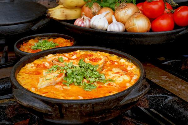
When it comes to dances, some of the popular expressions are the capoeira and jongo. Espírito Santo cuisine, in turn, does a lot use of seafood in your recipes. Moqueca and capixaba pie are two of the typical dishes of Espírito Santo.

History of the Holy Spirit
The Espírito Santo territory corresponded, at the time of the colonization of Brazil, to the Captaincy of Espírito Santo, donated to Vasco Fernandes Coutinho in 1534. A year later, the donee landed in Espírito Santo lands and named the captaincy.
On May 23, 1535, the day that marks the arrival of the Portuguese, the Vila Nova do Espírito Santo, later named Vila Velha. After disputes over land with the Goitacazes Indians in 1551 and the victory attributed to the Portuguese, the place was renamed Vitória, now capital of the state.
Since then, other obstacles have occurred with local populations, as well as domain attempts by other foreigners (English, Dutch and French). The autonomy of the territory of Espírito Santo in relation to Bahia, to which it had been annexed since 1715, was conquered in 1810, and its first governor was appointed two years later.
By Paloma Guitarrara
Geography teacher

