O relief it is the superficial part of the lithosphere (solid layer of the Earth). It is where geological transformations are most clearly expressed, and it is also the place of habitation for humans and most terrestrial animals. In summary, we can define the relief as the set of physical forms that make up the Earth's surface.
The science that studies the compositions and variations in the forms of relief is the Geomorphology, which is a branch of knowledge that has an interface with two sciences: Geography and Geology.
Types of relief
To better study and understand their formation and transformation dynamics, the relief was divided into some main types, based on their external physiognomies, namely: mountains, plateaus, plains and depressions.
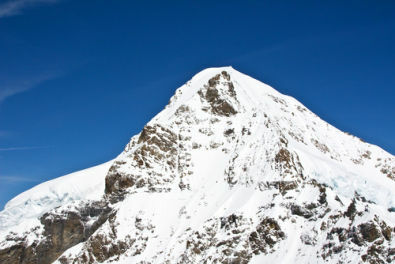
Mountains: they are landforms that present higher elevations and altitudes in comparison with immediately neighboring regions. Some authors claim that an elevation in the relief can only be considered as a mountainous formation if it is more than 300 meters high in relation to the surrounding relief.
This type of relief is usually characterized by being geologically recent, having this shape more accidental for having suffered for less time the action of surface shaping agents terrestrial.

Example of mountain formation in the Swiss Alps
When groups of mountains or mountain ranges are located parallel to each other, forming a kind of "wall" over large extensions, there is what is called a mountain range, such as the Andes Mountains (South America) and the Himalayas (Asia).
Plateaus: sometimes called plateaus, plateaus are relief elevations that have a somewhat wide extension and the highest part is relatively flat. They have, in general, medium altitudes, being smaller than the mountains and bigger than the plains.
Do not stop now... There's more after the advertising ;)

Image of the Tibetan Plateau, also called the “roof of the world” because of its high altitudes
They are classified according to the predominant composition of their rocks, dividing into crystalline plateaus (formed by intrusive and metamorphic igneous rocks), sedimentary plateaus (formed by sedimentary rocks) and basaltic plateaus (formed by extrusive igneous rocks).
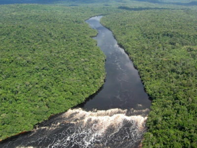
Plains: they are more or less flat areas that have a lower altitude in relation to the mountains and plateaus. They are characterized by the large amount of sediments accumulated on their surface, usually brought by rainwater, rivers or, in the case of coastal plains, by water from oceans and seas.

The Amazon region is one of the best known plains in the world
Depression: are areas that have lower altitudes in relation to the surrounding relief (relative depression) or in relation to sea level (absolute depression). In general, it usually covers geologically old regions and, therefore, have suffered a lot from actions erosion and sedimentation of rocks and soils, which is revealed in its generally undulating surface.

Rift Valley, located in Kenya. A type of depression caused by the action of endogenous agents in the relief
By Me. Rodolfo Alves Pena
Would you like to reference this text in a school or academic work? Look:
PENA, Rodolfo F. Alves. "What is Relief?"; Brazil School. Available in: https://brasilescola.uol.com.br/o-que-e/geografia/o-que-e-relevo.htm. Accessed on June 27, 2021.
