Belgium is a country in Western Europe. With a temperate oceanic climate and less rugged terrain, the country has an area of 30,500 km² and a narrow coastline bathed by the North Sea. Its population is 11.59 million inhabitants, who are divided into three regions (Flanders, Capital Brussels and Wallonia) and speak three languages: Dutch, German and French. highly developed, its economy is concentrated in the service sector. The country's modern transport system places it in a prominent position in European logistics.
Read too: 20 biggest countries in the world
General data for Belgium
- Nameofficial: Kingdom of Belgium
- Gentile: Belgian
- Extensionterritorial: 30,528 km²
- Location: Western Europe
- capital: Brussels
- Climate: Oceanic Temperate
- Government: constitutional monarchy
- Divisionadministrative: three regions (Capital of Brussels, Flanders, Wallonia), provinces, municipalities, sub-municipalities
- Language: german, french and dutch
-
religions:
- Catholic: 50%
- Protestant and other Christian religions: 2.5%
- Muslims: 5%
- Jews: 0.4%
- Buddhists: 0.3%
- atheists: 9.2%
- no religion: 32.6% - Population: 11,590,000 inhabitants (UN, 2020)
- Densitydemographic: 382.7 inhab/km² (UN, 2020)
- Human Development Index (HDI): 0,931
- Coin: Euro (€)
- ProductInternalGross(GDP): US$543.026 billion
- GDP per capita: US$ 47,293
- Gini: 0,274
- spindleschedule: GMT +1 hour (Central European Standard Time)
-
Relationsexteriors:
- UN
- European Union
- G10
- IMF
- nato
- OAS (observer)
- OECD
- WTO
- Paris Club
history of belgium
Previously under the rule of other territories, the Kingdom of Belgium was formed in 1830, a fact marked by the proclamation of its independence from the Netherlands. The constitutional monarchy was established as a form of government. The Netherlands, however, recognized Belgian independence only in the year 1839.
From the second half of the 19th century, also Belgium adhered to the practices imperialists and exercised domain in Congo, in Africa, in 1908. The country constituted two other colonies on the African continent: Ruwalk and Burundi.
During the First and the Second World War, were realized German invasions on Belgian territory, among them the offensive known as the lightning war (Blitzkrieg), in May 1940.
Read too: Invasion of France by the Nazis - one of the great feats of the Nazi army
Belgium Map
Belgium geography
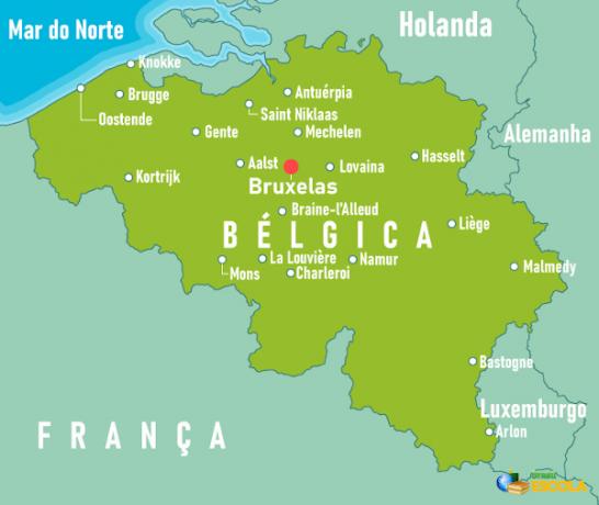
Belgium is a European country located in the west of the continent. It has a territorial extension of 30,528 km², which places it among the 20 smallest countries in the area of Europe.
the country has exit to the atlantic ocean, in the North Sea, on a narrow coastline of 66.5 km located to the northwest. Borders:
- to the north and northeast, with the Netherlands;
- to the east, with the Germany;
- to the southeast, with Luxembourg;
- to the west, with the France.
Belgian territory is divided into three regions: Flanders, to the north, Wallonia, to the south, and the Capital Brussels, the smallest region in the country and where, as the name implies, its capital.
Belgium climate
Located at high latitudes, Belgium is located in the temperate zone of the planet. The presence of the North Sea is, in addition, one of the main conditions of the country's climate, which is of the type Oceanic Temperate.
Temperatures are moderate most of the year, with averages of 3 ºC in the Winter and 17 ºC in the summer, and there may be rare extremes, ranging from temperatures below 0 ºC to 40 ºC. There is occurrence of westerly winds, in addition to heavy cloudiness and high rainfall.
Vegetation of Belgium
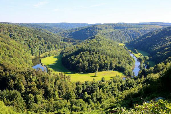
The country's vegetation cover is predominantly composed of deciduous seasonal forest, characterized by the loss of leaves in the dry season. The most common trees are oak, beech, elm and birch. To the south, where the relief it is mountainous, the vegetation is composed of coniferous species.
Belgium relief
Belgium is divided into three compartments: the first is that of flat land coastal, in the northwest of the territory. It is characterized by the flat lands and the cordon of dunes on the coastal strip, formed by the action of wind and water. The coastal landscape is also composed of dikes built to contain the advance of North Sea waters in lower areas.
The central portion of the Belgian territory is formed by the central plateau, where the altitudes vary between 100 m and 200 m.
In the lands to the south and southeast, mainly, the hills and mountains, of which the formation of the Ardennes stands out. In this region, the quotas exceed 500 meters. The highest point in Belgium is the Signal de Botrange mountain, with 694 meters.
Belgium hydrography
O Meuse river it is the biggest and one of the main rivers in Belgium. It extends for about 180 km in the eastern part of the country, and is, in total, 950 km in length. The second largest is the Scheldt, which runs in northwestern Belgian territory.
Belgium Demographics
The latest UN estimates indicate that Belgium has 11.59 million inhabitants. Belgian territory is one of the most populated in Europe, considering the demographic density 382.7 inhab/km² (UN, 2020).
The population is concentrated in the north of the country. The Flanders region is the most populous, with more than 6 million inhabitants. The region where the capital is located, in turn, is the most populated, and its demographic density is 7,384 inhab/km², according to 2017 data.
A total of 98.1% of the Belgian population live in cities, Brussels being the most populous, with more than 2 million inhabitants. The average age in the country is 41.6 years, and life expectancy of 81.65 years is considered high.
In addition to those born in Belgian territory, its population is made up of Italians, Moroccans, French, Turks and Germans.
the country has three official languages: Dutch, spoken by the largest portion of the population, concentrated in the Flanders region; French, more widely spoken in the Capital region of Brussels and Wallonia; and the German, which is concentrated in cities close to the German border.
Also access: What is the difference between absolute population and relative population?
Belgium Economy
O Gross Domestic Product (GDP) Belgium is US$543 billion, while its per capita value is US$47,293 according to UN information (2020). Both values place Belgium among the 30 largest economies in the world, and among the 10 largest in the European Union.
The country's economy is highly concentrated in the service sector, which accounts for more than 70% of GDP and most of the workforce. Financial activities and trade are the main highlights of the tertiary, followed by tourism. This is more intense in the Flanders region, in the north of the country, and in the mountains and forests of the Ardennes.
O secondary sector represents a share of about 22% of GDP. The Belgian industrial park has great diversity, and covers industries such as automobile, chemical, pharmaceutical, engineering products, metallurgy, textile, food and oil.
Farming accounts for only 1.3% of the Belgian economy. The main crops are sugar beet, potatoes, wheat, corn, barley, chicory. In livestock, the country stands out in the production of milk and dairy products and pork.
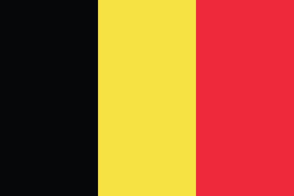
flag of belgium
culture of belgium
THE cultural wealth of Belgium is related to the different origins of its population and the linguistic composition of the country, which has three official languages.
Thinking about the regions, Flanders excels in the visual arts, and the regions of the capital and the municipalities of Liège, Ghent and Antwerp are known for the avant-garde music. The country has an extensive calendar of music festivals, which cover everything from metal and electronics to classical music. Furthermore, Brussels is recognized as the international capital of comics.
Belgian cuisine is highlighted worldwide, which is due to its high quality chocolate, one of the country's main export products, and to the various types of craft beer. Among the traditional dishes of the country, there is the mussel with fries or fried moules.
Belgium Infrastructure
Belgium has a dense and modern transport network which favors both the economic development of the country and the interconnection with other European countries, being described as a regional logistics center:
- its railway network is considered one of the densest in the world, with a length of 3,602 km in 2018;
- highways totaled 118,414 km in 2015;
- the total length of the waterways was 2,043 km in 2012.
Belgium also has:
- two sea ports;
- four river ports, of which Antwerp stands out;
- and 41 airports (2013).

Government of Belgium
Belgium has as a system of government the parliamentary monarchy. Its current king is Philippe Leopoldo Luís Maria, who assumed the throne in 2013. The country's prime minister is Alexander De Croo, who took office in 2020.
Curiosities about Belgium
![The protagonist of the famous series “The Adventures of Timtim” was created by the Belgian artist Hergé, in 1929.[1]](/f/0acc45fb10042de12215489043278612.jpg)
- The geographer, cartographer and mathematician Gerhard Mercator was born in Belgium, in the region of Flanders, in 1512.
- Belgium is home to the Museum of Comics in the capital, Brussels. Some of the most famous comic book characters were created in the country, such as Timtim and the Smurfs. The city also has a route known as the “Rota dos Quadrinhos” for visiting the large murals, painted on buildings in the capital, with their characters.
- In gastronomy, in addition to the Waffle, that emerged in the country, the famous French fries have their origin in Belgium, in the seventeenth century - information disputed by the French.
Image credit
[1] NeydtStock / Shutterstock
By Paloma Guitarrara
Geography teacher

