Located in southeastern Africa, the territory of Mozambique is limited to Tanzania (to the north), Malawi (to the northwest), Zambia and Zimbabwe (to the west), South Africa and Swaziland (to the southwest), as well as being washed by the Indian Ocean (the East).
Former Portuguese colony, Mozambique gained its independence on June 25, 1975. Portuguese is the official language of the country, however, only 40% of the population uses this language. The country is part of the Community of Portuguese Language Countries (CPLP).
Despite never having been a British colony, Mozambique is part of the British Community, a group formed by the United Kingdom and its former colonies.
A civil war lasting approximately 20 years, between the 1970s and 1990s, was responsible for the deaths of more than 1 million inhabitants. Another negative consequence of this conflict was the destruction of infrastructure, directly affecting the national economy.
The main sources of income come from fishing (mainly shrimp), agriculture (sugar cane, cotton, cassava, etc.), mining (bauxite, gold and precious stones), natural gas extraction, logging and tourism. The industrial sector is also important, operating in the beverage and tobacco segments.
Mozambique, like most countries in sub-Saharan Africa, presents several socio-economic problems. According to data released in 2010 by the United Nations (UN), the country's Human Development Index (HDI) is the fifth lowest in the world: 0.284. The life expectancy of the inhabitants is only 42.2 years; illiteracy affects more than 55% of the population; the infant mortality rate is 86 deaths per thousand live births.
Do not stop now... There's more after the advertising ;)

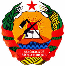
Coat of Arms of Mozambique
Mozambique data:
Territorial extension: 801,590 km²
Location: Africa.
Capital: Maputo.
Tropical weather.
Government: Republic with mixed form of government.
Administrative division: 11 provinces subdivided into 33 municipalities.
Languages: Portuguese (official), regional languages (main: ronga, changã, muchope).
Religions: Traditional beliefs 49.9%, Christianity 38.9% (Catholic 21.3%, Protestant 12.6%, other 5%), Islam 10.4%, other 0.2%, no religion and atheism 0, 6%.
Population: 22,894,294 inhabitants. (Men: 11,134,577; Women: 11,759,717).
Composition: Macuas 46.1%, tsongas, malavis and chonas 53%, other 0.9%.
Demographic density: 28.5 inhab/km².
Average annual population growth rate: 2.3%.
Population residing in urban areas: 37.65%.
Population residing in rural areas: 62.35%.
Undernourished population: 38%.
Life expectancy at birth: 42.4 years.
Households with access to clean water: 42%.
Households with access to a health network: 31%.
Human Development Index (HDI): 0.284 (low).
Currency: New metical.
Gross Domestic Product (GDP): 9.7 billion dollars.
GDP per capita: $340.
External relations: World Bank, British Commonwealth, IMF, WTO, UN, SADC, AU.
By Wagner de Cerqueira and Francisco
Graduated in Geography
Brazil School Team
countries - geography - Brazil School


