
You southeastern states from Brazil there are four:
Espírito Santo (ES);
Minas Gerais (MG);
Rio de Janeiro - RJ);
Sao Paulo-SP).
Together, the states of the Southeast are home to a population of 54.6 million inhabitants, thus being the most populous area in the country. These states have many historical, socio-cultural and geographic aspects in common, which has led them to be brought together in a single region. In this text, learn about the main characteristics of each of the four states in the Southeast.
Read too: What are the most populous cities in the world?
Topics of this article
- 1 - Summary on the states of the Southeast
- 2 - Map of the states of the Southeast
- 3 - What are the states in the Southeast?
-
4 - Characteristics of the Southeast states
- → Holy Spirit (ES)
- → Minas Gerais (MG)
- → Rio de Janeiro (RJ)
- → Sao Paulo (SP)
- 5 - Capitals of the Southeast states
Summary about the states of the Southeast
The Southeast region of Brazil is made up of four states.
The smallest state in the Southeast is Rio de Janeiro, representing 4.7% of the region's area.
Minas Gerais is the largest state in the Southeast region and occupies 63% of its area.
Espírito Santo is the least populous state in the Southeast, with only 4.5% of its population, or 3.8 million inhabitants.
São Paulo concentrates more than half of the population of the Southeast states.
The states of the Southeast have a tropical climate that varies from highland tropical to Atlantic tropical, in addition to predominantly plateau relief.
The predominant biomes in these states are the Atlantic Forest and Cerrado.
With the exception of Minas Gerais, all states in the Southeast are bathed by the Atlantic Ocean.
The states of São Paulo, Minas Gerais and Rio de Janeiro have the three largest economies in Brazil.
The economy of the Southeast states is based on the tertiary sector and the manufacturing industry. Mineral extraction and agriculture are also important.
The state of Rio de Janeiro was home to the capital of Brazil between 1763 and 1960.
The city of São Paulo (SP) is the largest capital in the Southeast and the most populous city in Brazil, with over 11 million inhabitants.
Do not stop now... There's more after the publicity ;)
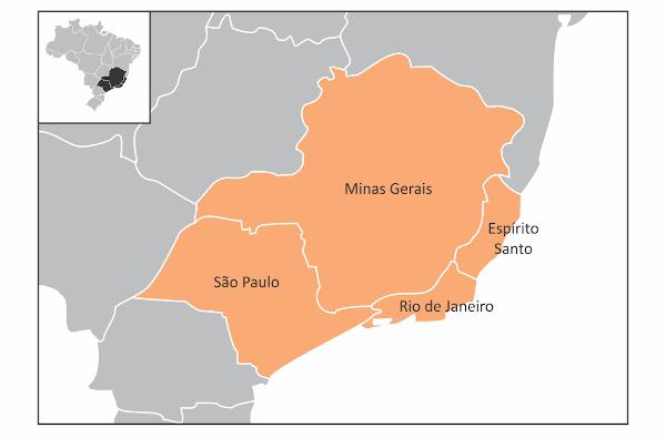
Southeast states map
What are the states in the Southeast?
The Southeast region of Brazil is made up of four states. We list all of them in the table below, along with the acronym used to represent them.
state |
Acronym |
Holy Spirit |
ES |
Minas Gerais |
MG |
Rio de Janeiro |
RJ |
São Paulo |
SP |
See too: Northeast Region — states, capitals, characteristics, general data
Characteristics of the Southeast states
Below, check out the main characteristics of each of the states that make up the Southeast region.
→ Holy Spirit (ES)

Gentile: capixaba or Espírito Santo.
Territorial extension: 46,074.44 km², which represents 4.98% of the surface of the Southeast region.
Number of municipalities: 78.
Population: 3,833,486 inhabitants (IBGE, 2022), 4.5% of the population of the Southeast.
Urbanization rate: 83.4% (IBGE, 2010).
Demographic density: 83.2 inhabitants/km².
GDP: BRL 138,446,000,000.
HDI: 0,771.
Time zone: GMT -3 hours (Brasília Standard Time).
Geography of the Holy Spirit:
Climate: tropical Atlantic, marked by mild temperatures and high rainfall.
Relief: plateaus, mountains and coastal plains.
Biomes: Atlantic Forest, with forest vegetation, and coastal formations, such as mangroves and sandbanks.
Hydrography: inserted in the hydrographic basins of the East Atlantic and Southeast Atlantic, it is bathed by the Atlantic Ocean. The Doce River is one of the main water courses in the state.
Economic profile: the tertiary sector and the exploitation of natural resources, especially oil and natural gas, are the two main segments of the state's economy. The Holy Spirit is still the third largest national steel producer.
Brief history: Espírito Santo was a hereditary captaincy and had its capital founded in 1535. Later, the lands were integrated into Bahia, resuming its autonomy at the beginning of the 19th century. To learn more about this status, click here.
→ Minas Gerais (MG)

Gentile: miner.
Territorial extension: 586,513.98 km², which represents 63.4% of the surface of the Southeast region.
Number of municipalities: 853 municipalities.
Population: 20,538,718 inhabitants (IBGE, 2022), 24.2% of the population of the Southeast.
Urbanization rate: 85.29% (IBGE, 2010).
Demographic density: 35.02 inhabitants/km².
GDP: BRL 682,786,000,000.
HDI: 0,774.
Time zone: GMT -3 hours (Brasília Standard Time).
Geography of Minas Gerais:
Climate: altitude tropical in most of the state, Atlantic tropical and typical tropical.
Relief: mountains and plateaus.
Biomes: Cerrado in the largest part of the state, Atlantic Forest and Caatinga in the extreme north.
Hydrography: inserted in four large hydrographic basins, which are the São Francisco, East Atlantic, Southeast Atlantic and Paraná basins. Among its main rivers are the São Francisco and the Doce.
Economic profile: Minas Gerais has the extraction of ores, such as iron, the transformation industry and agriculture, with cattle breeding, dairy production and coffee growing as the main economic activities.
Brief history: the discovery of mineral resources in the state turned it into an important economic center in Brazil during the 18th century. Your story stayed marked, still, by the Inconfidência Mineira, which dates from the end of the same century, and for his participation in the “coffee with milk policy” during the First Republic. To learn more about this status, click here.
→ Rio de Janeiro - RJ)

Gentile: fluminense.
Territorial extension: 43,750.42 km², which represents 4.73% of the surface of the Southeast region.
Number of municipalities: 92.
Population: 16,054,524 inhabitants (IBGE, 2022), 18.9% of the population of the Southeast.
Urbanization rate: 96.71% (IBGE, 2010).
Demographic density: 366.96 inhabitants/km².
GDP: BRL 753,824,000,000.
HDI: 0,762.
Time zone: GMT -3 hours (Brasília Standard Time).
Geography of Rio de Janeiro:
Climate: Atlantic tropical and altitude tropical in the Serrana Region.
Relief: plateaus and mountains are predominant forms.
Biomes: Atlantic Forest, with the presence of forests; mangroves and sandbanks.
Hydrography: inserted in the Southeast Atlantic Watershed. The state is bathed by the Atlantic Ocean and one of its main rivers is the Paraíba do Sul.
Economic profile: second largest economy in Brazil, Rio de Janeiro Tourism is one of its main economic activities.. Also noteworthy are the petrochemical industry and the extraction of oil and natural gas.
Brief history: the state became the political center of Brazil in the second half of the 18th century, when its capital became the capital of the Colony. In 1822, The city of Rio de Janeiro turned into the first capital of the Republic, a role he played until 1960. The state of Rio de Janeiro gained its current territorial configuration in 1975, with the incorporation of the state of Guanabara. To learn more about this status, click here.
→ Sao Paulo-SP)

Gentile: paulista.
Territorial extension: 248,219.48 km², which represents 26.84% of the surface of the Southeast region.
Number of municipalities: 645.
Population: 44,420,459 inhabitants (IBGE, 2022), 52.3% of the population of the Southeast.
Urbanization rate: 95.94% (IBGE, 2010).
Demographic density: 178.96 inhabitants/km².
GDP: BRL 2,377,639,000,000.
HDI: 0,806.
Time zone: GMT -3 hours (Brasília Standard Time).
Sao Paulo Geography:
Climate: variations of the tropical climate, with the presence of the typical tropical, the altitude tropical in the higher lands and the Atlantic tropical on the coast.
Relief: plateaus, mountains and depressions.
Biomes: Predominant Atlantic Forest and Cerrado in the west and northwest portions of the state.
Hydrography: inserted in the hydrographic basins of Paraná and the Southeast Atlantic. bathed by the Atlantic Ocean, its main rivers are Tietê, Grande and Paraná.
Economic profile: Sao Paulo holds the largest state economy in Brazil. Activities in the tertiary sector are predominant, but the state also has a very diversified industry (automotive, pharmaceuticals, footwear, sugar and alcohol, etc.) and agriculture is very present, with emphasis on the production of sugar cane, coffee, soy and orange.
Brief history: one of the first cities in the country, São Vicente, was founded on the coast of the state in 1532. The history of the state was marked by expeditions known as Bandeiras and by the rapid economic development provided by coffee growing. During the First Republic, São Paulo participated in the so-called Café com Leite Policy. To learn more about this status, click here.
Capitals of the Southeast states
state |
capital |
gentile of the capital |
Population of the capital (in inhabitants) |
Holy Spirit |
Victory |
capixaba |
322.869 |
Minas Gerais |
Belo Horizonte |
Belo Horizonte |
2.315.560 |
Rio de Janeiro |
Rio de Janeiro |
From Rio |
6.211.423 |
São Paulo |
São Paulo |
From São Paulo |
11.451.245 |
Sources
ATLAS of Human Development in Brazil. Available in: http://www.atlasbrasil.org.br/.
IBGE. Territorial structure: Territorial areas. Available in: https://www.ibge.gov.br/geociencias/organizacao-do-territorio/estrutura-territorial/15761-areas-dos-municipios.html.
IBGE. IBGE Explains: Gross Domestic Product (GDP). Available in: https://www.ibge.gov.br/explica/pib.php.
IBGE. SIDRA – Database of Statistical Tables. Available in: https://sidra.ibge.gov.br/home/pimpfbr/brasil.
IBGE Cities. Available in: https://cidades.ibge.gov.br/.
Cultural aspects that integrate the culture of the states of Southeast Brazil.
Discover the main geographic aspects of the state of Espírito Santo. Also read more about their background, culture, demographics and economy.
Get to know the economic activities that were consolidated in the Southeast from the Coffee Cycle to the industrialization process.
Find out about aspects related to the industrialization of the Southeast region of Brazil!
Learn more about Minas Gerais. Understand historical and geographical aspects of this state. See a little of the culture of this important Brazilian state.
Understand the general aspects of the Southeast region. Learn more about the climate and relief of the country's richest region, and find out about its main economic activities.
Click and see details about the Tietê River and the origin of its name. Also understand its hydrographic characteristics and ways of using its waters in São Paulo.
Read our text and learn more about Rio de Janeiro! Its capital was also the Brazilian capital and is currently the main tourist destination in the country.
Click here and read more about the state of São Paulo. Get to know the main geographic, economic and population aspects of this territory in Southeast Brazil.


