You States from the Midwest there are three, listed below, in addition to the Federal District (DF), which is also a federation unit and integrates this region of the country.
Goiás (GO);
Mato Grosso (MT);
Mato Grosso do Sul (MS).
These units of the federation have geographic characteristics — such as a tropical climate and plateau relief —, sociocultural and economic characteristics that allow them to be included in the same Great Region. The Federal District, although it has particular aspects, is also part of the Midwest because it is located in the center of the national territory, making the connection between all other areas of the country.
Read too: How RIDE works — an area that covers municipalities in the Federal District, Goiás and Minas Gerais
Topics of this article
- 1 - Summary about the states of the Midwest
- 2 - Map of the states of the Midwest
- 3 - What are the states in the Midwest?
-
4 - Characteristics of the states of the Midwest
- → Federal District (DF)
- → Goiás (GO)
- → Mato Grosso (MT)
- → Mato Grosso do Sul (MS)
- 5 - Capitals of the states of the Midwest
Summary on the states of the Midwest
The Midwest region is made up of three states and the Federal District.
Mato Grosso is the largest state in extension, occupying 56% of the regional surface.
Goiás is the most populous state, with more than 7 million inhabitants.
The least populous federation unit is Mato Grosso do Sul.
The Midwestern states have a typical tropical climate, with hot, rainy summers and mild, dry winters.
Most of them are inserted in the Central Plateau, and they present relief formed by plateaus, plateaus and plains.
The Cerrado biome is predominant in the Midwest states.
They are part of four large hydrographic basins: Amazon, Tocantins-Araguaia, Paraguay and Paraná.
The Federal District and Goiás are the largest economies in the Midwest, while Mato Grosso leads the national agricultural production.
Services and activities related to farming and agribusiness are the main economic activities in the states of the Midwest.
Brasília (DF), the federal capital, is the most populous capital in the Midwest.
Do not stop now... There's more after the publicity ;)
Midwest states map

What are the states in the Midwest?
The Midwest region of Brazil is formed by four units of the federation (UF), being three states and the Federal District. The table below brings together the four FUs in that region and the respective acronyms used to represent them.
state |
Acronym |
Federal District* |
DF |
Goias |
GO |
Mato Grosso |
MT |
Mato Grosso do Sul |
MS |
*It is not a state per se, but the unit of the federation that houses the headquarters of the Federal Government.
See too: São Francisco River — where it flows and why it is considered the “Brazilian Nile”
Features of the Midwest states
→ Federal District (DF)
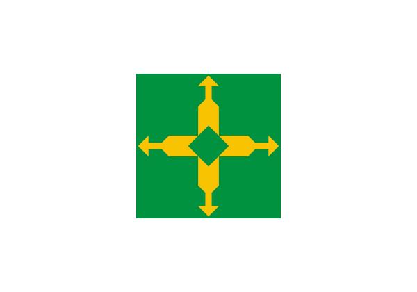
Gentile: brasiliense.
Territorial extension: 5,760.78 km², which represents 0.35% of the surface of the Midwest.
Number of municipalities: it is not divided into municipalities, but into 33 administrative regions (RA).
Population: 2,817,068 inhabitants (IBGE, 2022), 17.29% of the population of the Midwest.
Urbanization rate: 96.58% (IBGE, 2010).
Demographic density: 489.01 inhabitants/km².
GDP: BRL 265,847,000,000.
HDI: 0,814.
Time zone: GMT -3 hours (Brasília time).
-
Geography of the Federal District:
Climate: tropical with wet summers and dry winters.
Relief: plateaus.
Biomes: Cerrado, with vegetation characteristic of the fields.
Hydrography: inserted in the Tocantins-Araguaia Watershed.
Economic profile: the economy of the Federal District is the largest in the Midwest, formed predominantly by the tertiary sector, with emphasis on public services and also on commerce.
Brief history: was created in the mid-twentieth century with the aim of housing the new federal capital, the city of Brasilia. Its area was delimited in 1955, and Brasília was inaugurated on April 21, 1960.
→ Goiás (GO)
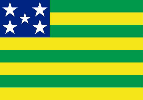
Gentile: goiano.
Territorial extension: 340,242.85 km², which represents 21.1% of the surface of the Midwest.
Number of municipalities: 246.
Population: 7,055,228 inhabitants (IBGE, 2022), 43.31% of the population of the Midwest.
Urbanization rate: 90.29% (IBGE, 2010).
Demographic density: 20.74 inhabitants/km².
GDP: BRL 224,126,000,000.
HDI: 0,737.
Time zone: GMT -3 hours (Brasília time).
-
Goiás Geography:
Climate: tropical with hot, rainy summers and mild, dry winters.
Relief: plateaus and plateaus.
Biomes: Cerrado, with the presence of fields and forest vegetation similar to the Atlantic Forest.
Hydrography: inserted in the watersheds of Tocantins-Araguaia and Paraná. The main water courses in the state are Araguaia, Aporé and Paranaíba.
Economic profile: second largest economy in the Midwest, the tertiary and primary sectors of Goiás are the main ones in the state. Agricultural production and the industry associated with it stand out, in addition to mineral extraction.
Brief history: the territory of Goiás was emancipated from the captaincy of São Paulo in 1749, becoming an autonomous captaincy. However, it was composed of the current states of Goiás and Tocantins, which officially separated in 1988. To learn more about this status, click here.
→ Mato Grosso (MT)
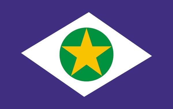
Gentile: Mato Grosso.
Territorial extension: 903,208.36 km², which represents 56.2% of the surface of the Midwest.
Number of municipalities: 141.
Population: 3,658,813 inhabitants (IBGE, 2022), 22.46% of the population of the Midwest.
Urbanization rate: 81.8% (IBGE, 2010).
Demographic density: 4.05 inhabitants/km².
GDP: BRL 178,650,000,000.
HDI: 0,736.
Time zone: GMT -3 hours (Brasília time).
-
Mato Grosso Geography:
Climate: tropical with hot, rainy summers and mild, dry winters.
Relief: plateaus, plateaus and the Pantanal plain.
Biomes: Predominant Cerrado, Amazon and Pantanal.
Hydrography: inserted in the Tocantins-Araguaia, Paraná and Amazon watersheds. The Xingu, Guaporé and Paraguay rivers are the main ones that cross the state.
Economic profile: is the main agricultural producer in Brazil. It stands out in the cultivation of agricultural commodities, such as soy, and in cattle raising, in addition to agroindustry.
Brief history: the settlement of the state began with the discovery of gold in the 18th century, and since then Mato Grosso has been involved in important events, such as the Paraguayan War. It separated from Mato Grosso do Sul in 1977, acquiring its current configuration. To learn more about this status, click here.
→ Mato Grosso do Sul (MS)

Gentile: south-mato-grossense or south-mato-grossense.
Territorial extension: 357,142.08 km², which represents 22.2% of the surface of the Midwest.
Number of municipalities: 79.
Population: 2,756,700 inhabitants (IBGE, 2022), 16.92% of the population of the Midwest.
Urbanization rate: 85.64% (IBGE, 2010).
Demographic density: 7.72 inhabitants/km².
GDP: BRL 122,628,000,000.
HDI: 0,742.
Time zone: GMT -4 hours.
-
Geography of Mato Grosso do Sul:
Climate: tropical in most of the state and subtropical in the southern end.
Relief: plateaus, plateaus and the Pantanal plain.
Biomes: Cerrado and Pantanal, the latter being in the northwestern part of the state.
Hydrography: integrates the watersheds of Paraguay and Paraná. Its main water courses are the Aporé, Miranda, Paraguay, Parnaíba and Paraná rivers.
Economic profile: the tertiary sector accounts for the largest share of the state's income, although agriculture, mainly agricultural commodities and cattle raising, and agribusiness are predominant in terms of activity economical.
Brief history: the territory of Mato Grosso do Sul was reunited with Mato Grosso. The break up took place on October 11, 1977. Two years later, Mato Grosso do Sul officially became a state. To learn more about this status, click here.
Midwest state capitals
state |
capital |
gentile of the capital |
Population of the capital (in inhabitants) |
Federal District |
Brasilia capital of Brazil) |
Brazilian |
2.817.068 |
Goias |
Goiania |
Goianiense |
1.437.237 |
Mato Grosso |
cuiabá |
cuiabano |
650.912 |
Mato Grosso do Sul |
Large field |
Campo Grande |
897.938 |
Sources
Atlas of. Human Development in Brazil. Available in: http://www.atlasbrasil.org.br/.
IBGE. Territorial structure: Territorial areas. Available in: https://www.ibge.gov.br/geociencias/organizacao-do-territorio/estrutura-territorial/15761-areas-dos-municipios.html.
IBGE. IBGE Explains: Gross Domestic Product (GDP). Available in: https://www.ibge.gov.br/explica/pib.php.
IBGE. SIDRA – Database of Statistical Tables. Available in: https://sidra.ibge.gov.br/home/pimpfbr/brasil.
IBGE Cities. Available in: https://cidades.ibge.gov.br/.
By Paloma Guitarrara
Geography Teacher
Would you like to reference this text in a school or academic work? Look:
GUITARRA, Paloma. "Midwest States"; Brazil School. Available in: https://brasilescola.uol.com.br/brasil/estados-do-centro-oeste.htm. Accessed on July 22, 2023.
Get to know some geographical aspects of Brasilia and the territorial organization of this city. Check also some social indicators of the Brazilian capital.
Access and discover important details about the construction of Brasilia. Understand how the project was born and how it was conducted by Juscelino Kubitschek.
The Federal District is home to the administrative headquarters of the country's government. Read our text about the DF and learn about its geographic, economic and population aspects.
Click here and learn more about Goiás, a state in the Midwest of Brazil. Get to know its main geographical aspects, its economy, population, history and culture.
Get to know a little more about Mato Grosso, a state in the Brazilian Midwest. Learn about its geographic particularities and aspects of its economy, culture and history.
Get to know the geographic particularities of Mato Grosso do Sul, a state in the Midwest of Brazil. Also read about its economy, population, history and culture.
Get to know the general aspects of the Midwest region. Understand the climate, hydrography and relief of this region. Learn about the cultural manifestations present in it.
Click here to read about the Araguaia River. Get to know the characteristics of this important Brazilian river and learn about the role it has for nature and society.
Cringe
The slang adapted from English is used to designate someone who is seen as tacky, shameful, outdated and out of fashion.
Neurodiversity
A term coined by Judy Singer, it is used to describe the wide variety of ways the human mind behaves.
PL of Fake News
Also known as PL2660, it is a bill that establishes mechanisms for the regulation of social networks in Brazil.

