
You GIS - Geographic Information Systems – are a set of procedures, equipment and computational programs used with the objective of analyzing the geographic space through information collection, storage, registration, manipulation and visualization of data in order to better understand and represent the surface terrestrial. It is an important tool for analyzing reality, used by organizations, governments and researchers, being also an important tool for the production of charts, cartographic bases and maps thematic.
The use of systems geographic information ranges from planning to solving problematic situations. The most classic and most widely used example to highlight the importance of GIS is the case of an English physician who, in the mid-nineteenth century, mapped (mapped) the registered cases of a cholera outbreak in the city of London, which allowed him to identify the source that caused the disease: a water well used by the population.
see more
Inequality: IBGE discloses the 10 worst states to…
Israel is the 4th strongest military power in the world; check the ranking
The operation of GIS occurs from the input and output of data. In the first moment, the systematization of information such as graphic, tabular, digital data, aerial photographs, satellite images, among others, takes place. Then there is the management, analysis and processing of this data, which results in the production of reports, maps, cartograms, digital data, statistical information and other types of representation of a given aspect of social reality or even Natural.
Among the functionalities of GIS, it is worth highlighting:
- Identify a given aspect of geographic space (such as population distribution, location of companies, etc.) and carry out its cartographic representation;
- Plan public investment actions in works or urban interventions;
- Plan and forecast public spending on services such as garbage collection, implementation of basic sanitation, construction of paved roads and many others.
- Real estate survey for the determination of subdivisions, tax calculations and measurement of the speculative value of a given area.
- Control and coordination of the transport system, be it public, private, municipal, interstate or national.
- Registration of residents based on pre-established criteria, such as income, age, among others, which allows the realization of the most diverse types of services, academic studies and other possibilities.
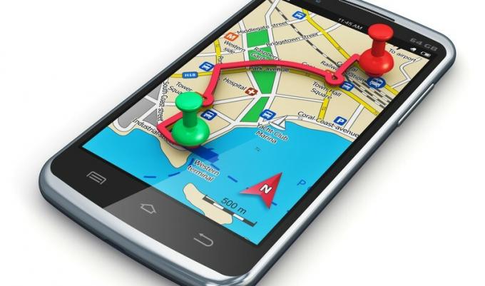
- Individual use, in which citizens use electronic equipment or maps to move around in cities or even in the countryside.
- Georeferencing of rural areas to assist in agricultural production, in the so-called “farming of precision” or for the control of deforestation and illegal occupation in preservation areas environmental.
For a better understanding of Geographic Information Systems and their elements, it is common, in the specialized literature, to differentiate between three types or procedures that constitute it: the remote sensing, O GPS and the geoprocessing.
REMOTE SENSING
Remote sensing is conceptualized as a set of techniques for capturing and recording geographic information from the Earth's surface. This record can be carried out both by obtaining images and by accumulating data referring to a given portion of the space. In some definitions, remote sensing is considered to be any analysis of space that is carried out at from the intermediation of some digital instrument, configuring an indirect visualization of the reality.
The process of obtaining images in remote sensing obeys two main methods: the first one is the aerophotogrammetry, which is obtaining aerial photographs and the second is recording images by satellites.
The aerial photogrammetry technique was developed through the use of balloons in the 19th century, even before remote sensing, which was created during the First World War. Over time, primarily for war purposes, the methodology of attaching photographic cameras to planes, which follow pre-established routes, was developed. In this system, the photos are processed by devices called restitutes, where they undergo an assembly process, which today is carried out by computer programs. Thus, it is possible to map or have a complete view of a given area or region.

With the technological improvement in the space field, accelerated mainly by the occasion of the Cold War, the use of satellite images has also been developed, which manage to capture, with great precision, any area of the earth's surface. The main satellite is landsat, originally released in the United States in 1972 and which has since been replaced several times, always by a more technologically advanced and accurate version. Several public and private organizations make use of these images, including the IBGE. In addition to this, another system is the CBERS (Sino-Brazilian Land Resources Satellite), resulting from an agreement between Brazil and China.
GPS - GLOBAL POSITIONING SYSTEM
The GPS (Global Position System: Global Positioning System) is a system composed of three different segments: the use of remote sensing, the terrestrial control of this information and the use by users on devices that are also usually called “GPS”, which can also be performed today by computers, websites, cell phones, tablets, vehicles and others.
In general, GPS uses a set of dozens of satellites, which analyze and send images to a terrestrial base. This base is responsible for receiving and qualifying these images, including the cartography of streets, neighborhoods and other types of location, which is very useful in terms of facilitating travel in large cities and obtaining addresses. Currently, there are websites and smartphone applications that allow the tracing of alternative routes in urban areas for avoid congestion, roadblocks and slow traffic, which demonstrates one of the many practical uses of the GPS.
GEOPROCESSING
Geoprocessing is considered the final stage of Geographic Information Systems. It consists of the use of images obtained by remote sensing to produce an interpretation of data, which is managed by a network of equipment and software, which are commonly called “programs”. GIS”. Between the software most used, highlight the ArcView and the arcgis, both produced by ESRI (Environmental Systems Research Institute). In general, the final product of geoprocessing are the cartographic bases and thematic maps, which include the didactic maps available on the internet and in textbooks.
Currently, both Geoprocessing itself and other forms of GIS are widely popularized, through the dissemination of the internet and the availability of online tools, such as the Google Earth, O Google Maps (both from Google), the Ovi Maps 3D (by Nokia), the Microsoft Worldwide Telescope (from Microsoft), among others.
By Rodolfo F. Alves Pena
Master in Geography
