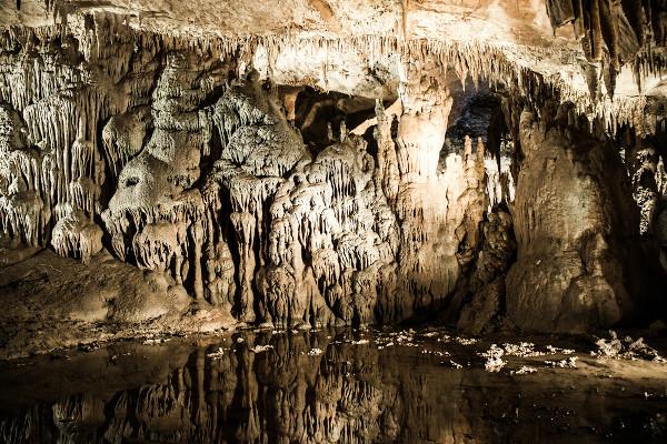
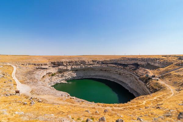
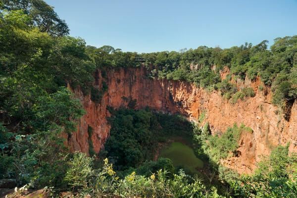
sinkholes are circular depressions that form on the surface associated with the process of chemical weathering on carbonate rocks. Dolines are classified as exokarst, since they are surface forms that are part of karst systems. They can originate from the slow sinking of the area due to the continuous action of the water, generating the dolines of subsidence or dissolution, or even by the collapse of cave ceilings, which results in the dolines of collapse. An example of a sinkhole in Brazil is the Buraco das Araras, in the state of Mato Grosso do Sul, considered the largest in the country and in Latin America.
Read too:Mountain — a landform characterized by high altitude
summary about sinkhole
Dolines are surface forms of karst relief (exokarst) generated by the action of water on carbonate rocks.
They correspond to depressions on the land surface.
They have a circular shape and characteristic depth, with variable size.
They can act as a sink for rivers or give rise to lakes.
They are classified according to the process of formation into dissolution sinkhole and collapse sinkhole.
Buraco das Araras is the name of the largest sinkhole in Brazil. It is located in the city of Jardim, in the state of Mato Grosso do Sul.
Xiaozhai Tiankeng, in the city of Chongqing, China, is the largest sinkhole in the world.
sinkhole formation
The dolines are formed by the water action on rocks with two specific characteristics.
One of these characteristics of the rock is the high permeability, which allows the entry and movement of water through its structure. In this sense, porous or fractured rocks are those in which there is a greater possibility of water penetration. Another feature is the ssolubility by the water, which can be described as a rock susceptible to chemical weathering.
Carbonate rocks are the main types of rock in which these properties are present. and therefore on which sinkholes are formed. Among the carbonate rocks on which sinkholes form are limestone, dolomite and marble.
As we will see later, the dissolution of subsurface rock causes a subsurface sinking and gives rise to depressions in the ground, which are sinkholes. This sinking can happen slowly or abruptly, as in the case of the collapse of a cave ceiling. Continuity in the subsidence process can cause two or more sinkholes to join, resulting in the formation of a uvala.

What we have seen so far is the natural process of sinkhole formation, but sinkholes can also be formed due to The anthropic actions. The expansion of infrastructure networks in urbanized areas can also give rise to structures similar to what we know as collapse sinkholes, a consequence of the removal of soil support and/or the asphalt. In this case, the process does not necessarily take place on rocks or on carbonate rocks and is a direct consequence of the human action on the environment.
sinkhole characteristics
Dolines are relief features associated with a karst system. Because they form on the surface, they are classified as exokarst. The sinkholes can be described as depressions (landforms recessed in relation to the areas that limit them) of varying sizes that have a circular shape and a certain depth, which give them a conical appearance.1|
![Example of sinkhole covered by vegetation. [1]](/f/4ba5243b6936f6a87df5613d68d00e70.jpg)
Constant rains can turn sinkhole areas into lakes. In the case of the presence of watercourses, the dolines perform the function of a sink, since the water from the river penetrates into the soil and in the underlying rock, which may give rise to underground rivers that resurface in other parts of the landscape, or even aquifers.

What are the types of sinkholes?
The sinkholes can be classified according to their formation process in:
Dissolution sinkhole (or subsidence sinkhole): formed as water infiltrates rock fractures, acting on its dissolution, which leads to a slow movement of sinking or subsidence of the land surface. This is the most common process of sinkhole formation.
Collapse sink: Formed suddenly, collapse dolines are the result of the collapse of cave ceilings or the relief of pressure that occurs inside the rock when, for example, there is the lowering of the water table level and the water moves in depth, thus creating a hollow area and causing the upper portion of the rock to lose its support and collapse.
See too:What is the difference between weathering and erosion?
Dolina in Brazil

The sinkholes present in Brazil are located in areas where there is the presence of carbonate rocks. According to geologist and professor Ivo Karmann, from the University of São Paulo (USP), the karst structures formed on these rocks represent only 3% of the national territory.
The main areas where the karst relief was formed and where, therefore, it is possible to observe the formation of dolines|2| are the following:
states of Mato Grosso and Mato Grosso do Sul and the east of the state of Goiás;
state of Paraná and the eastern and southern regions of the state of São Paulo;
center and part of the west of the state of Bahia;
northeast of the state of Minas Gerais and part of the state of Tocantins.
The largest sinkhole in Brazil and South America is known as Buraco das Araras and is located in the city of Jardim, in the state of Mato Grosso do Sul. This sinkhole is 500 meters in diameter and 100 meters deep and was formed around 200,000 years ago by through the dissolution of the limestone that was at the base of that region and the consequent collapse of the top sandstone.
Large sinkholes are also found in Chapada Diamantina (Bahia), in Terra Ronca State Park (Goiás) and in Gruta do Centenário (Minas Gerais).
What are the biggest sinkholes in the world?

Check out a list of some of the largest sinkholes in the world:
Xiaozhai Tiankeng, in the city of Chongqing (China), 660 meters deep;
Sótano de las Golondrinas, in the city of Aquismón (Mexico), 512 meters deep;
Minye, in the Nakanai Mountains, in Papua New Guinea, 510 meters deep;
Zacatón, in the city of Aldama (Mexico), 319 meters deep;
Devil's Sinkhole, in the city of Texas (United States), 290 meters deep.
Grades
|1| and |2|KARMANN, Ivo. Water: cycle and geological action. In: TEIXEIRA, Wilson.; FAIRCHILD, Thomas Rich.; TOLEDO, Maria Cristina Motta de; TAIOLI, Fabio. (org.) deciphering the earth. São Paulo, SP: Companhia Editora Nacional, 2009, 2nd ed. P. 186-209.
image credit
[1] Schorle / Wikimedia Commons (reproduction)
By Paloma Guitarrara
Geography Teacher

