O Minas Gerais state is in the Southeast region of Brazil. The capital is Belo Horizonte and the acronym MG.
- Area: 586,519,727 km2
- Limits: Minas Gerais is limited to the north and northeast with Bahia, east with Espírito Santo, south and southwest with São Paulo, to the southeast with Rio de Janeiro, to the west with Mato Grosso do Sul and to the northwest with Goiás and Distrito Federal.
- Number of municipalities: 853
- Population: 19.5 million (2015)
- Gentile: mineiro
- Main cities: Belo Horizonte, Uberlândia, Contagem, Juiz de Fora, Betim, Montes Claro, Ribeirão das Neves, Uberaba, Governador Valadares, Ipatinga, Santa Luzia and Sete Lagoas
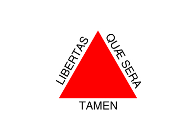
 Flag of the State of Minas Gerais
History of Minas Gerais
Minas Gerais was occupied by explorers from São Paulo who headed to the interior of Brazil. The expeditions took place in the 16th century, when groups were looking for metals and precious stones.
As a result of the expeditions, the first settlements began to appear between the 17th and 18th centuries. Concentrations took place in mountain regions where mineral discoveries took place.
The rush for gold took the sleep of the colonizers. In 1693, a large volume of gold was found in the region where the capital Belo Horizonte is today. The search for metal gave rise to many battles, the Emboabas War being the most important of them. The conflict, which took place in 1708, brought Paulistas, Portuguese and miners into confrontation.
In 1709, the captaincy of São Paulo and Minas de Ouro was created. Minas separated from São Paulo in 1720. The headquarters was Vila Rica, currently Ouro Preto.
Mining Inconfidence
It was wealth that gave the state of Minas Gerais its name. The abundance of precious metals made the region an important economic hub. In 1750, the Portuguese Crown applied strict rules to control the removal of metals and tax collection.
The measures generated revolt and the most important of them was the movement that became known as the Inconfidência Mineira, which took place in 1789.
The movement involved important personalities from the then Vila Rica and aimed to overthrow the local government and make the province independent. Among the conspirators was Joaquim José da Silva Xavier, who became known as Tiradentes.
Know more about the subject:
- Mining Inconfidence
- Tiradentes
- Tiradentes Day
- Vila Rica Revolt
- Gold Cycle
Minas Gerais Economy
Mining inhibited the diversification of the economic matrix in Minas Gerais. Only in the 19th century, the state started to explore the coffee plantations, which became the main product for the region.
Coffee induced industrialization. From 1930 onwards, the mining industry had an important support in the steel industry. Small industries also started to appear, mainly concentrated in the dairy and sugar sectors.
Read too:
- Coffee Cycle
- Brazilian Economic Cycles
- Extractivism in Brazil
Cities of Minas Gerais
Belo Horizonte
The capital of Minas Gerais has approximately 2.5 million inhabitants. His first name was Capital of Minas. Belo Horizonte's planning is inspired by Washington, in the United States, and the project was signed by engineers Aarão Reis and Francisco Bicalho.
Construction began in 1893 and inauguration took place on December 12, 1897. Today, Belo Horizonte has 23 municipalities in the metropolitan region, home to 4.8 million inhabitants.
Black gold
The city is one of the main deposits of Brazilian cultural heritage. Ouro Preto was created in 1711 to be the capital of Minas Gerais, which at the time was the city of Mariana.
It ceased to be the capital in 1897, when the seat of government was transferred to Belo Horizonte. The idea was to make a new planned city that would break with the colonial and Portuguese past of the newly proclaimed republic.
In Ouro Preto are the works of Antônio Francisco Lisboa, the cripple, born in 1738 and considered the most important Brazilian sculptor.
Geographical Aspects of Minas Gerais
Relief
The mining relief is characterized by plateaus with cliffs. Examples include the Serra da Mantiqueira and the Serra do Espinhaço. Pico da Bandeira is the highest point in the state, at 2.8 meters high.
Climate
The climate in Minas Gerais is influenced by tropical altitude. The average temperature is 20º C and there are two well-defined seasons, rainy and dry.
Territorial Division
Minas Gerais is divided into twelve regions that follow characteristics of geographic and economic affinity.
The regions are: Campos das Vertentes, Central Mineira, Jequitinhonha, Metropolitana de Belo Horizonte, Northwest of Minas, North of Minas. West of Minas, South and Southwest of Minas, Mining Triangle and Alto Paranaíba, Vale do Mucuri, Vale do Rio Doce and Zona da Mata.
See too: Map of Minas Gerais
Minas Gerais Culture
The Minas Gerais culture is one of the richest and most diverse in Brazil. The influences of the Portuguese colonizer in handicraft, popular manifestations, cuisine and art are strong.
As with other Brazilian states, the mixture with indigenous and African cultures is also remarkable.
Among the most important cultural manifestations of Minas are the congado, the kings' revelry, shepherdesses, ox of kings, feast of the Divine, cavalhada, golden mule, dance of São Gonçalo, Caxambu, cool the stick and the gang.
Minas cuisine
The history of mining was directly reflected in the cuisine of Minas Gerais. Among the best known dishes are tropeiro beans, angu, chicken with okra, dried meat paçoca, farofa, suckling pig, crackling and roasted ham.
Also read about the other states in the Southeast region:
- Southeastern States
- Southeast region
- Southeast culture
- Climate of the Southeast Region
- Southeast Region Economy
- Brazil states
- Acronyms of Brazilian States


