O São Francisco River, nicknamed "Old Chico" is the largest river entirely nationally and one of the most important rivers in the country, especially for the Northeast region. With an economic, cultural and social wealth, the São Francisco River runs through six states in Brazil and has several tributaries and together constitute the São Francisco River Basin.
Read too: Watersheds
All about the São Francisco River
The São Francisco River covers most of the northeastern semiarid, in addition to bathing the states of Minas Gerais, Bahia, Goiás, Distrito Federal, Pernambuco, Alagoas and Sergipe. It reaches around 507 municipalities where approximately 13 million people live, such as Penedo (AL), Pirapora (MG), Juazeiro (BA), Paulo Afonso (BA), Três Marias (MG), among others.
It is a perennial river, that is, it does not disappear during the dry season and is, according to the Brazilian Institute of Geography and Statistics, about 2,700 km long, equivalent to 8% of the Brazilian territory. The São Francisco River drains an area of approximately 641,000 km 2 with an average flow per second of 2,846 cubic meters according to the National Water Agency.
Regarding its navigability, the São Francisco River presents natural conditions for the navigation in the sections between pirapora in the state of Minas and Juazeiro in Bahia and from pirapora à mouth of the river in Alagoas.
know more: Know what types of rivers are.
Where does the São Francisco River start and where does it flow?

The source of the São Francisco River is in the state of Minas Gerais.
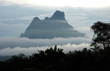
Until 2002 it was believed that the source of the São Francisco River was located at the top of the Serra da Canastra National Park, in the state of Minas Gerais, in the municipality of São Roque de Minas. Through studies carried out by the São Francisco and Parnaíba Valleys Development Company (Codevasf), it was discovered in 2002 that the source of the São Francisco River is actually the RiverSambura, located in Medeiros in the state of MinesGeneral. Thus, the historical source is in Serra da Canastra and the geographical source is the River Samburá.
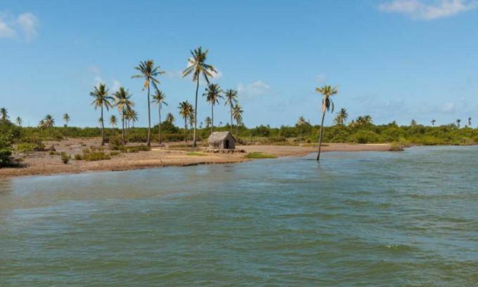
São Francisco River mouth between Alagoas and Sergipe.
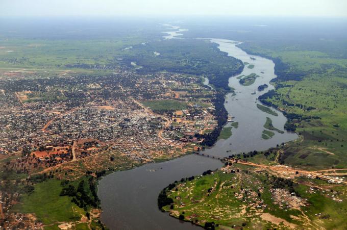
The São Francisco River has its mouth (place where the drainage of the watercourse occurs) between the states of Alagoas and Sergipe. After traveling nearly three thousand kilometers, the river flows into the Atlantic Ocean, therefore becoming a chevronNatural between states.
São Francisco River Basin
THE São Francisco River Basin Has as mainRiver himself They areFrancisco. It covers the area of the states of Minas Gerais, Bahia, Goiás, Pernambuco, Sergipe, Alagoas and part of the Federal District. The basin drains an area of approximately 641,000 km2. The basin area is comprised of the biomes thick, Caatinga and Atlantic forest. About 62.5% of the basin is in the Northeast Region; 36.8% in Southeast region and 0.7% in Midwest region.
According to the Ministry of the Environment, the São Francisco River Basin is divided into four physiographic regions, that is, with specific physical characteristics present in an area1. Are they:
Alto San Francisco: corresponds to the area between the source of the river to Pirapora and Montes Claros, in the state of Minas Gerais, with about 702 km in length.
Middle San Francisco: corresponds to the area between the municipality of Pirapora and Remanso, in the state of Bahia, with about 1,230 km in length.
Middle School San Francisco: corresponds to the area between the states of Bahia and Pernambuco with about 440 km in length.
Lower San Francisco: corresponds to the area between Paulo Afonso, in Bahia, and the mouth of the river between the states of Alagoas and Sergipe, about 214 km long.
→ Main characteristics of the basin according to data from the Ministry of the Environment:
Features |
Alto San Francisco |
Middle San Francisco |
Middle School San Francisco |
Lower San Francisco |
Climate |
Predominance of humid tropical and temperate altitude. |
Predominance of tropical semiarid and dry sub-humid. |
Predominance of semiarid and arid. |
Sub-humid. |
annual precipitation |
Between 1,000 mm and 2,000 mm. |
Between 600 mm and 1400 mm. |
Between 800 mm and 350 mm. |
Between 350 mm and 1500 mm. |
Temperature |
23°C |
24°C |
27°C |
25°C |
Maximum average annual flow |
Pirapora 637 m3/s in February |
Juazeiro 4,393 m3/s in February. |
Sugar Loaf 4,660 m3/s in February. |
Mouth 9,999 m3/s in March. |
Read more:Discover the types of climate present in Brazil
Tributaries of the São Francisco River
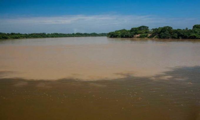
Meeting between the waters of the São Francisco River and the Rio das Velhas, one of its tributaries.
According to the Ministry of the Environment, the São Francisco River has 168 tributaries 99 being perennial rivers and 69 intermittent rivers (rivers that disappear during the dry season). The main tributaries are located on the left bank of the Upper São Francisco and Middle São Francisco.
Examples of tributaries are:
Rio das Velhas
Abaete River
Urucuia River
Pajeú River
Paracatu River
Paraopeba River
Rio Verde Grande
Transposition of the São Francisco River
The transposition of the São Francisco River it's not a current project. The first proposal to cross the São Francisco River was presented in 1847 to Dom Pedro II by the engineer Marcos de Machado, however it was not carried out. Attempts in 1856, 1886 and 1889 were also unsuccessful. The most recent governments such as Itamar Franco and Fernando Henrique Cardoso also presented the transposition project, but again it did not come off the paper.
In 2003, during Lula's government, the project for the transposition of the São Francisco River was once again the topic of discussion and this time it came out of the paper. The president started the project throughout his term, however, to this day, it has not been finalized. Currently, the project goes by the name of “Project for the Integration of the São Francisco River with the North-Northeast Hydrographic Basins”.
→ What is the São Francisco River transposition?
It is a Federal Government project to build canals connecting perennial rivers such as the São Francisco, to the intermittent rivers to serve the populations of the states of Ceará, Pernambuco, Paraíba and Rio Grande do North.
→ What goal?
The project's objective is to “divert” water from the São Francisco River in order to serve areas that suffer from extreme drought. In the semiarid region, the average rainfall does not exceed 800 mm per year, putting many families in a precarious state, since a large part of the population in the semiarid region lives from activities such as agriculture and livestock, which depend on the rainfall regime.
→ How it works?
The project is divided into the North Axis, which corresponds to the water collected in the region of Cabrobó, in Pernambuco, taking it to the states of Ceará, Pernambuco, Paraíba and Rio Grande do Norte. The stretch will run for 400 km and will operate with a continuous flow of 16.4 cubic meters per second.
The other axis, the East Axis, corresponds to the water collected in the Floresta region of Pernambuco that will be taken to the hinterland and wild areas of Pernambuco and Paraíba. The stretch will cover 220 kilometers with a continuous flow of 10 cubic meters per second.
→ What are the negative points of the project?
There are many criticisms about the transposition project. Many environmentalists and agencies linked to the environment emphasize that the diversion of water from the São River Francisco may cause the removal of vegetation cover in some areas and the consequent loss of biodiversity; the soil will be harmed, as changes in the landscape will favor soil leaching processes; changes in river flow; loss in power generation, among others.
Importance of Rio to the Brazilian Northeast
The São Francisco River played a fundamental role in the occupation of the Brazilian Northeast during the Colonial Period, allowing entry to the interior of the country. During the colonization process, several riverside communities were formed on the banks of the river.
The river also served and still serves as a way of transport of food and minerals like gold. Navigation was, therefore, one of the factors that boosted the region's development, as the river presents favorable navigation conditions, throughout the year, as it is a perennial river.
It is a fact that the São Francisco is intrinsically related to the development of the Brazilian Northeast. Many communities live off what it can provide, for example the fishing and agriculture favored by the floods that flood the areas and make the soil more fertile. In agriculture, fruit growing has the greatest prominence. Fishing has been greatly reduced in the region due to the installation of dams along the rivers, reducing the volume of fish according to the Ministry of the Environment.
The construction of dams, despite affecting the fishing activity, represents an important activity provided by the São Francisco: the generation of energy. Several hydroelectric plants such as Sobradinho, Apolônio Sales, Xingó, Paulo Afonso (I, II, III and IV) and Luiz Gonzaga.
The waters of the São Francisco River supply a large part of the semiarid region, bringing water to many communities that live with extreme drought. Therefore, it is a river of extreme importance not only economically, but also culturally and socially.
Curiosities about the São Francisco River
It is known as “river of national integration” for connecting the Northeast and Southeast regions of Brazil.
Also known as the “Brazilian Nile” for making its banks fertile, promoting agriculture.
It is affectionately nicknamed “Old Chico”.
It was widely used by quilombola communities, such as Quilombo dos Palmares, for water supply and also as a means of transporting materials needed by the community.
He is often cited in many lyrics by important composers in Brazil, such as Luiz Gonzaga.
1 São Francisco – Notebook of the Hydrographic Region. To access, Click here.