At geographic coordinates are some 'imaginary lines' that help us find our location on the earth's surface. These lines we name latitudeand longitude.
It's like a naval battle game (see illustration below). In this game, you have to combine rows and columns in order to identify the locations where the targets are located.

Game Battleship. Combine rows and columns to hit the target¹
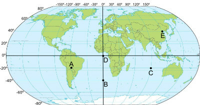
Geographic coordinates work the same way, you must combine the lines and columns of the planisphere to identify the locations on the planet. So the lines would be latitudes and columns would be longitudes.
Latitude: is the distance measured in degrees from a given point on the surface to the Equator. It can vary from 0º to 90º and be to the North or the South.
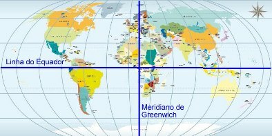
Longitude: is the distance measured in degrees from a given point on the surface to the Greenwich meridian. It can range from 0º to 180º and be east or west. Look at the map below:

Note that the Equator Line is a latitude and the Greenwich Meridian is a longitude
As we can see, the combination of latitudes and longitudes helps us locate any point on Earth. This is very important, after all, we must always be aware of our position on the earth's surface.
There is a device that uses information referring to geographic coordinates to tell us the exact location of a particular point: it is the GPS (Global Positioning System). This device connects to a system composed of 24 satellites and, through them, provides us with information not only about our location, but also the speed of displacement, the altitude, in addition to showing us the best paths to reach a given destination.
_________________
¹ Image credits: peng
By Rodolfo Alves Pena
Graduated in Geography

