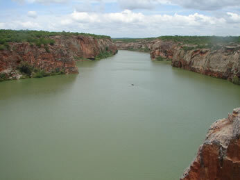
A watershed is a portion of the earth's surface drained by a main river, streams, streams and streams. According to the National Water Resources Council (CNRH), the Brazilian territory has 12 hydrographic basins.
Occupying an area of approximately 640 thousand square kilometers, the São Francisco Hydrographic Basin is one of the most important in Brazil. It covers the states of Minas Gerais, Bahia, Alagoas, Pernambuco, Sergipe, Goiás, in addition to the Federal District.
The main river is the São Francisco, affectionately known as “Old Chico”. Its source is located in Serra da Canastra, in Minas Gerais. After traveling about 2,700 kilometers in a south-north direction, it reaches its mouth in the Atlantic Ocean, between the states of Alagoas and Sergipe.

São Francisco River
Other rivers of great importance that make up this basin are: Cariranha, Pardo, Grande, das Velhas, Paracatu, among others. The rivers in the São Francisco Basin provide water for a population of 13 million people. The average annual flow represents 2% of the country's total.
The São Francisco basin, in addition to providing water for human consumption, is very important for the economic development of the region, especially in areas with a semiarid climate. Through irrigation systems, it is possible to carry out agricultural activities, with emphasis on cattle raising and fruit cultivation.
Its hydroelectric potential is also used. Among the plants installed in this hydrographic basin are Sobradinho, Três Marias, Paulo Afonso, Moxotó, Itapirica, Xingó, etc.
There is a wide variety of biomes in this region: Cerrado, Caatinga, Atlantic Forest, in addition to coastal and insular ecosystems. However, the expansion of agricultural activities has drastically reduced vegetation cover and triggered the siltation of the São Francisco River.
By Wagner de Cerqueira and Francisco
Graduated in Geography
Kids School Team

