A country on the African continent, Mali borders Mauritania and Senegal (to the west), Algeria (to the north and to the east), Niger (to the east), Burkina Faso (to the southeast), Côte d'Ivoire (to the south) and Guinea (to the south-west). The country has no access to the sea and its northern portion is covered by the Sahara desert, a region inhabited by nomadic Tuareg tribes.
Mali is a former French colony, the official language (French) is one of the consequences of this colonization process. National independence was won on September 22, 1960.
The country has one of the worst economies on the planet. Agriculture is responsible for employing approximately 70% of Mali's population, especially for the cultivation of cotton, the main national export product. However, agriculture has been extremely harmed due to the desertification process in the country.
In addition to cotton, Mali also produces rice, vegetables and maize. The industrial sector is underdeveloped, operating in the textile segment. The main natural resources with economic potential in Mali are uranium and gold.
With an average of 0.309, Mali is among the ten worst in the world ranking of the Human Development Index (HDI), according to data published in 2010 by the United Nations (UN). The country has a low life expectancy (53 years); the infant mortality rate is one of the highest in the world: 104 deaths per thousand live births; and illiteracy affects 74% of the population, being one of the highest averages on the planet.
Do not stop now... There's more after the advertising ;)

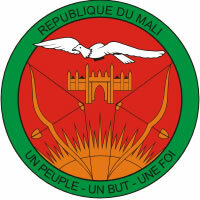
Mali Coat of Arms
Mali data:
Territorial extension: 1,240,192 km².
Location: Africa.
Capital: Bamako.
Climate: Tropical (mostly) and arid tropical (in the north).
Government: Republic with mixed form of government.
Administrative division: 8 regions and 1 district.
Languages: French (official), regional languages (main: Bambara, Fulani, Sonrai, Soninquê and Dogão).
Religions: Islam 80.7%, traditional beliefs 16.3%, Christianity 2.7%, no religion and atheism 0.3%.
Population: 13,010.209 inhabitants. (Men: 6,424,448; Women: 6,585,761).
Composition: Bambaras 50%, Fulanis 17%, turns 12%, Chongais 6%, Dogões, Peules, Bozos and Tuareg 15%.
Demographic density: 10.4 inhab/km².
Average annual population growth rate: 2.3%.
Population residing in urban areas: 32.74%.
Population residing in rural areas: 67.26%.
Undernourished population: 11%.
Life expectancy at birth: 53 years.
Households with access to drinking water: 60%.
Households with access to a health network: 45%.
Human Development Index (HDI): 0.309.
Currency: CFA Franc.
Gross Domestic Product (GDP): 8.7 billion dollars.
GDP per capita: $554.
External relations: World Bank, IMF, WTO, UN, AU.
By Wagner de Cerqueira and Francisco
Graduated in Geography
Brazil School Team
countries - geography - Brazil School
Would you like to reference this text in a school or academic work? Look:
FRANCISCO, Wagner de Cerqueira e. "Mali"; Brazil School. Available in: https://brasilescola.uol.com.br/geografia/mali.htm. Accessed on June 28, 2021.


