
Located on the island of Timor, on the Asian continent, the mountainous territory of Timor-Leste only has a land border with Indonesia. Former Portuguese colony, the country is the only one in Asia that has Portuguese as its official language, despite being spoken by only 10% of the national population. With this, the nation is one of the members of the Community of Portuguese Language Countries (CPLP).
Timor-Leste became independent in 2002, making it one of the youngest countries in the world. This conquest came after several years of struggles against the colonizers. The Portuguese were the first to occupy the territory, in 1859, exploiting hardwoods, a fact that caused the destruction of the local forest. Between 1975 and 1999, Indonesia invaded East Timor, starting a wave of terror in that country. The teaching of the local language, Tetum, was banned, mass executions were carried out, and infrastructure was destroyed.
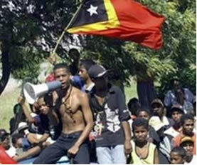
Action of militias in Timor-Leste
All these years of conflict have harmed the economic development of the country, which has one of the lowest Gross Domestic Products (GDP) in the world. The majority of the population works in rural activities (80%), especially in coffee plantations. The nation lives the expectation of boosting the economy with the exploration of oil and natural gas in the Timo Sea. Since gaining independence, Timor-Leste has depended on international aid.
With an average of 0.502, the country has an average Human Development Index (HDI), according to data released in 2010 by the United Nations (UN). Most inhabitants live below the poverty line, that is, on less than $1.25 a day; the illiteracy rate is 50% and the infant mortality rate is 63 deaths per thousand live births.

Coat of arms
Timor-Leste data:
Territorial extension: 14,874 km².
Location: Asia.
Capital: Dili.
Climate: Equatorial.
Government: Parliamentary Republic.
Administrative division: 13 districts.
Languages: Portuguese and Tetum.
Religions: Christianity 84.2% (80.6 Catholics, others 3.6%), Islam 3.2%, traditional beliefs 11.1%, others 1.5%.
Population: 1,133,594 inhabitants. (Men: 577,044; Women: 556,550).
Demographic density: 76.2 inhab/km².
Average annual population growth rate: 3.3%.
Population residing in urban areas: 27.69%.
Population residing in rural areas: 72.31%.
Life expectancy at birth: 60.2 years.
Households with access to clean water: 62%.
Households with access to a health network: 41%.
Human Development Index (HDI): 0.502.
Currency: US Dollar.
Gross Domestic Product (GDP): $498 million.
GDP per capita: $393.
External relations: World Bank, IMF, UN.
By Wagner de Cerqueira and Francisco
Graduated in Geography
Brazil School Team
countries - geography - Brazil School