Located in the western portion of the African continent, Côte d'Ivoire borders Mali and Burkina Faso to the north; Ghana to the east; Liberia and Guinea to the west, and is washed by the Atlantic Ocean to the south.
The name of Côte d'Ivoire was given by the Portuguese, being a reference to the large number of elephants that existed in the region during colonial times.
The country gained its independence on August 7, 1960. Côte d'Ivoire is one of the most prosperous nations in West Africa, this is due to agricultural development, mainly coffee and cocoa production (the country is the largest producer of cocoa in the world). Also noteworthy are the food, textile, oil and natural gas exploration, in addition to diamond extraction.
Currently, more than 60 ethnic groups live in the Ivorian territory, this fact contributes enough for the cultural diversity of the country, however, it generates conflicts between different groups ethnic groups.
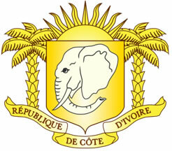
Coat of arms of Côte d'Ivoire
Do not stop now... There's more after the advertising ;)
Data from Côte d'Ivoire:
Territorial extension: 322,463 km².
Location: Africa.
Capital: Abidjan.
Climate: Forest subequatorial in the south, tropical wet in the northwest, tropical dry in the northeast.
Government: Presidential Republic.
President: Laurent Gbagbo.
Administrative division: 19 regions subdivided into departments.
French Language.
Religion: Traditional beliefs 37.6%, Christianity 31.8% (Catholics 14.8%, Independent 9.3%, others 7.7%), Islam 30.1%, no religion 0.2%, others 0, 3%.
Population: 21,075,010 inhabitants. (Men: 10,733,376; Women: 10,341,634).
Ethnic Composition: Bauleses 23%, Betes 18%, Senufos 15%, Mandingas 11%, others 33%.
Demographic density: 58 inhabitants/km².
Average annual population growth rate: 1.73%.
Population residing in urban areas: 49.49%.
Population residing in rural areas: 50.51%.
Undernourished population: 14%.
Life expectancy at birth: 47.7 years.
Households with access to drinking water: 81%.
Households with access to a health network: 24%.
Human Development Index (HDI): 0.397 (low).
Currency: CFA Franc.
Gross Domestic Product (GDP): US$ 20,650 million.
GDP per capita: US$ 1,072.
External relations: World Bank, IMF, WTO, UN, AU.
By Wagner de Cerqueira and Francisco
Graduated in Geography
Brazil School Team
countries - geography - Brazil School
Would you like to reference this text in a school or academic work? Look:
FRANCISCO, Wagner de Cerqueira e. "Costa do Marfim "; Brazil School. Available in: https://brasilescola.uol.com.br/geografia/costa-marfim.htm. Accessed on June 27, 2021.