Acre is one of the smallest Brazilian states and one of the most isolated, on the other hand it has an immense natural wealth in its territory. Given the biodiversity present in the State, it is important to understand the characteristics and relationships between natural elements, such as relief, climate, vegetation and hydrography.
Relief
The geological formation and geomorphological structure of Acre:
Amazon Depression: refers to an extensive recessed surface. The relief is made up of hills and mountains in the areas close to the Peruvian border. The altitudes in the plains reach up to 300 meters above sea level, while in the higher parts the altitude reaches 580 meters.
Lowered Plateau: means unevenness in the plateaus that are parallel to the plain of the Amazon River, the altitude in this place does not exceed 250 meters.
Amazon Plain: it is formed from strips that are established on the banks of the main rivers of the State, present flooded and flooded regions and a great concentration of lakes.
From these geomorphological structures, the main types of relief are formed. Are they:
- Erosive Forms – Areas sculpted by the river (fluvial erosion), with a declivity towards the river bed.
- Forms of Accumulation – Correspond to river plains, areas that are almost always flooded.
- Forms of Dissection – This is composed of hills, ridges and tabular interfluves.
Climate
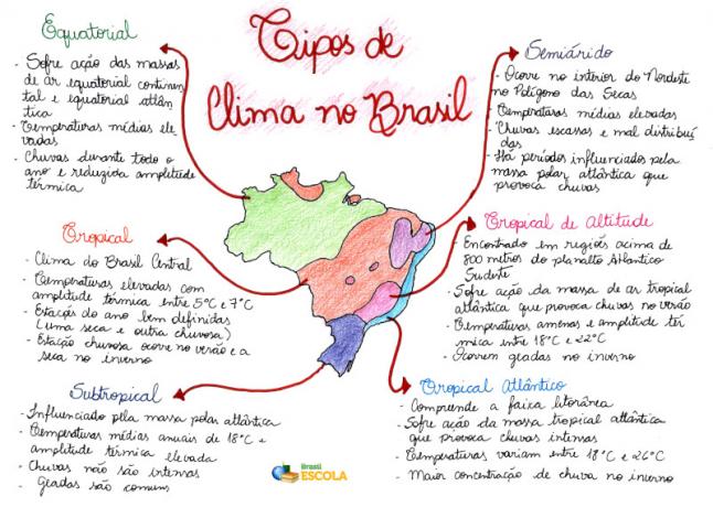
The predominant climate in Acre is the equatorial Amazon, which corresponds to a high temperature and a high concentration of humidity, ideal conditions for the proliferation of biodiversity.
As for the temperature, it can vary between 24.5°C and 32°C, in this territory there are two well-defined seasons, one of which has a characteristic of high incidence of precipitation, that is, the rainy season. While the other corresponds to periods of drought, or dry season.
The dry season occurs from the month of May to October, it is during this period that there is a decrease in the temperature, triggered by the influence of a polar front driven by a polar air mass Atlantic.
The rainy season develops from November to April, during this period there is a great incidence of periodic and abundant rains. The relative humidity of the air is around 80 and 90%, a high percentage in relation to other places in Brazil, and the pluviometric indexes are between 1,600 and 2,750 mm per year.
Vegetation
The vegetation cover of the State of Acre is basically composed of three types of phytoecological regions:
♦ Domain of the Dense Ombrophilous Forest.
♦ Domain of the Open Ombrophilous Forest.
♦ Campinarana.
The main forest typologies in Acre are:
- Open Forest with dominant bamboo, occupies 9.4% of the entire territory of Acre.
- Open Forest with bamboo and open forest with palm trees, covers 26.2% of the State.
- Open Forest with palm trees from alluvial areas, represents 5.48% of the state area.
- Open Forest with palm trees, occupies 7.77% of Acre.
- Open Forest with palm trees and dense forest, occupies 12.12% of the area.
- Dense Forest and open forest with palm trees occupy 7.2% of the state area.
- Open Forest with palm trees and open forest with bamboo occupies 21.02% of the area.
- Open Forest with bamboo in alluvial areas, occupies 2.04% of the territory.
- Dense Forest corresponds to 0.53% of the territory.
- Bamboo forest and dense forest, occupying 0.36% of the state area.
- Dense submontane forest, corresponds to 0.47% of the territory of Acre.
- Deforested areas correspond to 7% of the State's total area.
Hydrography
Do not stop now... There's more after the advertising ;)
The hydrographic network is an important means of transport in Acre, since most urban centers are located on the banks of rivers.
The main rivers in the central part of the state are the Tarauacá and Perus rivers, in the northwest are the Gregório, Taraucá, Muru, Envira and Jurupari rivers. To the west, the Juruá river.
The hydrographic basins that make up the hydrographic network of the State of Acre are: Acre-Purus Basin and Juruá Basin.
By Eduardo de Freitas
Graduated in Geography


