
The narrow territory of Togo, about 100 kilometers wide, is located in the western portion of the African continent, bordering on the east with Benin, on the north with Burkina Faso and on the west with Ghana, besides being bathed by the Gulf of Guinea. south. The name of the country, in the native language, means “shore of the lake”.
The Germans were the first to colonize the region that currently corresponds to the countries of Togo and Ghana, in 1884. However, after World War I (1918), the territory was divided between France and the United Kingdom, in which the former were responsible for the administration of the Togolese portion. National independence was won in 1960. Since then, the nation has been ruled by several dictators, with successive coups d'état. The first presidential election with popular vote took place in 1992, however, this historic moment for the nation was marked by accusations of fraud and murders involving different groups politicians.
The situation of political instability reflects on the national economy, which is underdeveloped and has agriculture as its main source of income. In the plains of the south of the country, manioc, cotton, corn, fruit, coffee and cocoa are grown. The industrial sector, not very diversified, operates in the following segments: food, steel, textiles and mining.
More than half of Togolese live on less than $1.25 a day, an amount considered insufficient to meet the basic consumption needs of human beings. This fact is reflected in the high rate of malnutrition (37%), low life expectancy (58 years) and high infant mortality rate (70 for every thousand live births), which is aggravated by the lack of environmental sanitation in most homes - only 10% of homes benefit from this service.
Do not stop now... There's more after the advertising ;)
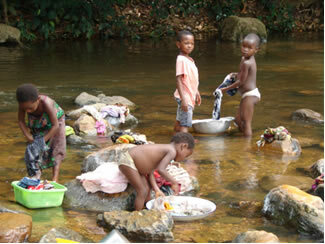
Togolese children
Togo data:
Territorial extension: 56,785 km².
Location: Africa.
Capital: Lomé.
Climate: Equatorial rainy (coastal) and tropical (inland).
Government: Republic with mixed form of government.
Administrative division: 5 regions subdivided into prefectures.
Languages: French (official), cabiê, euê.
Religions: Christianity 44.7% (Catholics 28.1%, Protestants 11.8%, others 4.8%), traditional beliefs 35.5%, Islam 19%, others 0.6%, no religion and atheism 0, two%.
Population: 6,618,613 inhabitants. (Men: 3,276,418; Women: 3,342,195).
Composition: Indigenous ethnic groups 99.2% (Eues 45.4%, Cabies 23.9%, Minas 12.1%, Gurmas 10.5%, Temnes 7.3%), Europeans 0.8%.
Demographic density: 116.5 inhab/km².
Average annual population growth rate: 2.4%.
Population residing in urban areas: 42.74%.
Population residing in rural areas: 57.26%.
Undernourished population: 37%.
Life expectancy at birth: 58 years.
Households with access to drinking water: 59%.
Households with access to a health network: 12%.
Human Development Index (HDI): 0.428 (low).
Currency: CFA Franc.
Gross Domestic Product (GDP): 2.8 billion dollars.
GDP per capita: 386 dollars.
External relations: World Bank, IMF, WTO, UN, AU.
By Wagner de Cerqueira and Francisco
Graduated in Geography
Brazil School Team
countries - geography - Brazil School