Goiás is one of the Brazilian states that make up the country's Midwest region. It borders the Federal District and five other federative units. The state currently has 7.1 million inhabitants, and its capital, Goiânia, is the most populous municipality.
It is located in the Cerrado and has a predominantly tropical climate, with relief marked by the presence of plateaus and plateaus. It is the second largest economy in the region, with emphasis on agricultural production and ethanol.
Read too: What are the capitals of Brazil?
General data of Goiás
- Region: Midwest
- capital: Goiania
- Government: representative democracy
- Areaterritorial: 340,242,854 km² (IBGE, 2020)
- Population: 7,113,540 inhabitants (IBGE, 2020)
- Densitydemographic: 17.65 inhab./km² (IBGE, 2010)
- spindle: Brasília Standard Time (GMT -3 hours)
- Climate: Tropical Semi-Wet
Do not stop now... There's more after the advertising ;)
Geography of Goiás
Goiás is a Brazilian state located in the Midwest of the country, and its capital is the municipality of Goiânia. With 340,242.85 km²,
is the seventh state in area of Brazil and the third from the region to which it belongs.The state borders the Federal District, which is located in the eastern portion of its territory, and with five other units of the federation, namely:
- Tocantins, at North
- Bahia, northeast
- Minas Gerais, east and southeast
- Mato Grosso do Sul, southwest
- Mato Grosso, to the west
Goiás climate
The predominant climate in Goiás is the Tropical Semi-Wet.It is characterized by summers hot and rainy, with rainfall concentrated between the months of October and April, and winters dry, with relatively lower temperatures and reaching 12 ºC in the southern parts of the territory. Thermometers can show high values during the driest months of the year, ranging from 30 ºC to 40 ºC.
Relief of Goiás
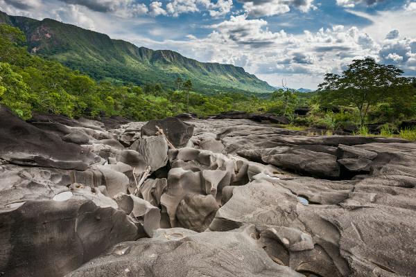
Inserted in the Brazilian Central Plateau, according to the classification of the geographer Aziz Ab’Sáber, the morphology of the terrains in Goiás is marked by the intense action of weathering agents. As a result, most of its territory is composed of features such as chapadas and also plateaus.
The main elevated areas are in the northeast of Goiás, in the region of Veadeiros Plateau, where the altitudes exceed 1200 meters. The highest point in the state can be seen in this area: the hill of Pouso Alto, measuring 1676 meters.

Vegetation of Goiás
About 98% of the area of the state of Goiás is included in the biome thick, with vegetation cover characteristic of this domain. A small portion to the southeast of its territory presents vegetation patches typical of the formation Atlantic forest, according to the mapping carried out by IBGE.
A survey by the National Institute for Space Research (Inpe) indicates, however, that Goiás is the second state with the highest rate of deforestation of the cerrados Brazilians, second only to Mato Grosso. The devastated area is in the order of 45,861.54 km². Several factors linked to anthropic action can be pointed out as causes of logging, among them the opening of new agricultural and pasture areas, mainly in the north of the state.
Read too: Deforestation in the Amazon – anthropic action that harms this important vegetation
Goiás Hydrography
The territory of Goiás is part of two important national hydrographic basins: Paraná, which covers the south, and Tocantins-Araguaia, which includes most of the center and the entire north of the state. The two water courses that give name to the second basin have their source located in Goiás. In addition to these, other rivers that bathe the territory of Goiás are: Aporé, Vermelho, Paraná, Paranaíba, Verde, Maranhão, Claro and Paranã.
Goiás Map

Demographics of Goiás
The population of Goiás is currently of 7,113,540 people, a value that consists of a portion of 43.1% of the inhabitants of the Center-West region of the country. On a national scale, Goiás represents the 12th state in terms of population. When was the last IBGE Census in 2010, The demographic density of this federative unit was 17.65 inhab/km². Taking into account the updated data, today there is a distribution of 20.9 inhab/km².
Most of Goiás live in urban centers, being the urbanization rate of the state of 90.28%, according to the 2010 Census. Goiânia, the state capital, is the 10th most populous city in Brazil and the one with the largest number of inhabitants in Goiás, currently with 1,536,097 residents. Following are Aparecida de Goiânia (590,146) and Anápolis (391,772).
Between 2019 and 2020, the state's population grew 1.4%, this rate is higher than the national rate for the same period (0.77%), which is mainly due to the birth rate higher than the mortality rate. We also have that life expectancy at birth in Goiás is 74.7 years.
Geographical division of Goiás
IBGE divides Brazilian states into immediate geographic regions and intermediate geographic regions, a classification that has been in effect since 2017. The 246 municipalities in Goiás are grouped into 22 immediate regions and six intermediate regions, being these:
- Goiânia, in the central region of the state;
- Itumbiara, to the southeast;
- Rio Verde, which covers the south and southwest;
- São Luís de Montes Belos–Iporá, to the west;
- Porangatu–Uruaçu, to the northwest;
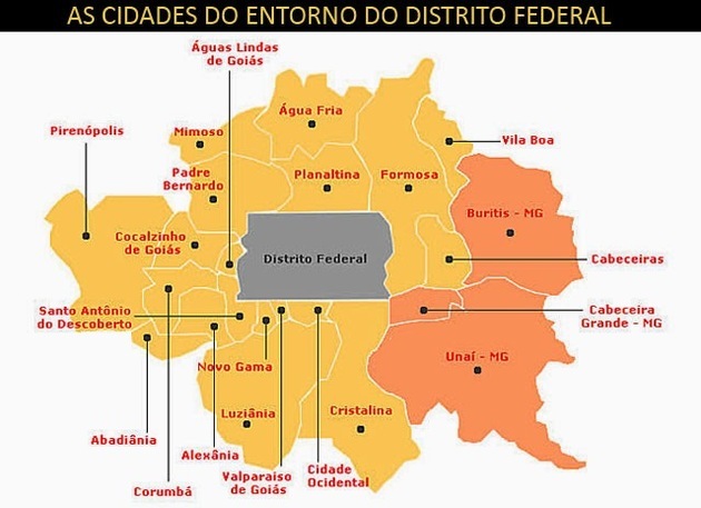
- Luziânia–Águas Lindas de Goiás, northeast.
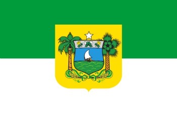
Flag of Goiás

Economy of Goiás
With a Gross Domestic Product (GDP) of R$ 195.68 billion, the state of Goiás represents 2.8% of the national economy, being in 9th place among the federative units. It also represents the second largest GDP in the Midwest region, only behind the Federal District. The service sector accounts for just over half of this amount, while industry and agriculture are responsible, respectively, for 20.76% and 11.45% of the value added to the state GDP.
In addition to civil construction, it stands out in the secondary sector the food industry, mining, automobile production as well as the chemical and metallurgy industries. The state is also the second largest Brazilian producer of ethanol, a fuel made from corn and sugarcane.
Driven, therefore, by the sugar-alcohol industry, the Sugarcane is one of the main crops in the state. With it are soy, corn, cotton and beans. Livestock has an equally important role in the economy of Goiás.
See too: Industrial concentration and deconcentration in Brazil

Goiás Government
The government of Goiás is of the representative democratic type, with elections held every four years. The state executive branch is headed by the governor, who has a vice governor. The Legislative of Goiás is formed by three senators, 17 federal deputies and 41 state deputies.
Infrastructure of Goiás
Near the Federal District, the state of Goiás is crossed by major highways interconnecting the federal capital and adjacent locations to other Brazilian regions. One of them is the BR-153, which crosses the country in the North-South direction and goes from Rio Grande do Sul to Pará. Besides it, some other roads that cross the territory of Goiás are: BR-010, BR-020, BR-364, BR-158, BR-070.
The railways are part of the logistic system in Goiás, being they finalized or still under construction and concession. This means of transport has great strategic value for the production chains in Goiás and throughout the Brazilian Midwest, being responsible for the flow of grains and other products from this region. The North-South, the West-East Integration Railway (Fiol) and the Centro-Atlântica Railway (FCA) stand out.
The state also has a port complex that is part of the Tietê-Paraná waterway it is a dry port in the city of Annapolis. Considering air transport, the main airport in the state is located in Goiânia, with domestic and international flights.
Culture of Goiás
Goiás culture is very rich and diverse, composed of elements and traditions incorporated by indigenous populations, migrants from other regions of Brazil, as well as Portuguese, Africans and people from other countries neighbors.
The state's traditional festivities mix folkloric and religious aspects, such as the Bonfire Procession, at cavalcades and the congada. Moving on to manual and artistic work, plastic arts and handicraft are widely featured among Goiás cultural manifestations. The works of José Joaquim da Veiga Valle, born in Pirenópolis, are still a reference today.
Great authors of Brazilian literature have their roots in Goiás, as Cora Coraline and José J. Veiga. We must also mention the music from Goiás, which encompasses several styles, with an emphasis on traditional viola fashion and the country music genre.
In terms of gastronomy, rice with pequi, pie from Goiás and pamonha are some of the typical dishes of the state.
History of Goiás
Until the arrival of the Portuguese, through expeditions known as bandeiras, the current territory of Goiás was inhabited by indigenous populations.
About three years after leaving São Paulo, the bandeirante Bartolomeu Bueno da Silva, or Anhanguera, arrived in Goiás in 1725 and was successful in the search for gold deposits. He is credited with beginning exploration of state lands and also of its population. The first occupied area is where the current Cidade de Goiás is located, in the west of the state.
Goiás belonged to the captaincy of São Paulo until 1749, when it became an independent captaincy. For little more than two centuries, Tocantins was part of this area. The dismemberment officially took place only in the year 1988.
Gold activity lasted for half a century in the region, giving place, then, to livestock and agriculture in the first half of the nineteenth century. The state's economic and urban dynamism increased with the establishment of the capital, Goiânia, in 1934, and with the March to the West in the 1950s.
The advance of productive model of agribusiness in the Cerrado in the 1970s it has great relevance for the structuring of the economy of Goiás as it currently stands, as well as the intensification of the industrialization process in the 1980s and 1990s.
By Paloma Guitarrara
Geography teacher


