Burkina Faso (or Burkina Faso) means “land of worthy men” in the local dialect. The country has most of its territory located in an arid region on the edge of the Sahara Desert in West Africa. Its territory has no access to the sea, it is limited to Mali (to the west and north), Côte d'Ivoire (to the southwest), Ghana (to the south), Togo (to the south), Benin (to the southeast) and Niger (to the North East).
Between 1894 and 1904, French armies invaded the territory of Bukina Faso with great violence, devastating tribes, houses, plantations and herds established there. The country's independence was only obtained in 1960. Since then, the country's history registers a series of military coups.
The national economy is based on agriculture, however, the long periods of drought hinder the development of the activity, and its production is not necessary to meet local demand, causing a large part of the food to be imported.
The country is home to national parks and reserves with great tourist potential, however, this potential is not significantly explored.
Burkina Faso presents a series of socioeconomic problems. Poverty, hunger and lack of clean water punish the local population. The illiteracy rate is the highest on the planet (80%). All of these factors directly reflect the country's Human Development Index (HDI), which is currently one of the lowest in the world.
Do not stop now... There's more after the advertising ;)

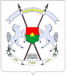
Burkina Faso Coat of Arms
Burkina Faso data:
Territorial extension: 274,200 km².
Location: Africa.
Capital: Ouagadougou.
Tropical weather.
Government: Republic with mixed form of government.
Administrative division: 45 provinces.
Language: French (official), regional languages (main: mossi).
Religion: Islam 48.6%, traditional beliefs 34.%, Christianity 16.7% (9.5% Catholics, others 7.2%), no religion and atheism 0.7%.
Population: 15,756,927 inhabitants. (men: 7,870,112; women: 7,886,815).
Ethnic Composition: Indigenous ethnic groups 97.2%, other 2.8% .
Demographic density: 57 inhab/km².
Average annual population growth rate: 3.19%.
Population residing in urban areas: 19.97%.
Population residing in rural areas: 80.03%.
Undernourished population: 10%.
Life expectancy at birth: 51.7 years.
Households with access to clean water: 72%.
Households with access to a health network: 13%.
Human Development Index (HDI): 0.305 (low).
Currency: CFA Franc.
Gross Domestic Product (GDP): US$7,136 million.
GDP per capita: 483 US$.
External relations: World Bank, IMF, WTO, UN, AU.
By Wagner de Cerqueira and Francisco
Graduated in Geography
Brazil School Team
countries - geography - Brazil School
Would you like to reference this text in a school or academic work? Look:
FRANCISCO, Wagner de Cerqueira and. "Burkina Faso"; Brazil School. Available in: https://brasilescola.uol.com.br/geografia/burkina-fasso.htm. Accessed on June 28, 2021.


