Malawi is a small country located in the southeast of the African continent, its territory has no exit to the sea and borders Tanzania (to the north), Zambia (to the west) and Mozambique (to the east and to the south). The country was a British colony, and became independent on July 6, 1964.
Although small, Malawi has the third largest lake in Africa (Lake Malawi), which comprises about 20% of the country's area. With mountainous territory, it features savannas and rainforests, a fact that attracts many tourists to its parks with wild animals and tribal villages.
According to the International Monetary Fund (IMF), Malawi is one of the economically poorest countries on the planet. The national economy is based on agriculture and tourism. The main export products are tobacco, coffee, peanuts and wood. The country is extremely dependent on international financial assistance, especially from South Africa, the United States and the United Kingdom.
Malawi's population suffers from various socioeconomic problems. The country's Human Development Index (HDI) is one of the lowest in the world: 0.385. The infant mortality rate is alarming: 80 deaths for every thousand live births. Approximately 55% of inhabitants live below the poverty line; malnutrition affects 29% of the Malawian population.
Do not stop now... There's more after the advertising ;)

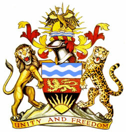
Malawi Coat of Arms
Malawi Data:
Territorial extension: 118,484 km².
Location: Africa.
Capital: Lilongue.
Climate: Tropical (mostly) and tropical in altitude.
Government: Presidential Republic.
Administrative division: 3 regions subdivided into 24 districts.
Languages: English and Chicheua (official).
Religions: Christianity 76.8% (23.8% Catholics, Protestants 26.9%, Independents 14.3%, others 11.8%), Islam 15.6%, traditional beliefs 6.9%, others 0.4 %, no religion and 0.3% atheism.
Population: 15,263,417 inhabitants. (Men: 7,584,763; Women: 7,678,654).
Composition: Maraves 58.3%, lomues 18.4%, iaos 13.2%, engonis 6.7%, other 3.4%.
Demographic density: 128.8 inhab/km².
Average annual population growth rate: 2.7%.
Population residing in urban areas: 19.26%.
Population residing in rural areas: 80.74%.
Undernourished population: 29%.
Life expectancy at birth: 47 years.
Households with access to clean water: 76%.
Households with access to a health network: 60%.
Human Development Index (HDI): 0.385 (low).
Currency: Malawian Quacha.
Gross Domestic Product (GDP): 4.3 billion dollars.
GDP per capita: $257.
External relations: World Bank, Commonwealth, IMF, WTO, SADC, AU.
By Wagner de Cerqueira and Francisco
Graduated in Geography
Brazil School Team
countries - geography - Brazil School


